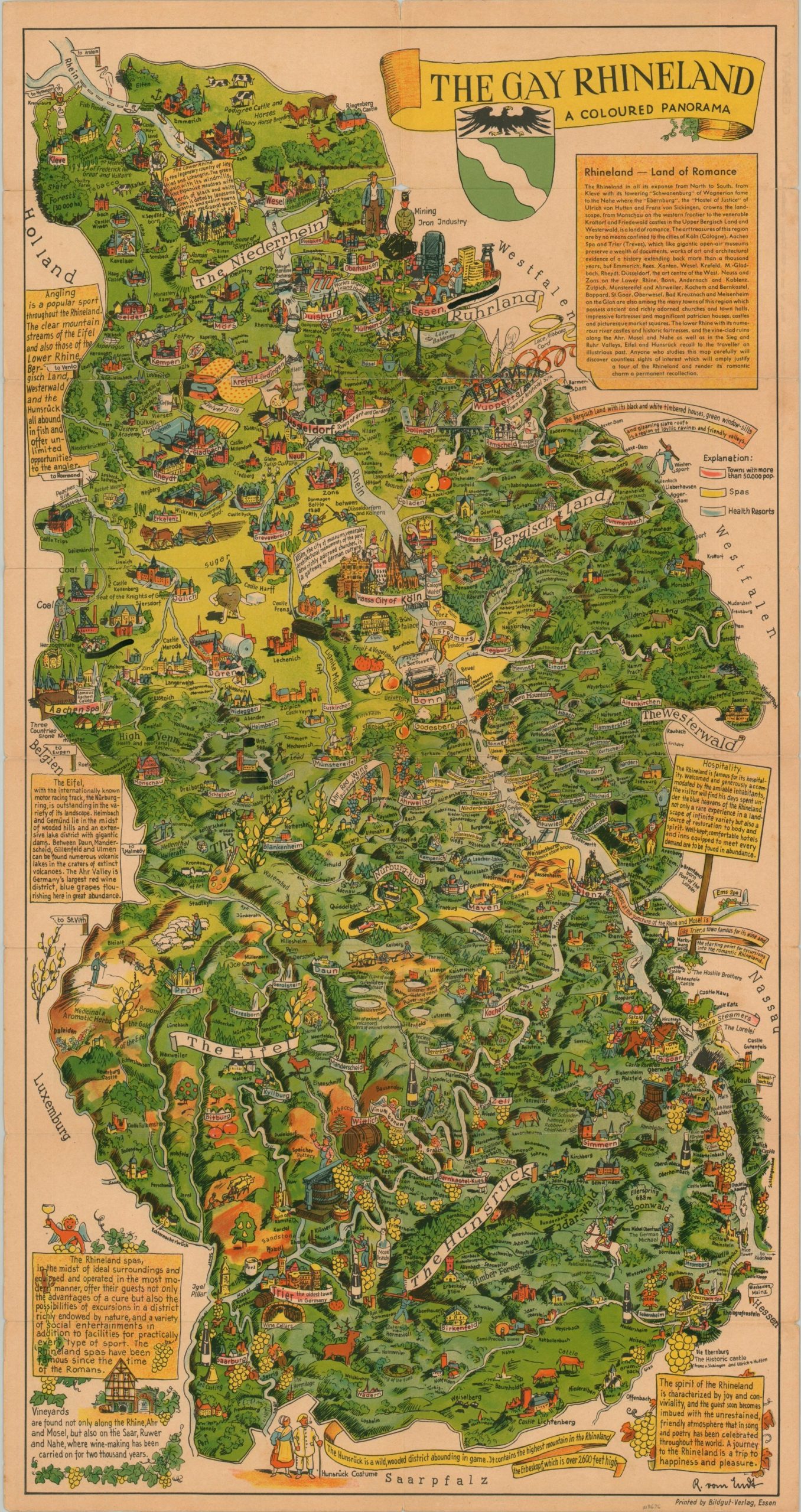
The Gay Rhineland A Coloured Panorama
Using prewar maps to reinvigorate a postwar German economy.
Out of stock
Description
This attractive and idyllic pictorial map of the Rhineland (the middle section of western Germany along the Rhine River) was originally illustrated by R. von Ernst and printed in Essen by Bildgut-Verlag around 1938. Lush rolling countryside is dotted with illustrated vignettes highlighting agricultural exports, local cuisine, cultural sites, and much more. Accompanying text, in English, provides further information on the ‘Land of Romance’.
At the time of publication, Germany was drastically increasing the militarization of the Rhineland, directly in contravention of the Versailles Treaty. This map possibly represents an effort to assuage the fears of an American audience at a time of rearmament and increasing risk of conflict across Europe.
What makes this particular example even more interesting is that it has been updated for distribution in a postwar world. All references to Nazi Germany, Hitler, and the Third Reich have been overwritten in black ink. Furthermore, a stamp on the front panel (in German) states [approximately] that ‘the present publication originates from residual stocks of older publications and serves the general information. We as for this to be taken into account where text and presentation does not reflect today’s conditions.”
Map Details
Publication Date: c. 1940
Author: R. Von Ernst
Sheet Width (in): 16.25
Sheet Height (in): 31.00
Condition: B+
Condition Description: The sheet is slightly, but evenly, toned from age and shows wear along former fold lines and in the outer margins. Remains in good to very good condition overall.
Out of stock

