The Folding Earth
A novel way of explaining continental drift.
Out of stock

Description
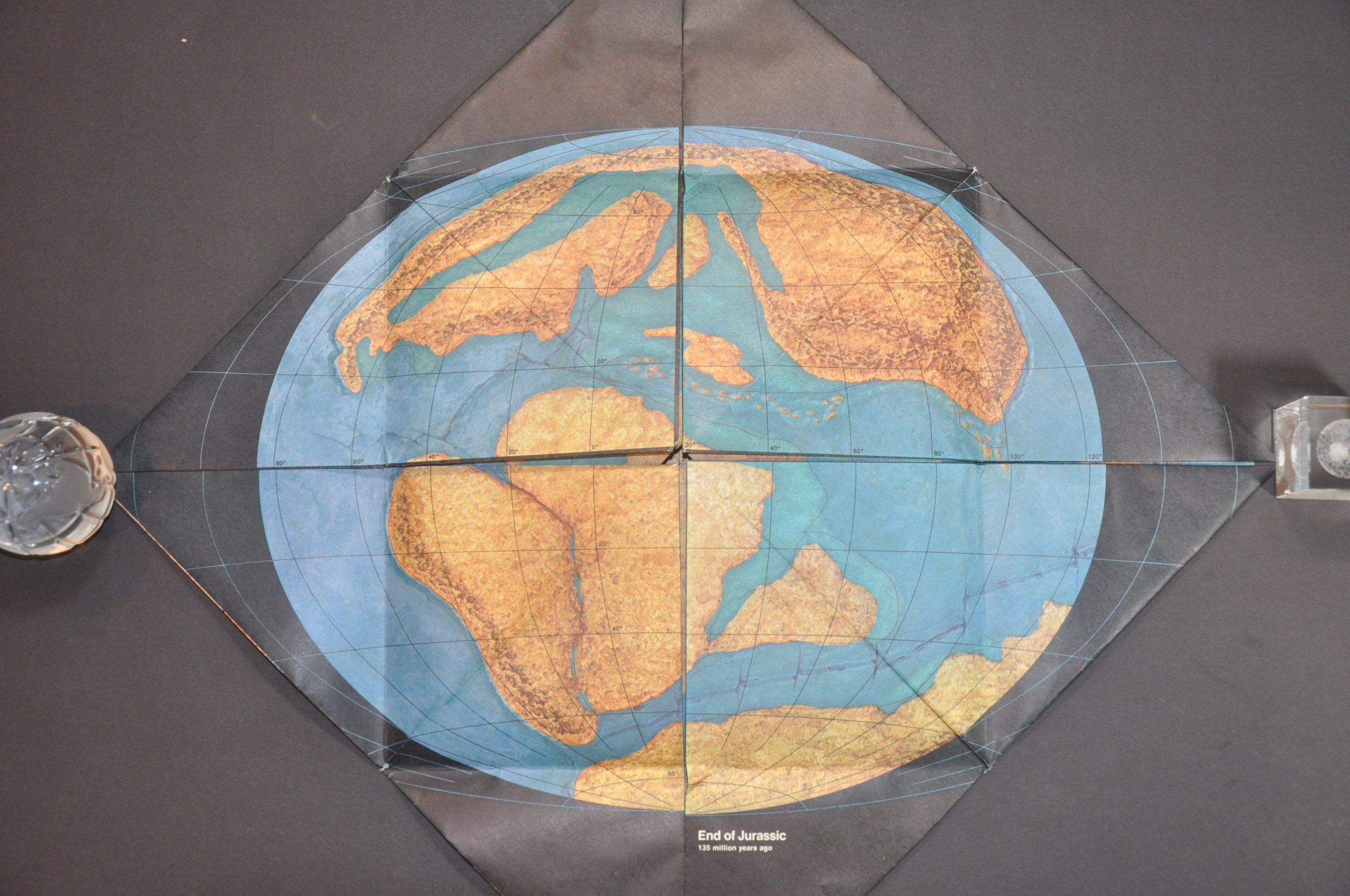
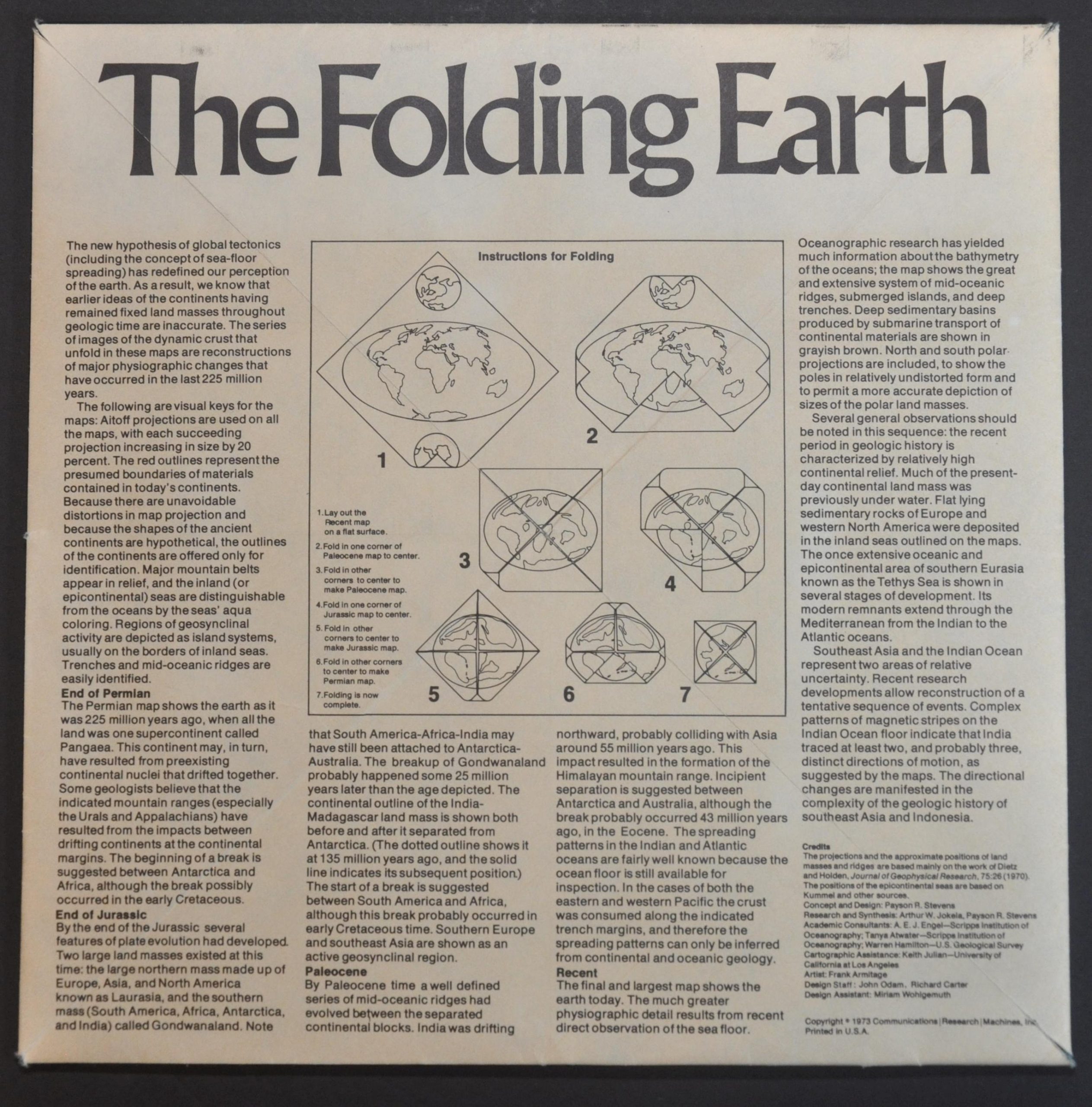
“The new hypothesis of global tectonics (including the concept of sea-floor spreading) has redefined our perception of the earth. As a result we know that earlier ideas of the continents having remained fixed landmasses throughout geologic time are inaccurate. The series of images of the dynamic crust that unfold in these maps are reconstructions of major physiographic changes that have occurred in the last 225 million years.” Text – verso.
Scientific knowledge about plate tectonics increased dramatically during the 1960s, as a series of seismometers were installed around the globe by nations keen on monitoring the testing of nuclear weapons. A fortunate side-effect was the accumulation of massive amounts of data that showed earthquakes, volcanoes, and other geographic features are concentrated at the borders of these plates, thus helping to explain the idea of continental drift.
The hypothesis is outlined even further with this innovative evolving map, which shows the gradual progression of global tectonic plates across 4 distinct eras – the Permian, Jurassic, Paleocene, and modern.
Designed by Payson R. Stevens, with assistance from a broad team representing the Scripps Institutitution of Oceanography, the U.S.G.S., and UCLA. Copywritten in 1973 by Communications Research Machines, Inc.
Map Details
Publication Date: 1973
Author: Payson R. Stevens
Sheet Width (in): See Description
Sheet Height (in): See Description
Condition: A-
Condition Description: An approximately 10.5" x 10.5" square map unfolds into a progressively larger image, eventually measuring about 29.75" x 29.75". Some minor wear along the fold lines and one or two tiny spots of separation along creases, but overall in very good, functioning, condition.
Out of stock