The Fishing Grounds of Bristol Bay, Alaska
Scientific investigations of the Albatross, “the first vessel built especially for marine research by any government” [NOAA]
Out of stock
Description
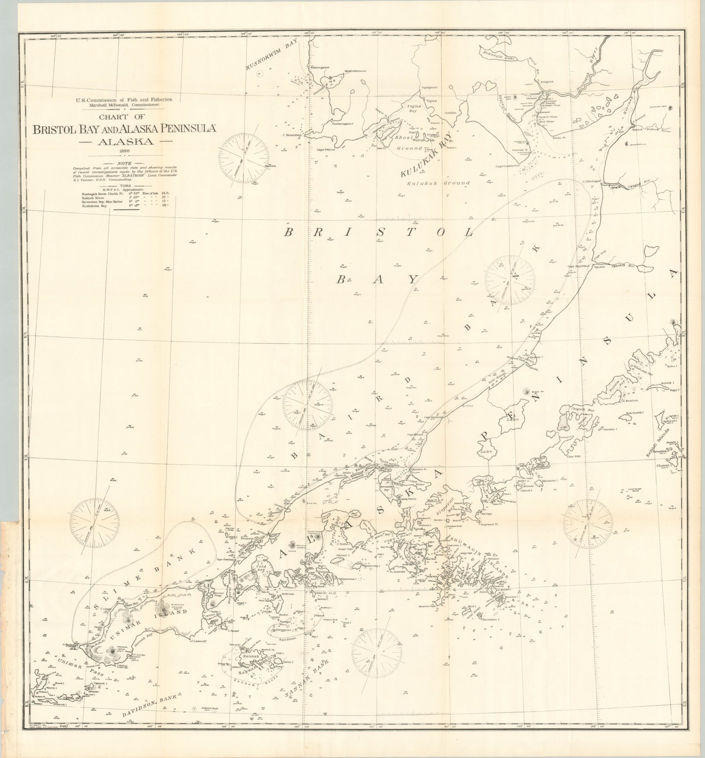
“Bering Sea was designated as the working ground for the steamer Albatross during the summer of 1890, the object of the cruise being to develop its offshore fishing grounds. The exploration of the cod banks of Bristol Bay occupied most of the time, and this report is chiefly limited to a discussion of that region.” [pg. 279]
This government report catalogs the efforts of the United States Fish Commission steamer Albatross during the summer of 1890, under the command of Lieutenant Commander Zera Turner. It was originally published in Washington, D.C. by the Government Printing Office in 1891 as part of the U.S.F.C. report to Congress that year.
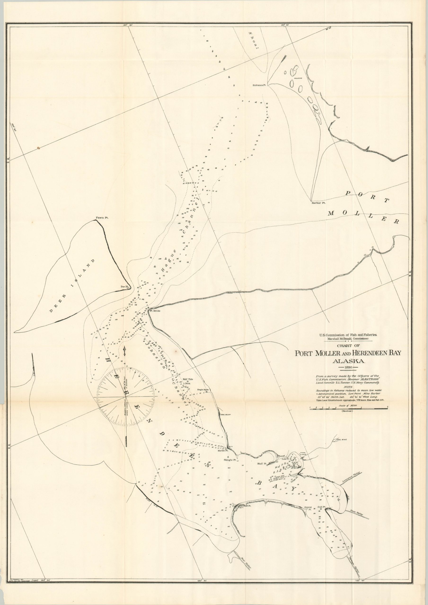
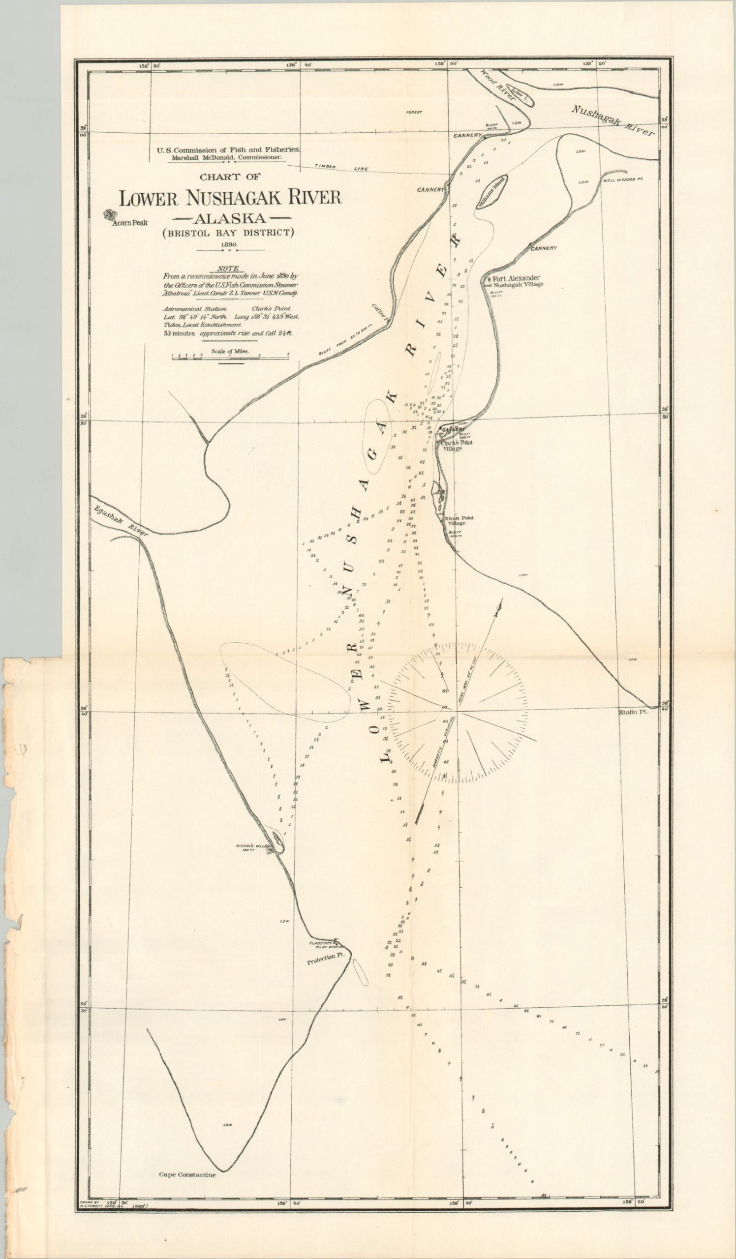
In addition to a detailed account of Turner’s observations, the report includes three folding maps that note depth soundings, magnetic readings, tidal measurements, and the composition of the seabed. The first sheet measures approximately 29.75″ x 32.75″ and covers Bristol Bay and the Alaska Peninsula. The second chart focuses on the mouth of the Lower Nushagak River and measures about 12″ x 21″, while the third map is 22″ x 30.5″ and shows Port Moller and Herendeen Bay.
Map Details
Publication Date: 1891
Author: Zera Tanner
Sheet Width (in): See Description
Sheet Height (in): See Description
Condition: A-
Condition Description: 10 pp. printed report (pgs. 279 - 288) and three folding maps (plates CVIII-CX) rescued from a busted and incomplete Congressional volume. Lightly toned and spotted in a few places, but overall very good condition. Contents are loose and show a ragged edge as a result of being previously bound.
Out of stock