
The Dalles – An Inland Seaport
$95.00
Promoting the economic benefits of the Bonneville Dam to local communities.
1 in stock
Description
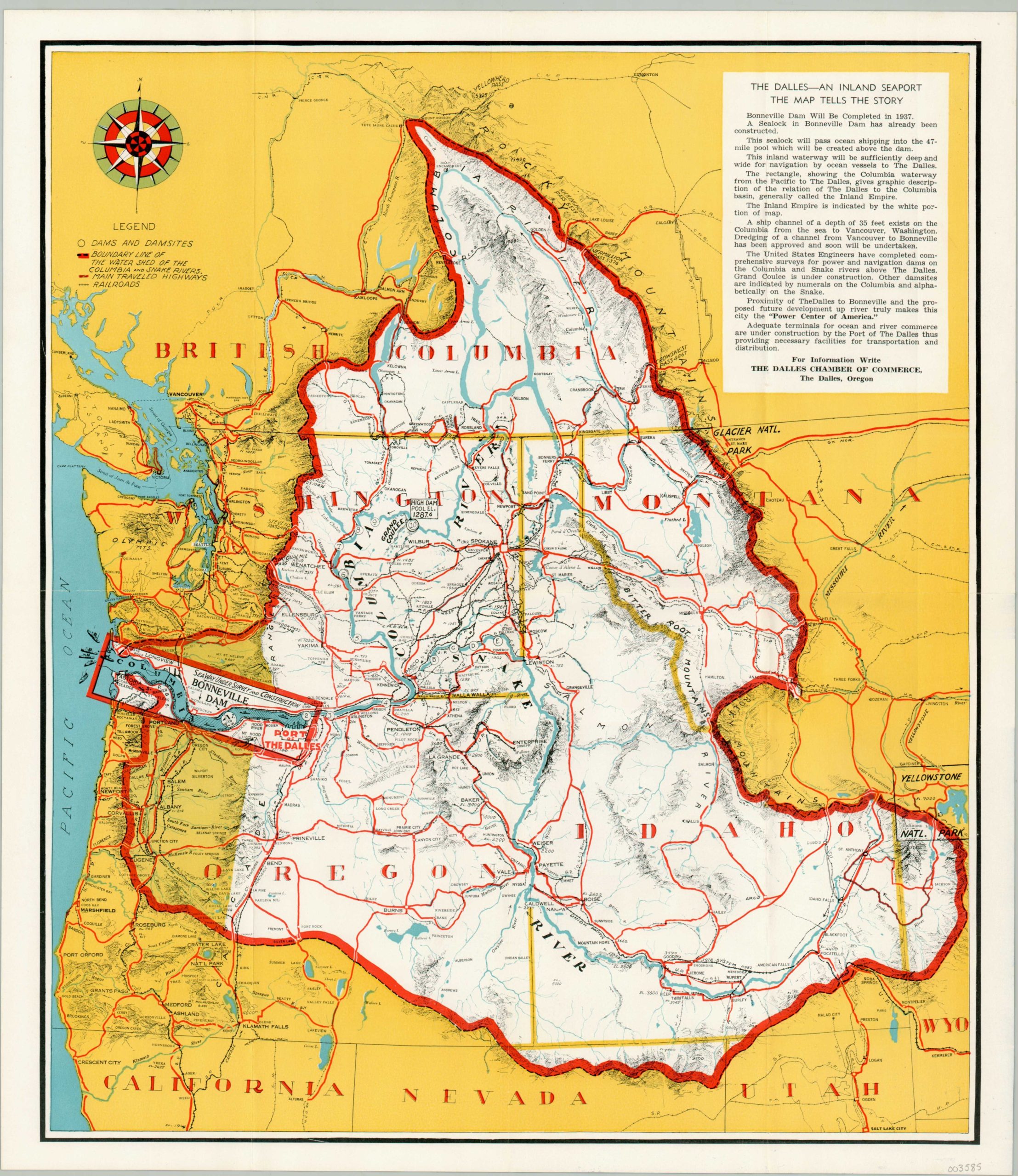
Situated on the Columbia River about 40 miles east of Portland, Oregon, the Bonneville Dam and Lock first opened in 1937 as part of Roosevelt’s New Deal to combat the effects of the ongoing Great Depression. Over 3,000 workers toiled for nearly 3 years prior to its completion, resulting in one of the largest hydroelectric projects in the world (at that time). Inexpensive electricity fueled industrial growth while the increased navigability of the Columbia River led Oregon to create a special economic district called the Port of the Dalles.
This map of the region, issued by the Dalles Chamber of Commerce shortly before the completion of the dam, emphasizes how the new improvements will benefit Oregon and Washington economically. An outline of the river’s watershed alludes to the vast territory requiring sufficient export facilities, while the highways and railroads highlight the robust transportation network. Text on the verso provides additional information on the various benefits provided by the Bonneville Dam, Columbia Basin, and Port of the Dalles.
Map Details
Publication Date: c. 1936
Author: The Dalles Chamber of Commerce
Sheet Width (in): 15.50
Sheet Height (in): 17.75
Condition: A
Condition Description: 8 panel brochure with light creasing along originally issued fold lines. Near fine.
$95.00
1 in stock