
The Coronation Route and Route of Royal Procession
$110.00
King George V takes the throne and greets his people for the first time.
1 in stock
Description
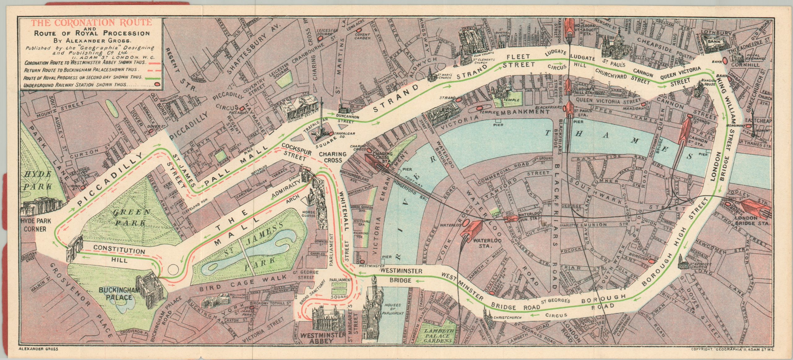
This ephemeral pocket map of central London outlines the precise routes taken by King George V and Queen Mary during their coronation ceremonies in June 1911. The cornerstone of day one was the elaborate religious ceremony at Westminster Abbey, followed by a tight loop around Whitehall before returning to Buckingham Palace. Day two was a much more public affair; this massive “Royal Progress” followed a meandering route that took the royal party down the Strand and Fleet Street, across the Thames into Southwark via London Bridge, and back north over Westminster Bridge. The newly completed Admiralty Arch was a key feature for both processions—one of several landmarks carefully illustrated in profile across the landscape.
The map was designed by Alexander Gross and published by Geographia at their early Adam Street, Whitechapel offices in 1911. A heavy cartographic emphasis on railway lines and Underground stations indicates it was explicitly intended as a handy guide for the massive throngs of visitors descending into London for the imperial celebrations.
Map Details
Publication Date: 1911
Author: Alexander Gross
Sheet Width (in): 14.75
Sheet Height (in): 6.60
Condition: A-
Condition Description: Color printed map on a single-sided sheet, affixed to back paper cover, but front is missing. Light wear along the outer edges and faint creasing along folds. Good to very good condition overall.
$110.00
1 in stock