The Construction of Maps in Relief
$165.00
Highlighting the application of 3D maps for uses in the mining industry.
1 in stock


Description
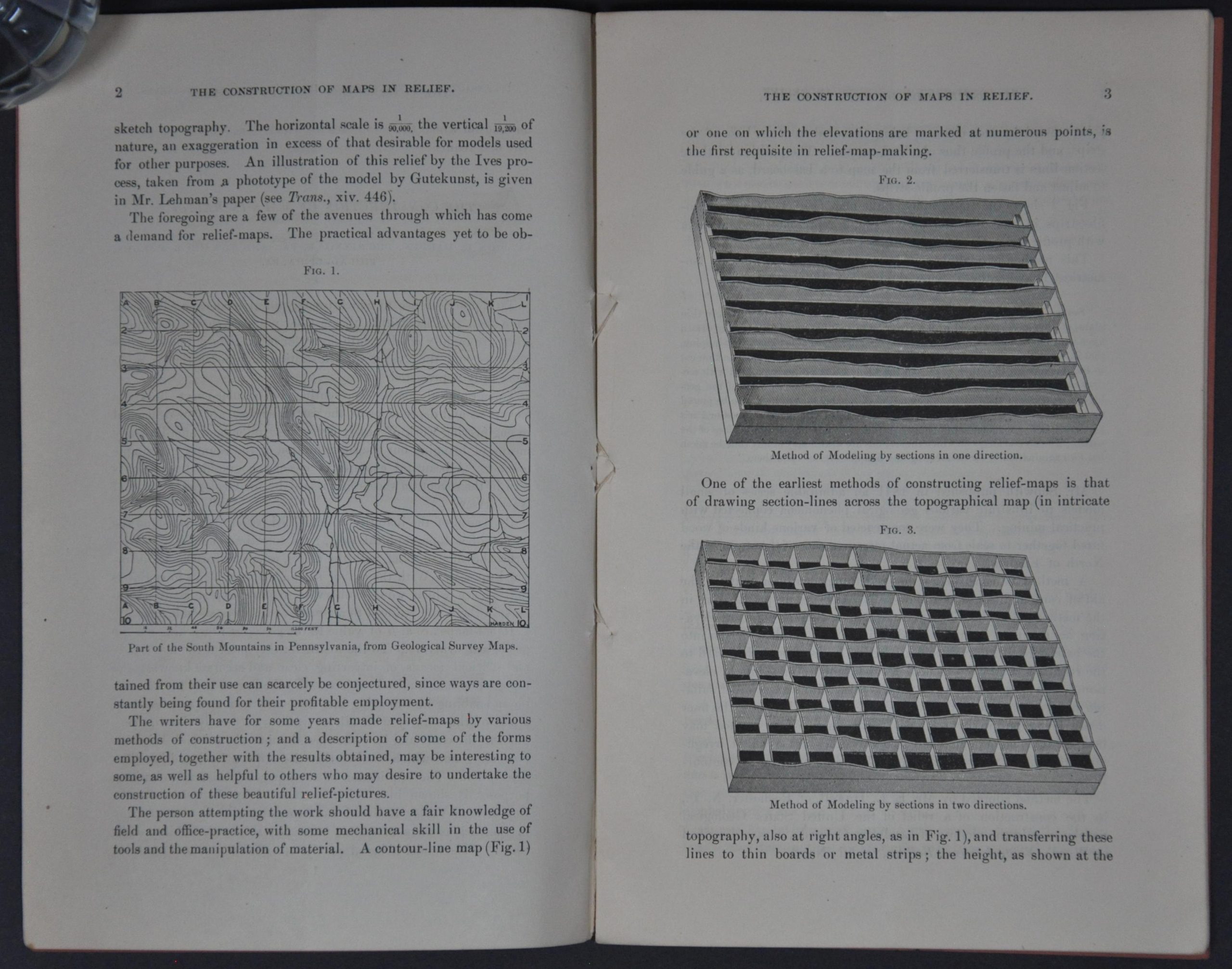
“The practical use to which topographical models or relief -maps have been put, has within the last few years taken a wider range. They are rapidly coming into favor for other than purely scientific purposes, and their value for illustration and instruction is being more fully appreciated…By reason of the inability of the unskilled persons to understand the nature of a topographical map, it is sometimes necessary to construct the same in relief…” – pg. 1.
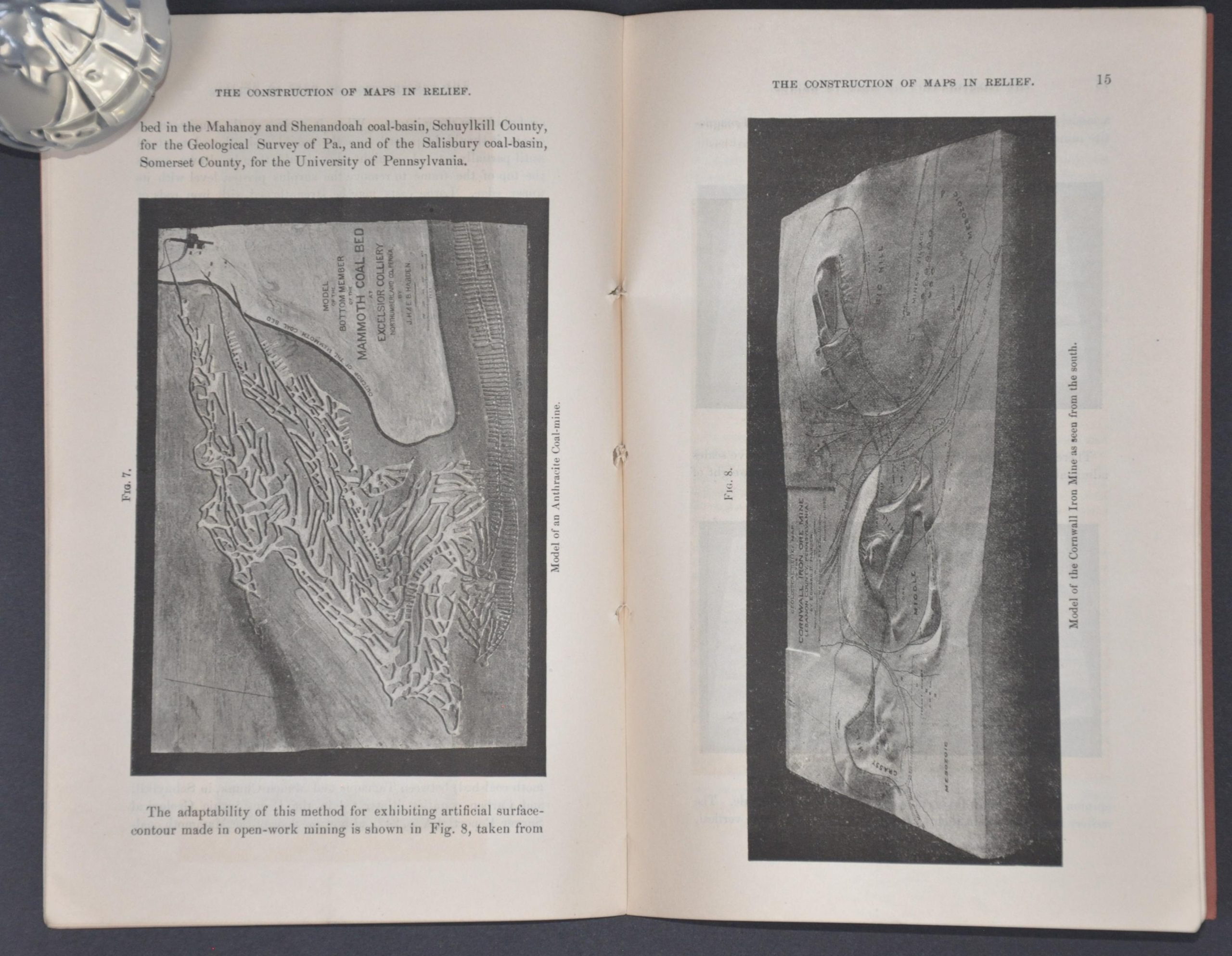
This instructional guide to the practical construction of relief maps was first given to the American Institute of Mining Engineers at the meeting in Duluth, Minnesota, in 1887. John and Edward Harden (probable relations?) provide a technical overview of converting ‘standard’ topographic plans into 3D models that could be used for a variety of purposes, including engineering, surveying, proposals, etc. Includes several photographic plates, plus one fold-out in the back that shows a relief map of the Cumberland Valley (designed by the Hardens).
Map Details
Publication Date: 1887
Author: John and Edward Harden
Sheet Width (in): 5.75
Sheet Height (in): 9.00
Condition: A-
Condition Description: 23 pp. of text + 1 fold out plate bound with staples in original brown paper wraps. Creased along an old vertical fold and moderately toned (consistent with age). Very good overall.
$165.00
1 in stock