The Conquest of Space
Presenting outer space exploration as a globally cooperative effort.
Out of stock

Description
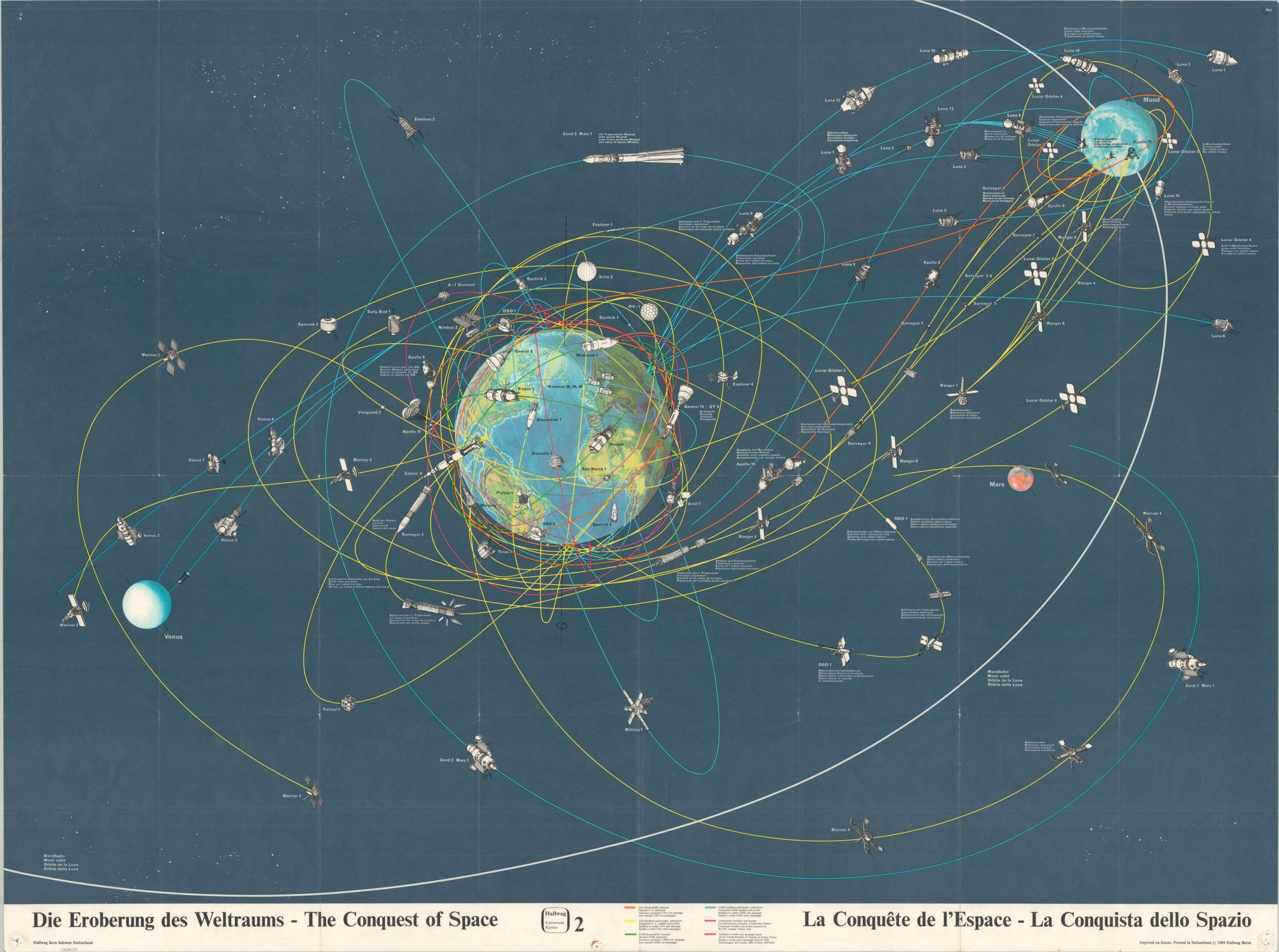
This striking chart of outer-space exploration showcases the tremendous technological advancements made since the first artificial satellite was launched. Five different colors highlight the paths of manned spacecraft and unmanned probes for the United States, the Soviet Union, and the coalition of the U.K., France, Canada, and Italy. Collectively, the routes present the impression of significant global (and even galactic!) coverage, with a cluttered thermosphere reflecting worldwide competition almost as much as cooperation.
Map Details
Publication Date: 1969
Author: Hallwag AG
Sheet Width (in): 44.00
Sheet Height (in): 33.00
Condition: B+
Condition Description: Large color printed chart with text and photographs on the verso. Creased along original fold lines (includes original envelope), with pinholes in each corner and wrinkling at the fold joints. Good condition overall.
Out of stock