The Comprehensive Series of Historical-Geographical Maps of the United States
A nice, complete example of popular schoolroom maps from the late 1930s.
Out of stock


Description
This incredible assortment of educational maps and charts was compiled by the talented geographers Olin Morrison and Erwin Raisz. They were published by the Modern School Supply Company in the small town of Goshen, Indiana (pop. ~ 11,000) shortly after the outbreak of World War II. The firm was part of a cluster of specialized educational manufacturers in Indiana, such as George Cram, the Peabody Seating Company, and Weber Costello.
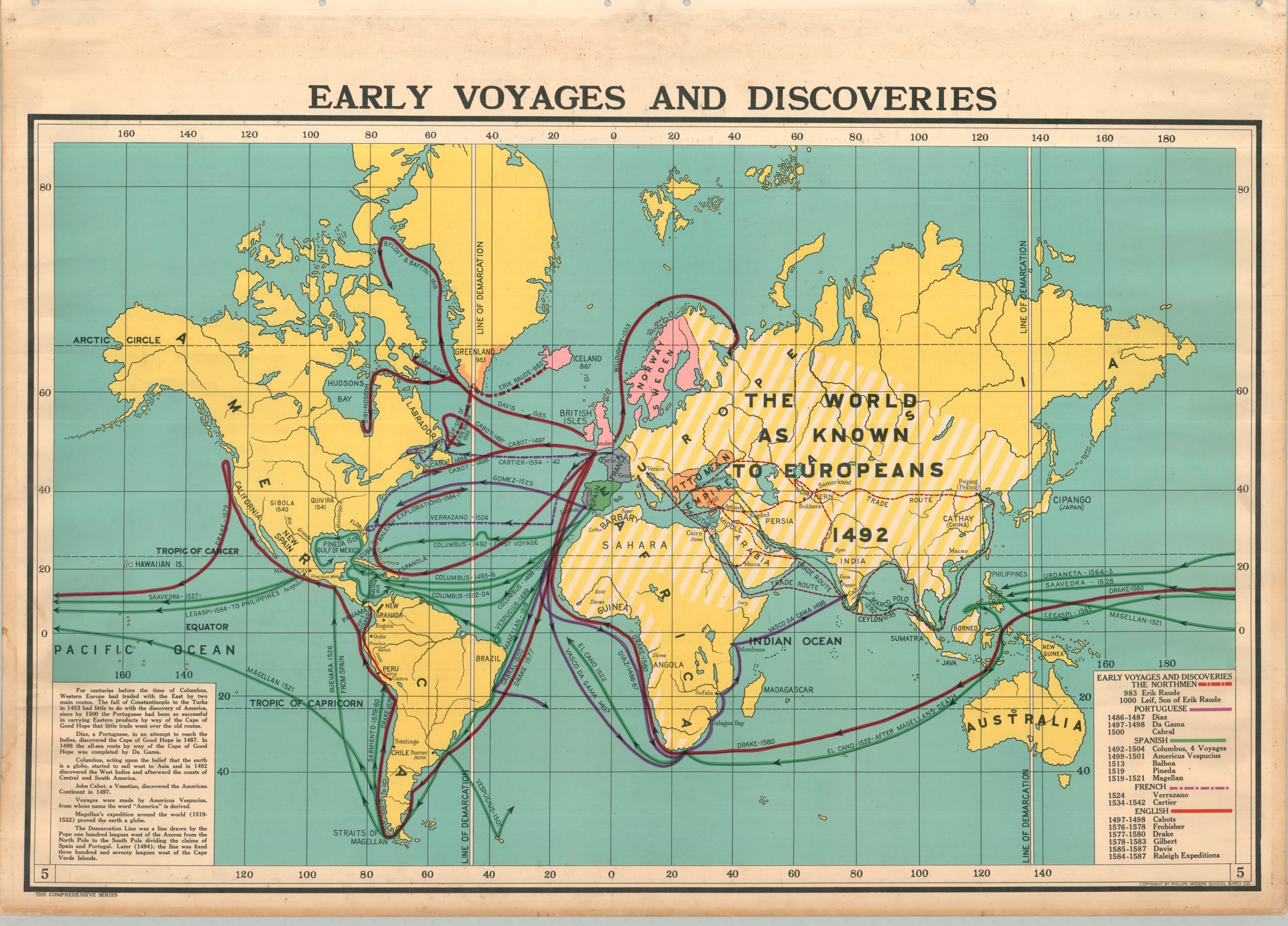
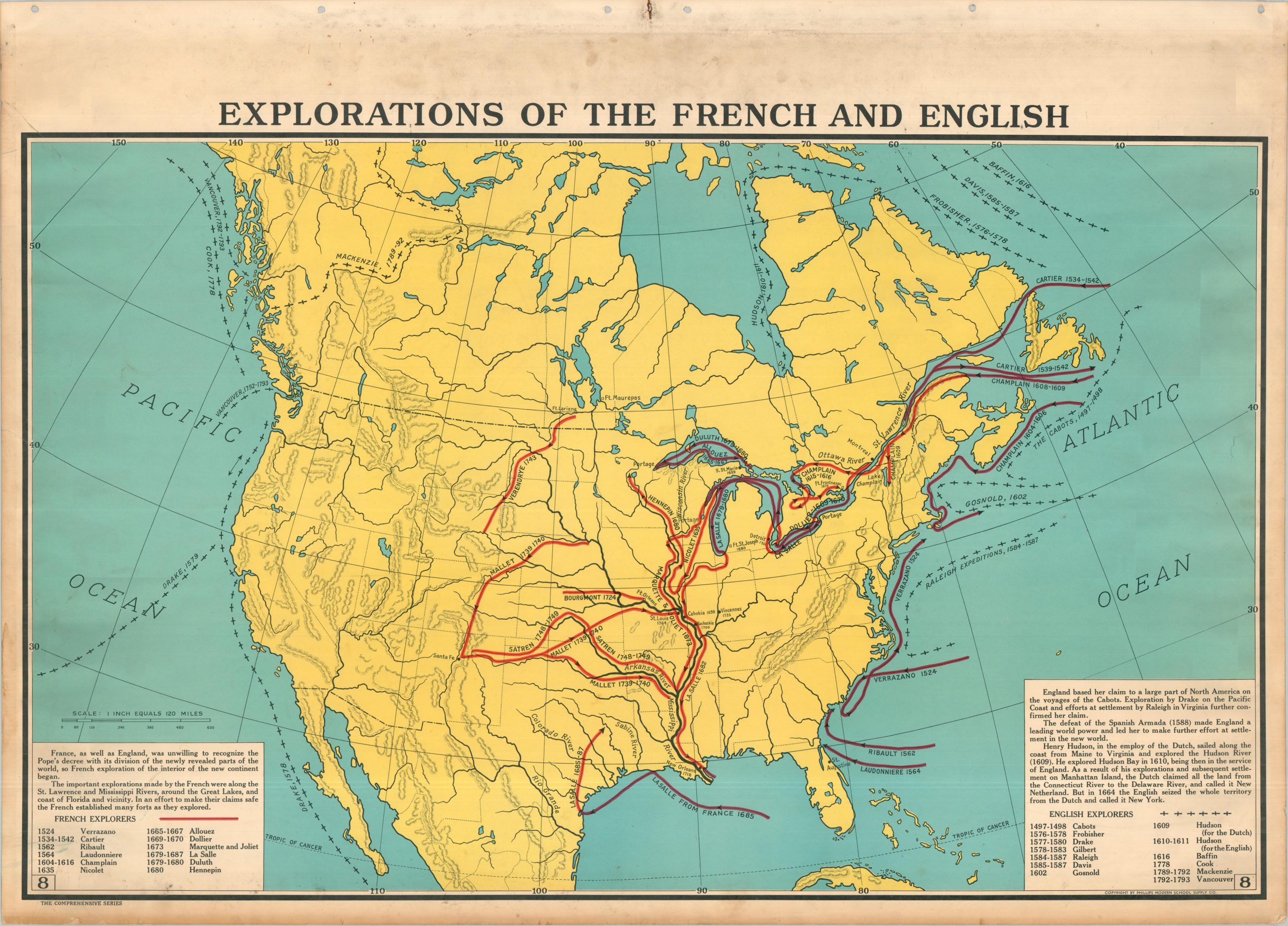
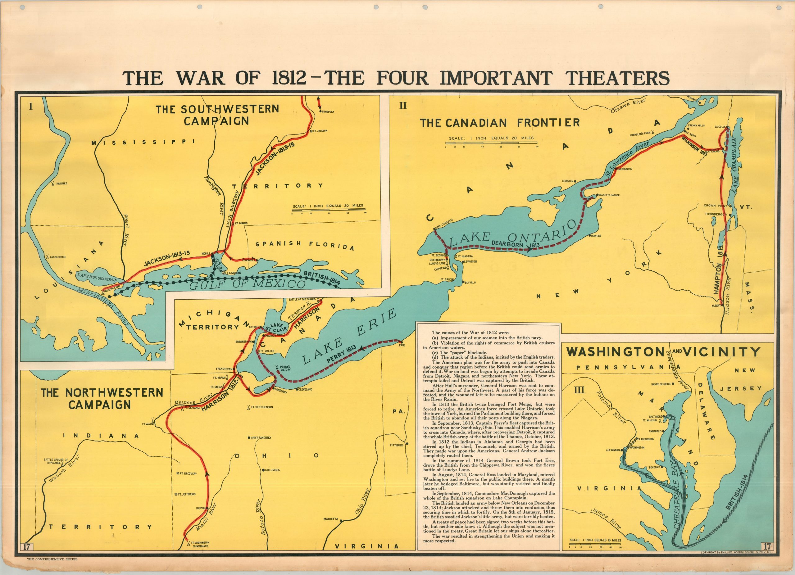
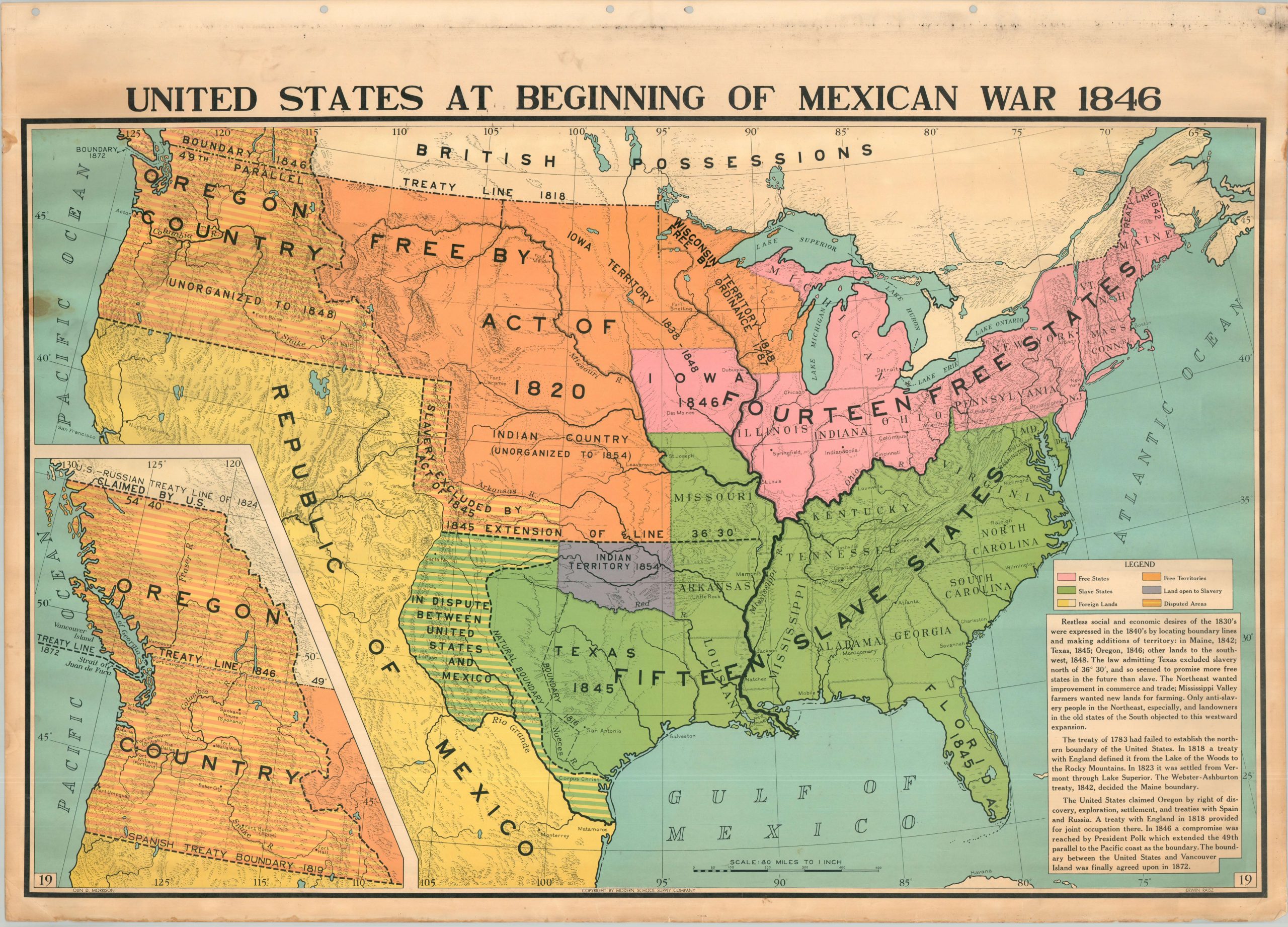
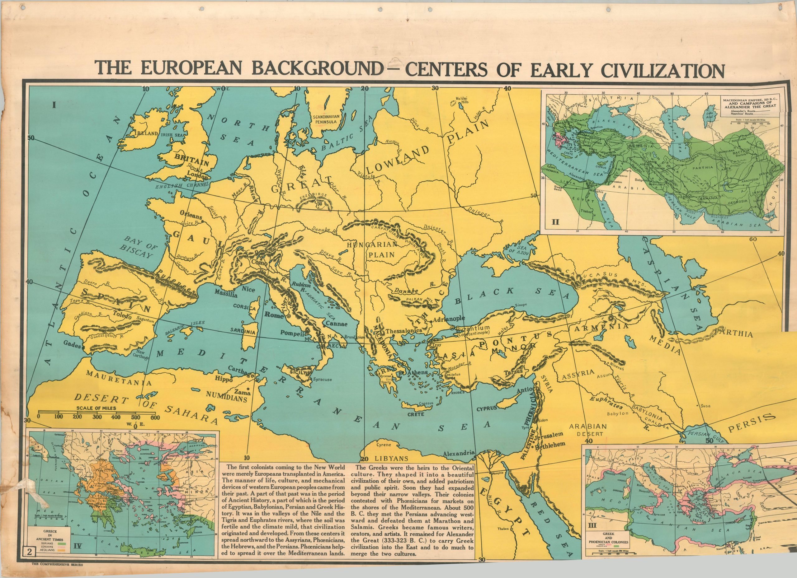
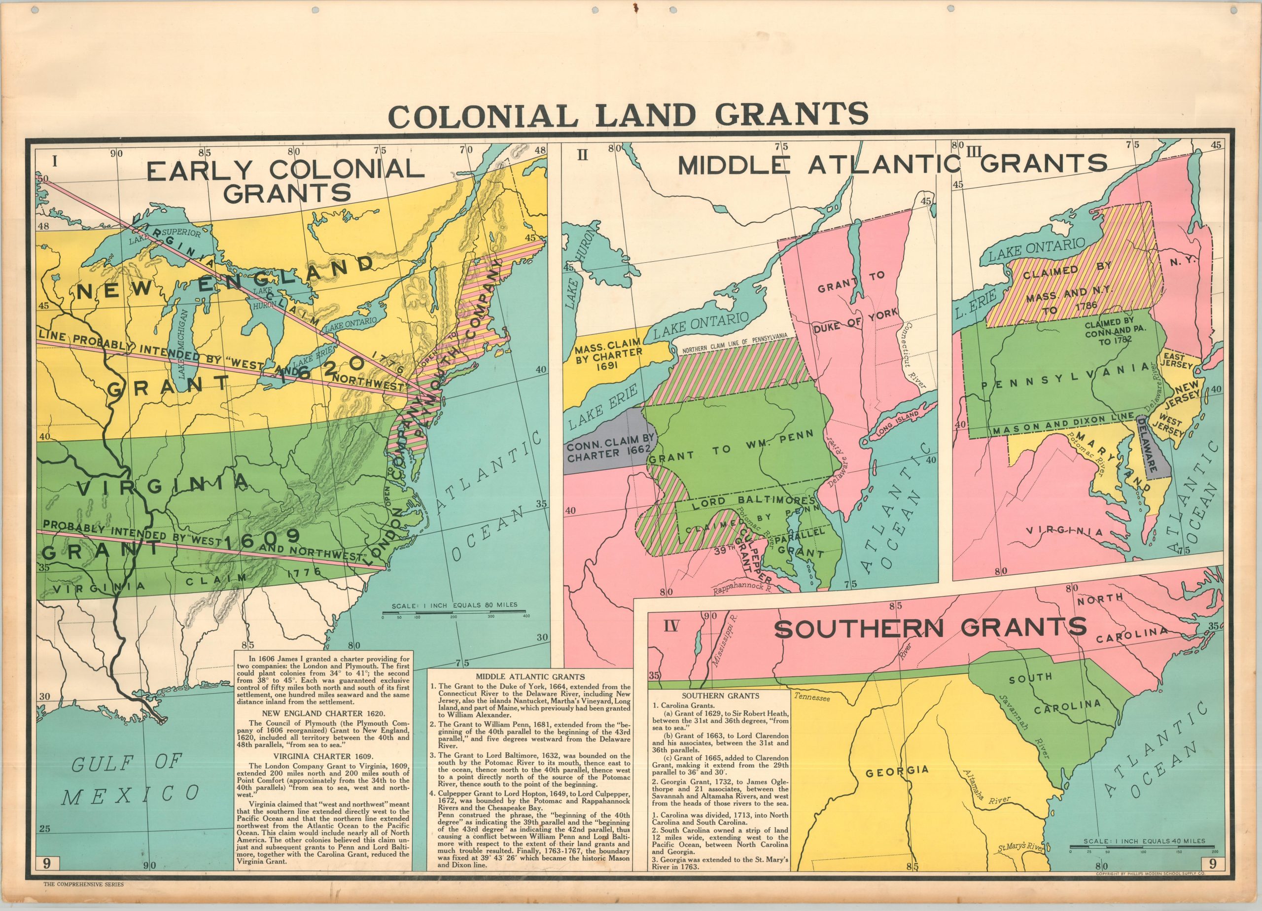
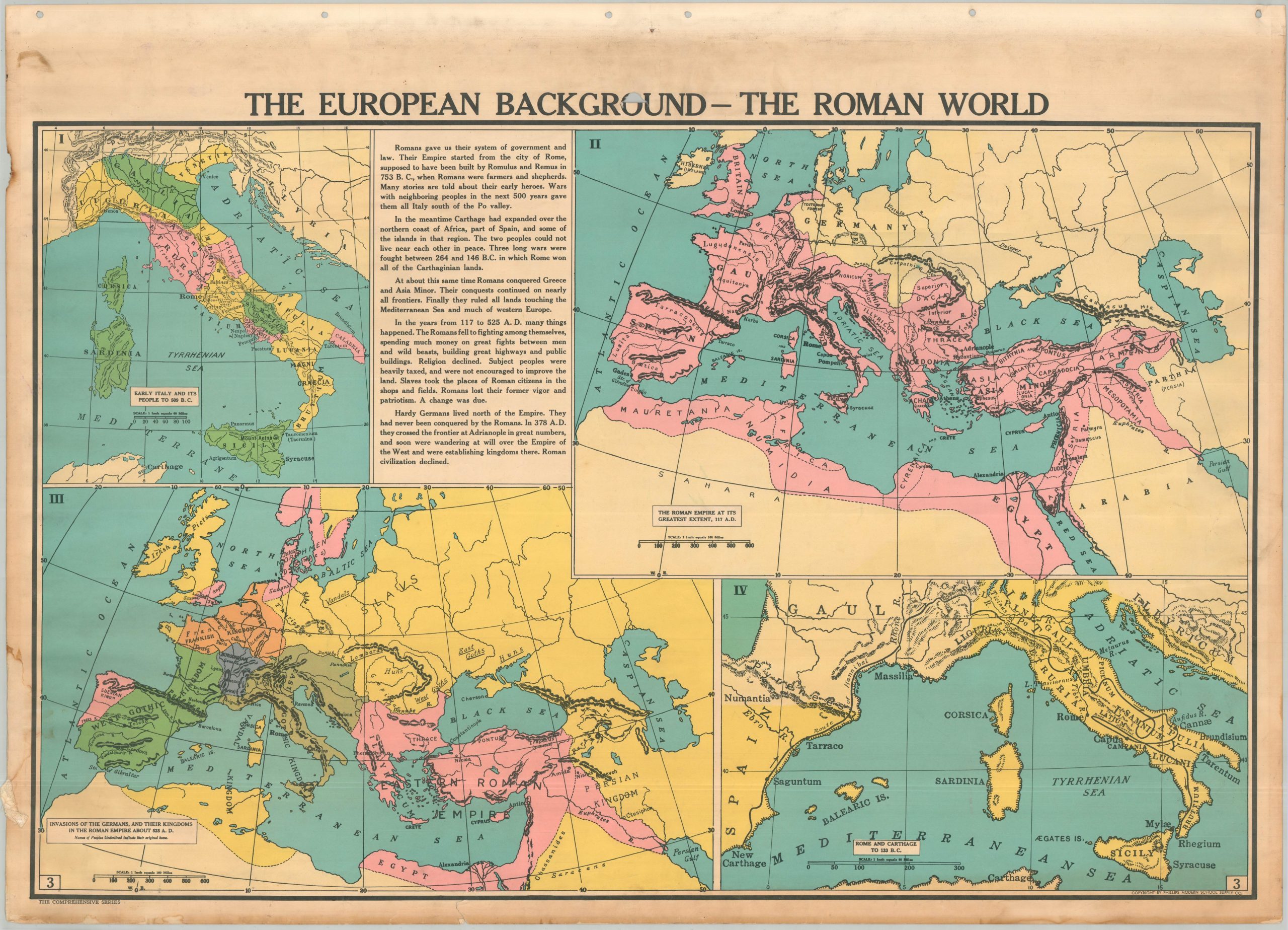
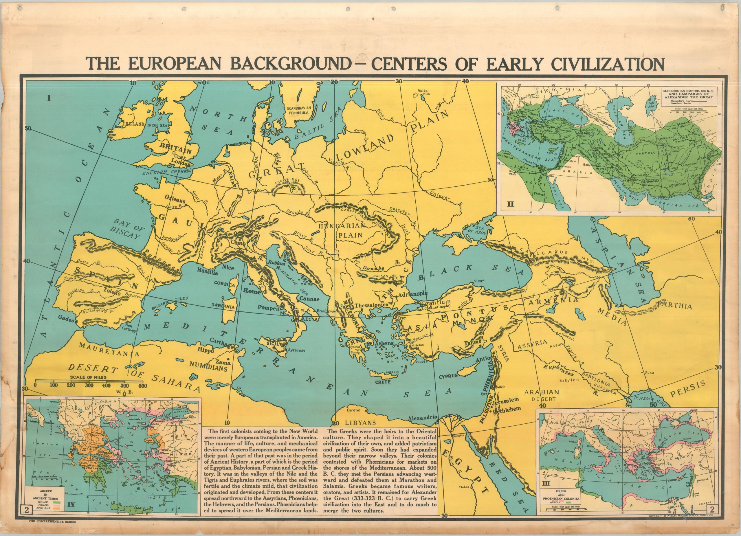
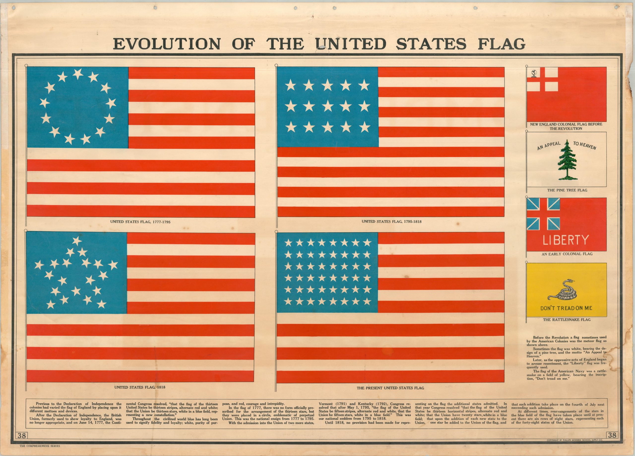
The history of the United States is explored in spectacular visual detail, from the foundations of Western Civilization to the ‘The World at Present.’ There is a great diversity of subjects in between, including early exploration, Native Americans, the Revolutionary War, Westward Expansion, the Civil War, the development of the flag, transportation (roads, railroads, and airways), America’s empire, industrial and agricultural resources, physical geography, World War I, the nation’s political evolution, and the current European conflict.
Raisz and Morrison were a veritable ‘dream team’ in terms of editorial oversight. The former was a Hungarian-born engineer in the Austro-Hungarian Army who graduated from Columbia University and spent twenty years teaching at Harvard, where he established one of the first courses in cartography in the United States. Raisz was an expert in the visualization of physical landscapes. Olin Morrison, on the other hand, was a prominent historian at Ohio University who focused on the development of America’s social and political factors. He meticulously tracked shifting boundaries, battle lines, and voting patterns to help craft a coherent chronology of the United States.
Sources: Library of Congress; Raisz Maps; University of Ohio;
Map Details
Publication Date: 1939
Author: Olin Morrison and Erwin Raisz
Sheet Width (in): 43.50
Sheet Height (in): 31.50
Condition: B+
Condition Description: A series of nineteen double sided sheets formerly attached to a steel binder (now removed). Heavy soiling on the front index, concentrated along the upper and lower edges. Maps are generally clean and in good shape, with the odd errant tear, spots of foxing and soiling, and moderate marginal wear that does not usually affect the image. There are strips of linen adhered to the edges of the sheets, likely for reinforcement, but they are beginning to pull away in several areas, leaving some discoloration behind but otherwise not affecting much. Pretty good condition overall for a set that presumably hung in a schoolhouse.
Out of stock