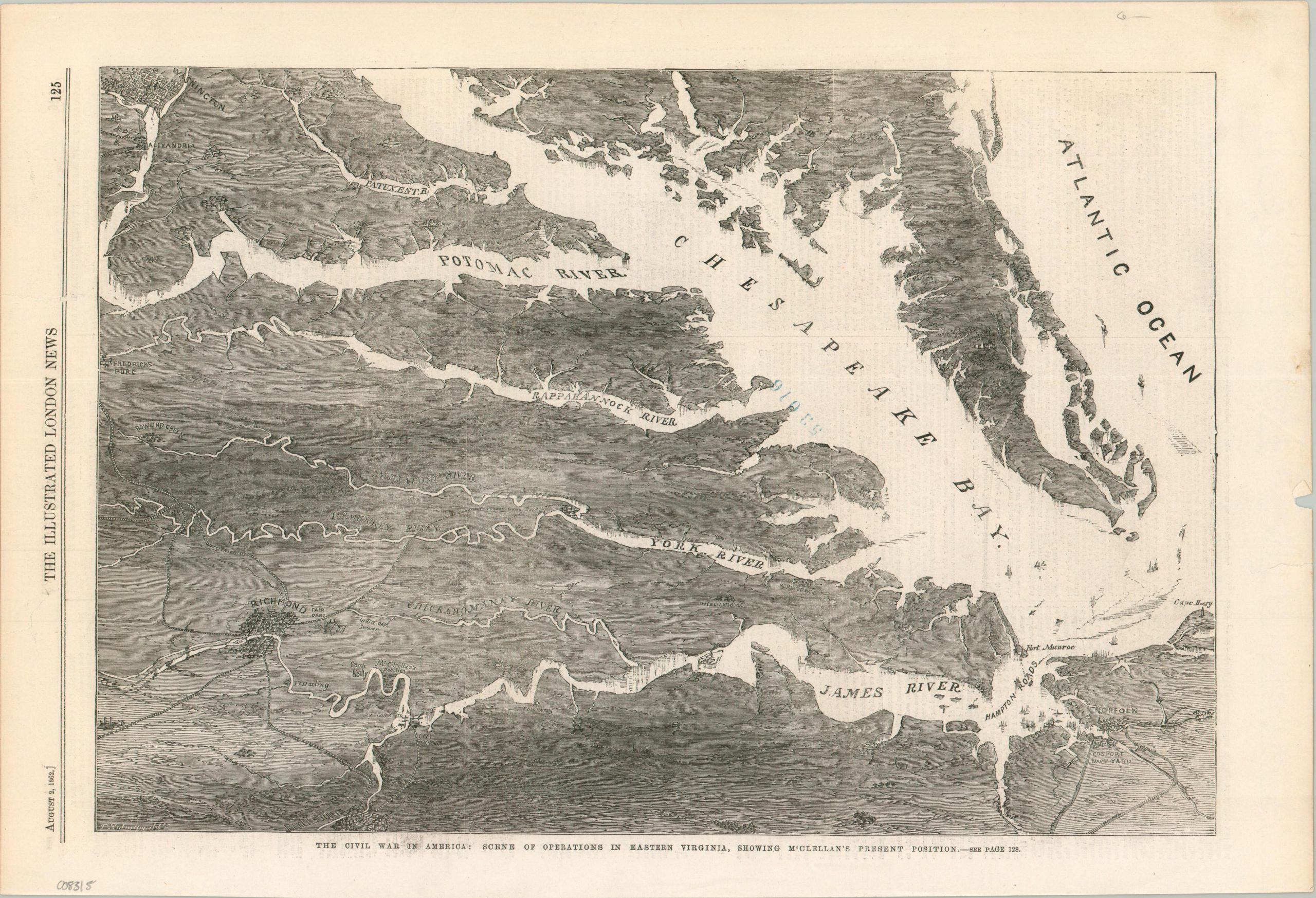
The Civil War in America: Scene of Operations in Eastern Virginia, Showing McClellan’s Present Position
$100.00
Visualizing the proximity of the Confederate and Union capitals during the Civil War.
1 in stock
Description
This fascinating aerial view of Virginia and the waters of the Chesapeake Bay was issued at a pivotal moment for the Union in the early months of the Civil War. McClellan’s army, supported by gunboats, is camped along the James River outside of Richmond after a brutal defeat at the Seven Days’ Battle. The Peninsula campaign was at an end and the field of conflict would shift to the war-torn plains of northern Virginia.
Originally published in the August 2, 1862 edition of the Illustrated London News. The following day, General-in-Chief Henry Halleck officially issued the order for McClellan’s retreat.
Map Details
Publication Date: 1862
Author: Illustrated London News
Sheet Width (in): 15.75
Sheet Height (in): 10.75
Condition: B+
Condition Description: Woodcut image extracted from an issue of the Illustrated London News. Remnants of an old blue rubber stamp in the center of the sheet. Moderate marginal wear, including several small repaired tears, light soiling, and toning. Very good condition overall.
$100.00
1 in stock