The City of New York (The Five Boroughs)
Immaculately detailed mid-century map of the Big Apple.
Out of stock

Description
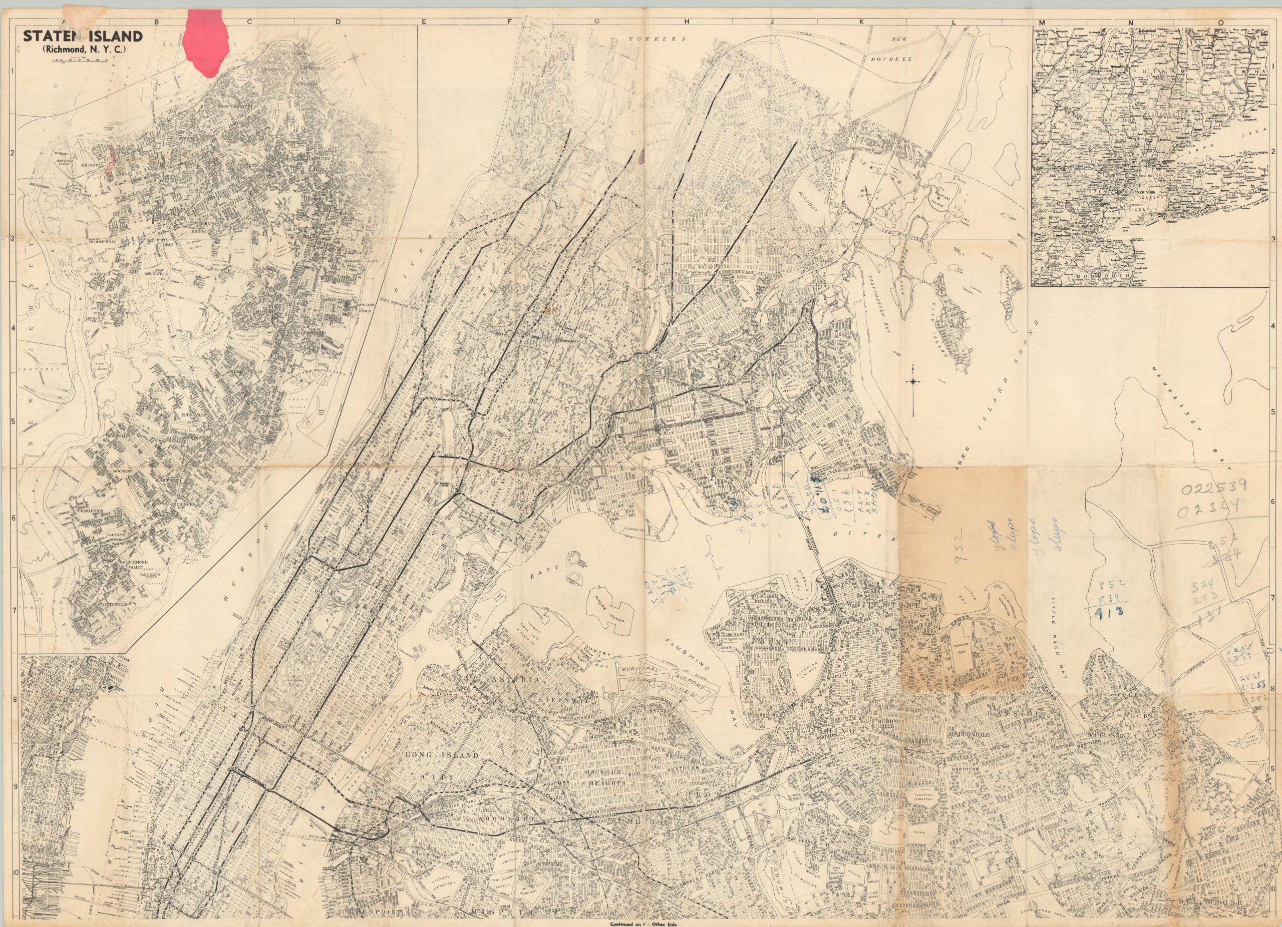
This wonderfully detailed map of New York City was published locally around 1951 by the Geographia Company. The image was dated using the presence of the Brooklyn-Battery Tunnel (1950) and ongoing construction around the United Nations Plaza (1952).
Across both sides, the presents a comprehensive overview of the city’s five boroughs. Primary transportation routes, locations of interest, geographic features, and prominent businesses are labeled throughout. According to Wikipedia;
Geographia was founded in 1911 by Alexander Gross (1879 -1958), a native of Hungary who had established Geographia, Ltd, a commercial map publisher in Fleet Street in London. In the United States, the new Geographia initially produced maps of the New York area, expanding into neighboring urban areas. Beginning in the 1940s, Geographia entered a period of rapid growth, introducing world maps and atlases, topical maps detailing aspects of World War II, and a catalog of atlases, street guide books (“Red Books”), travel guides (“Famous Guides”), wall maps, and street atlases covering dozens of cities in the United States and Canada.
Map Details
Publication Date: c. 1951
Author: Alexander Gross
Sheet Width (in): 36
Sheet Height (in): 25.75
Condition: B
Condition Description: Pocket map now disbound from original guidebook. Heavy wear and creasing along fold lines and moderate wear along the outer edges of the sheet. Annotations and toning visible on one side. Between fair and good condition overall.
Out of stock