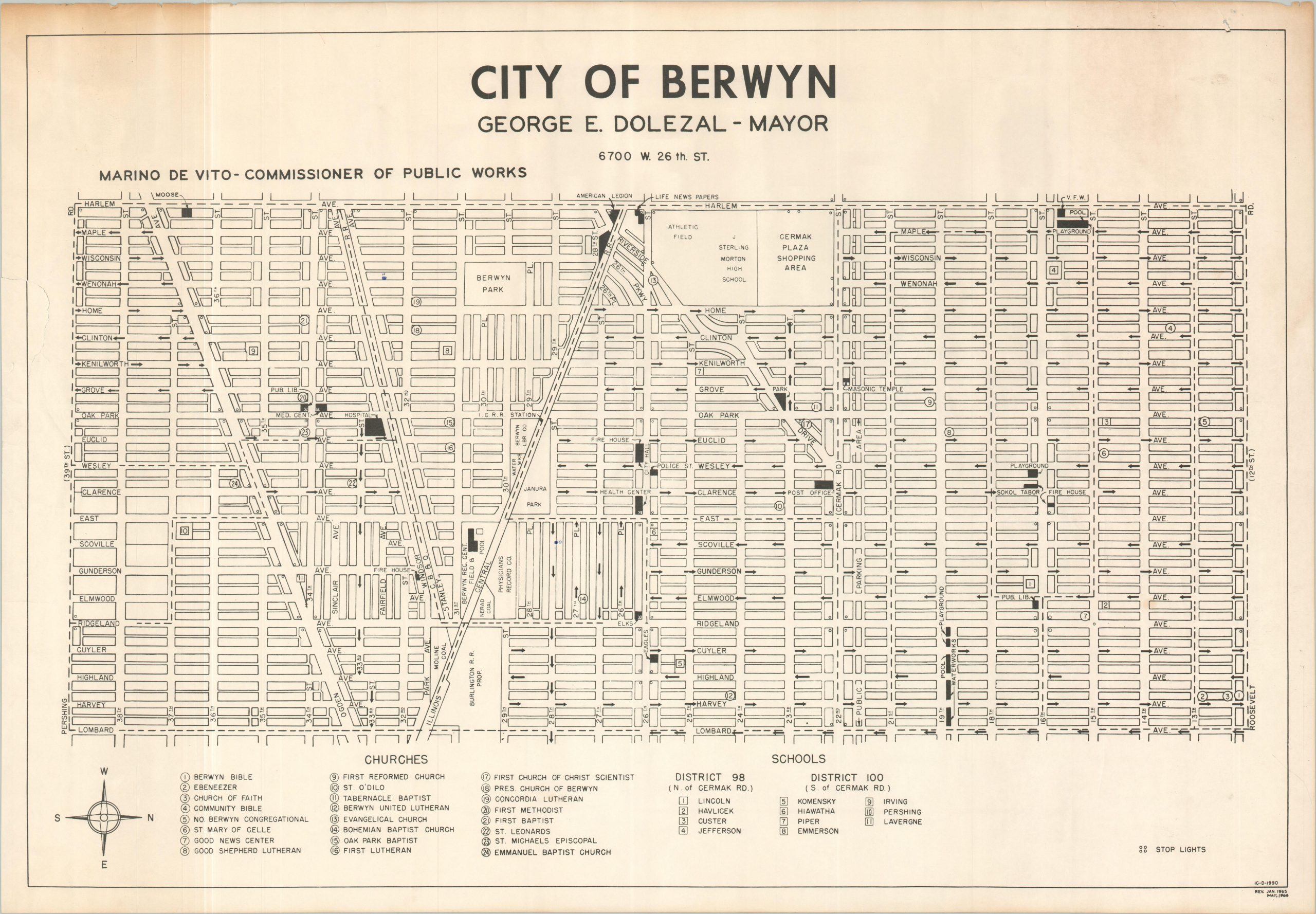
The City of Berwyn
$75.00
The home of Svengoolie! And Curtis Wright Maps!
1 in stock
Description
This straightforward street plan of Berwyn presents a comprehensive overview of the western Chicago suburb, oriented with west at the top. Stop lights are noted at their respective intersections, and nearly three dozen schools and churches are numbered throughout the image. Other labeled features include the Hospital, parks, the Cermak Plaza shopping center, public buildings, and the recreation center.
Originally created in January 1965, showing revisions to May 1966, during the tenure of Mayor George E. Dolezal. A third date in the lower right indicates 1990 – perhaps a later re-issue to commemorate Dolezal’s passing that year?
Map Details
Publication Date: 1990
Author: Berwyn Public Works Department
Sheet Width (in): 28.90
Sheet Height (in): 20.00
Condition: B+
Condition Description: Black & white map printed on a single sided sheet. Moderate wear in the margins, including discoloration and several small tears. Slightly wrinkled throughout, where previously rolled.
$75.00
1 in stock