[The Chicago Loop]
Uncommon cartographic advertising from the 1893 World’s Fair in Chicago.
Out of stock

Description
Unusually for such items produced during the fair, this map of Chicago does not emphasize the grounds of the 1893 Columbian Exposition held in Jackson Park. Instead, it focuses on the commercial district known colloquially as the Loop and shows transportation options to both the fairgrounds and Lincoln Park. Over fifty buildings are outlined and identified within Chicago Avenue, Jefferson Street, 22nd Street, and the lakefront.
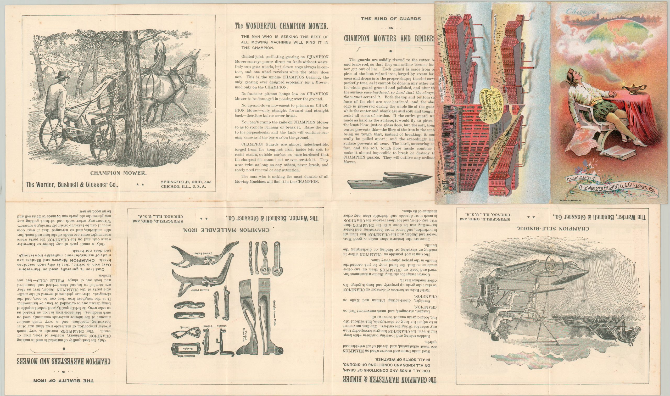
The map was issued by the Warder, Bushnell, and Glessner Company as a promotional item for the throngs of tourists crowding the city. A view in the lower left shows the company headquarters, completed in 1882 and still standing today.
Several advertisements for farm implements sold by the firm can be seen on the verso, while associated manufactories are shown on the cover to impress the viewer with their grand scale. Also depicted is an amusing scene of Columbus, fallen asleep at a table and dreaming contentedly of what would become of his discoveries.
Map Details
Publication Date: 1893
Author: G.H. Dunston
Sheet Width (in): 19.5
Sheet Height (in): 11.5
Condition: A
Condition Description: Pocket map folded into 12 panels, with faint edge wear and a bit of toning and light spotting on the verso. Affixed to original illustrated paper covers. Near fine.
Out of stock