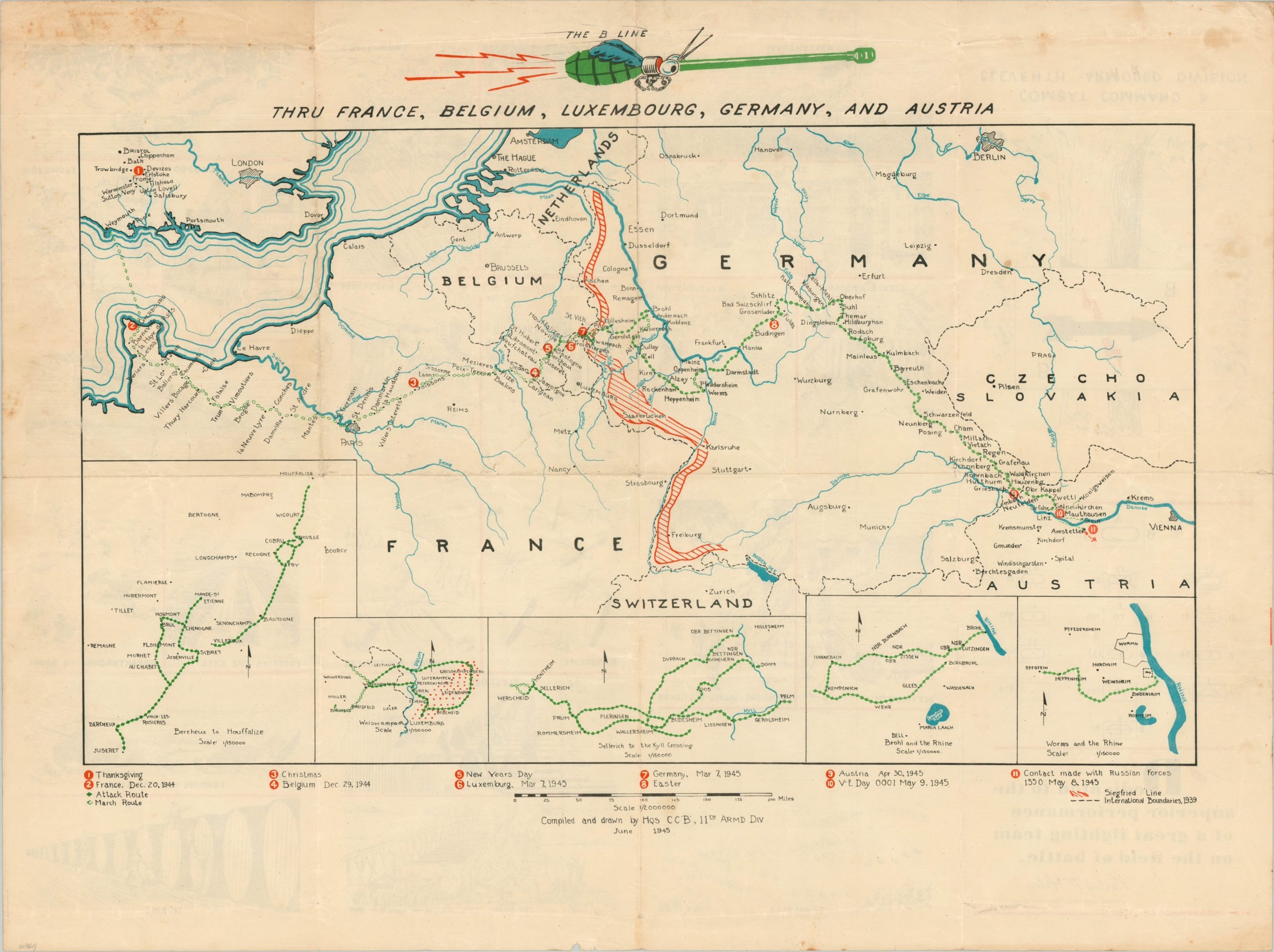
The B Line Thru France, Belgium, Luxembourg, Germany, and Austria
Command Company ‘B’ of the 11th Armored Division making a ‘B Line’ across Europe.
Out of stock
Description
This fascinating map of Europe chronicles the World War II campaign of the 11th Armored Division, in particular, the route of Command Company B. Towns, rivers, and political borders are noted throughout the image, which is bisected by the bright red Siegfried Line. Shaded triangles represent progress while in combat and eleven different points are numbered within the image and explained along the bottom of the page.
Of particular interest is New Year’s Day (#5). On January 1, 1945, members of the unit executed as many as 80 German prisoners in cold blood near the Belgian town of Chenogne, allegedly in retaliation for similar massacres of American POWs by S.S. troops. No one was punished for the incident and a subsequent cover-up in the Army prevented public knowledge for decades. The village can be seen in the first inset in the lower left, one of five depicting the various areas of combat.
Compiled and drawn by Headquarters of Command Company B of the 11th Armored Division in June of 1945.
Map Details
Publication Date: 1945
Author: Command Company B 11th Armored Division
Sheet Width (in): 30.90
Sheet Height (in): 23.00
Condition: B+
Condition Description: Scattered soiling and discoloration visible in several places, most evident in the upper left margin. The image remains quite clean overall. Creased along former fold lines and light wear throughout, consistent with age.
Out of stock


