The Antarctic Regions
$95.00
A catalog of discovery across Antarctica.
1 in stock
Description
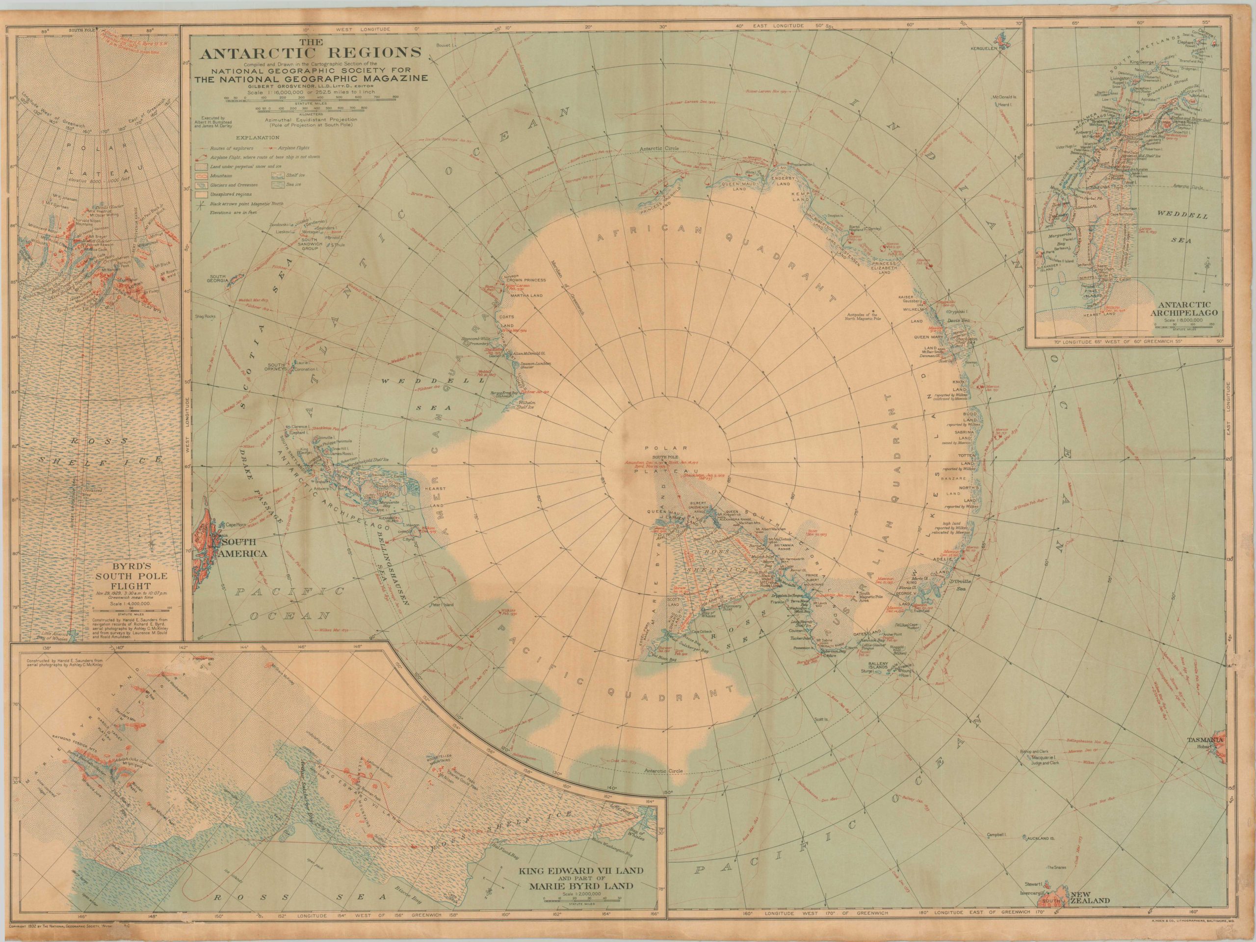
This impressively detailed map of Antarctica was compiled by Albert Bumstead and James Darley and copywritten in 1932 by the National Geographic Society. The routes of numerous polar explorers are marked and dated throughout the image, ranging from James Cook’s second voyage in 1773 to Gunnar Isachsen’s travels aboard a converted sealer, the Norvegia, in 1930.
Insets show the route of Byrd’s South Pole Flight, King Edward VII Land, and the Antarctic Archipelago. A legend in the upper left outlines the various symbols used to showcase different geographic features. The cartographers did a fine job of presenting the latest available geographic data while cleverly speculating on the many unknowns that remained.
Map Details
Publication Date: 1932
Author: Albert Bumstead and James Darley
Sheet Width (in): 26.25
Sheet Height (in): 19.4
Condition: B
Condition Description: An unusual variant, issued on linen, that shows moderate and uneven toning throughout the image. Discoloration on the verso does not affect the image. Good condition overall.
$95.00
1 in stock