The American Gazetteer
An important geographic and political record of the newly constituted United States of America.
Out of stock


Description
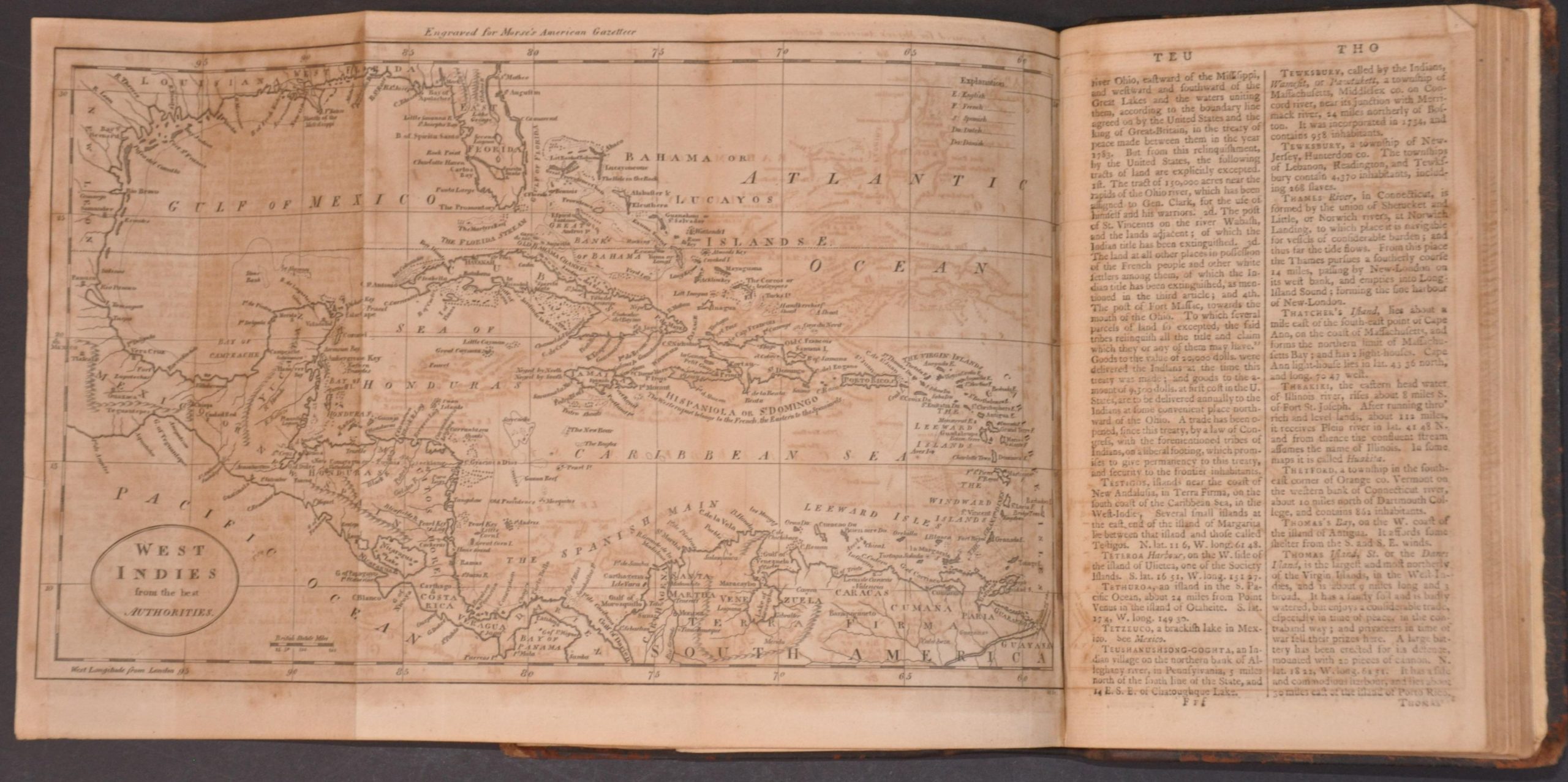
This landmark 1797 Boston printing of Jedidiah Morse’s The American Gazetteer is a definitive cartographic manifesto of the infant United States. It marks the first time the new nation systematically defined its own borders and character, moving away from British geographies that previously treated the American colonies as a peripheral interest. Morse, widely regarded as the Father of American Geography, placed the continent at the center of the world stage, believing that a successful Republic required its citizens to understand their own territory fully.
The Gazetteer contains over 7,000 entries of different locations spanning the entire continent, from the far north to the Spanish Floridas. It is anchored by seven maps that illustrate the early internal divisions of the states and the vast, largely uncharted Western Territory (plus the Pacific and Caribbean). Morse’s descriptions often function as a form of national promotion, highlighting the potential for urban growth and the abundant agricultural wealth of the interior.
Map Details
Publication Date: 1797
Author: Jedidah Morse
Sheet Width (in): 5.00
Sheet Height (in): 8.25
Condition: B
Condition Description: Complete copy with errata and all seven fold-out maps, expertly re-bound in original boards and an elegantly repaired spine. Contents are toned and foxed throughout (ranging from moderate to heavy), with scattered creased corners, offsetting, and wear. About good condition overall.
Out of stock