Tennessee’s Kentucky Lake Has Everything
$45.00
Vacation-Land of Mid-America For the Entire Family!
1 in stock

Description
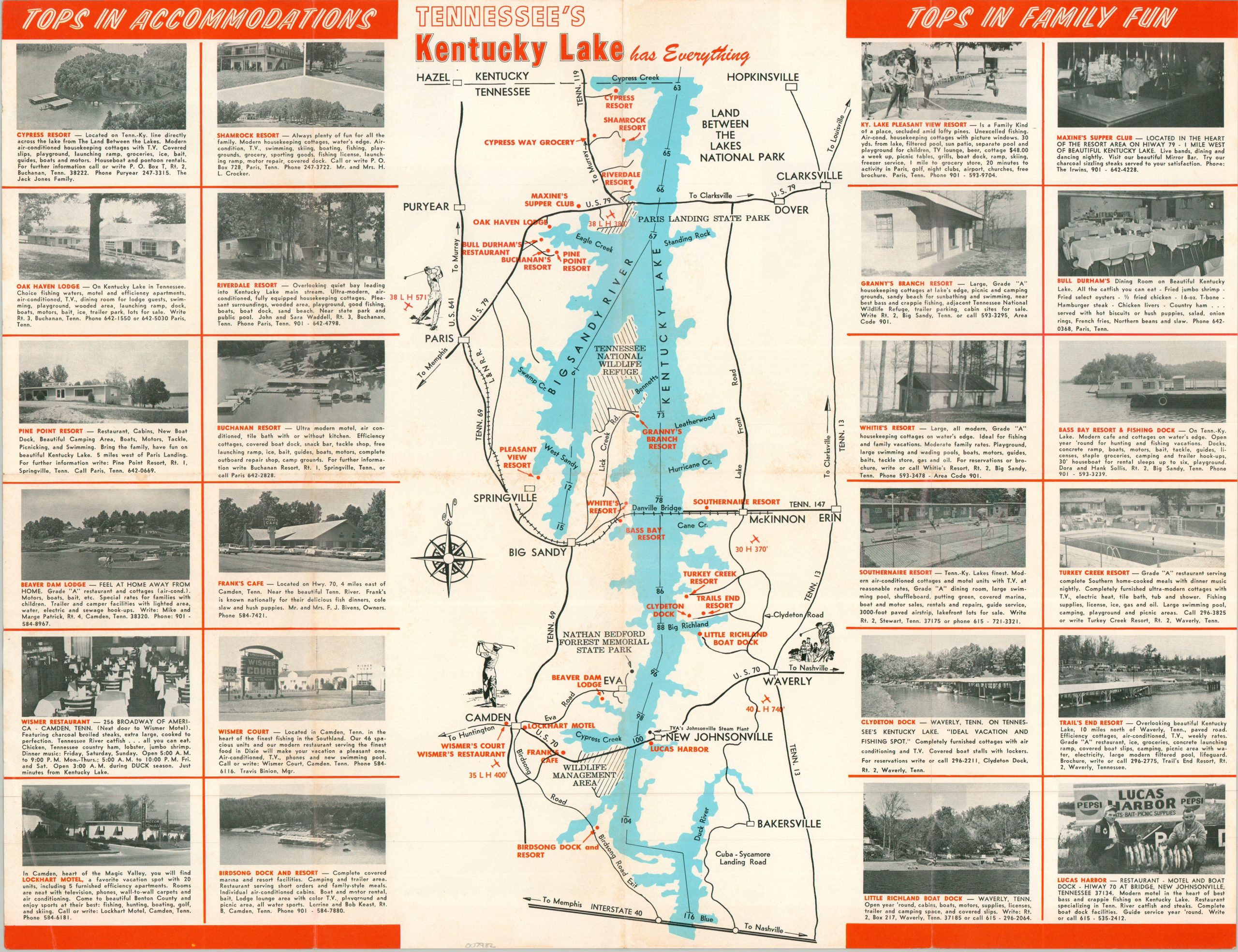
This quaint tourist map shows the southern portion of Kentucky Lake, the largest artificial body of water east of the Mississippi River. Though much of the lake sits in Kentucky, the image emphasizes only the portion within Tennessee. Accommodations and recreations are emphasized both within the map and the adjacent captioned photographs.
Published in 1968 by the Tennessee’s Kentucky Lake Vacation Association. A list of participating merchants and resorts can be found on the verso, along with color photos and a diagrammatic map pinpointing Kentucky Lake in relation to urban areas up to 470 miles away.
Map Details
Publication Date: 1968
Author: Tennessee's Kentucky Lake Vacation Association
Sheet Width (in): 21.75
Sheet Height (in): 16.90
Condition: A-
Condition Description: Double sided brochure printed on glossy paper. A creased corner in the lower left and light wear along the edges of the sheet. Very good condition overall.
$45.00
1 in stock