Target Berlin
$325.00
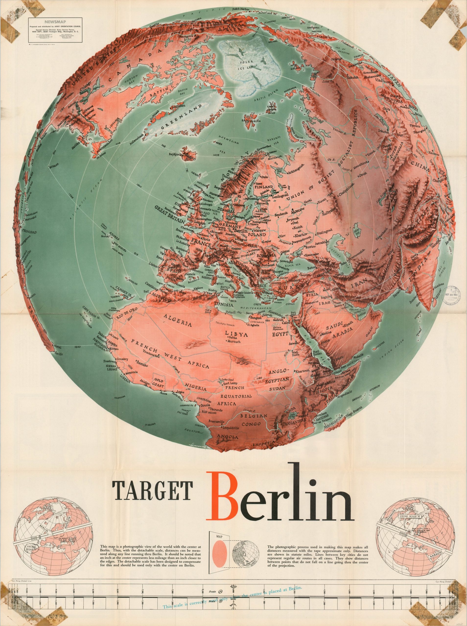
Emphasizing the singular target of Berlin on a global scale.
1 in stock
Description
This bold shaded relief map covers a large portion of the Eastern Hemisphere and leverages a custom map projection to center the image on Berlin, Germany. In case the title wasn’t obvious enough, concentric circles around the capital of the Third Reich give the impression of a literal target for the bombs of the Allied Air Forces. Aerial distances between points are noted in numerous circumstances, though the inclusion of a custom scale at the bottom of the page allowed the user to take any measurements from any point, as long as the ruler was centered on Berlin. Helpful diagrams and instructions are also provided. Presumably, the tool was used to measure the shrinking distances between Allied bases in North Africa after the successful invasion of 1942.
The map was designed by F.E. Manning in 1943 and published by the Special Services Division of the Army Special Forces. One of the numerous NEWSMAPS issued by the War Department over the course of the conflict, all provided biased information on the contemporary state of affairs to bolster morale and educate the troops. This example was issued on October 25, 1943, and the verso includes descriptive text and photographs of events from the week prior. Of interest is the rubber stamp in the center-right, indicating it was received on that date by the Wisconsin Council of Defense. Tape marks in the corners show that it was likely hung for public display.
Map Details
Publication Date: 1943
Author: F.E. Manning
Sheet Width (in): 34.75
Sheet Height (in): 46.75
Condition: B+
Condition Description: Signs of use, including discoloration from old tape in the corners. Creasing along fold lines and small spots of separation at fold intersections. Contemporary rubberstamp dated 11/25/1943 in the center right.
$325.00
1 in stock

