
Taiwan Island Province of the Republic of China
$70.00
A detailed tourist map of Taiwan from the late 1960s.
1 in stock

Description
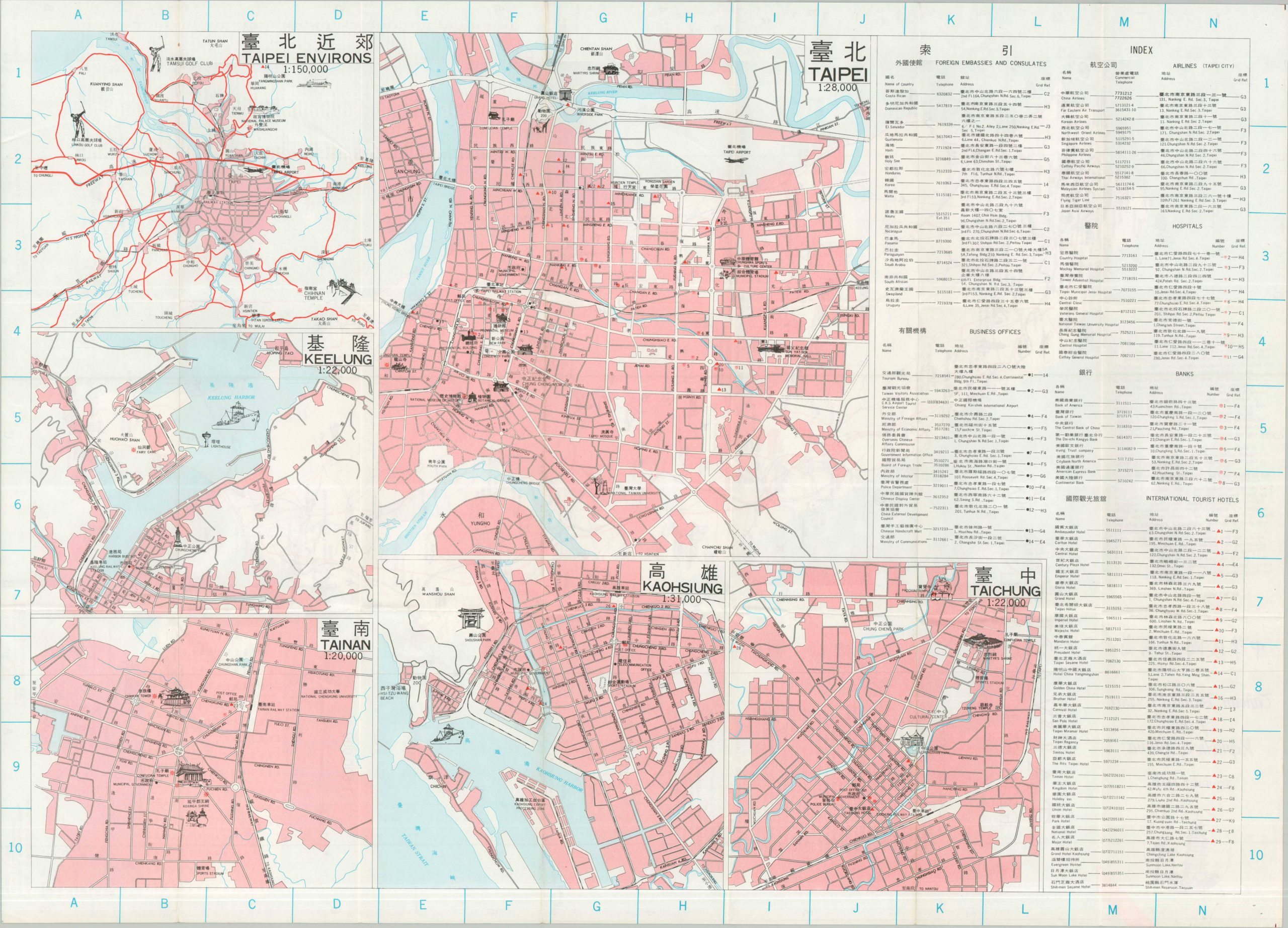
This straightforward map of the Republic of China, more commonly called Taiwan, outlines the primary transportation infrastructure across the island during the late 1960s. Railways, air lines, highways, hot springs, and scenic spots are noted according to the legend in the lower left, while the lower right presents a convenient index of popular place names. City plans on the verso provide overviews of Taipei, Keelung, Tainan, Kaohsiung, and Taichung.
Map Details
Publication Date: 1969
Author: Republic of China Combined Service Forces Topographic Service
Sheet Width (in): 21.00
Sheet Height (in): 29.00
Condition: A-
Condition Description: Double-sided map brochure with light wear and toning along original folds, consistent with age and use. Orange highlighting on two city names. Very good condition overall.
$70.00
1 in stock