Tabula XI Asiae
$695.00
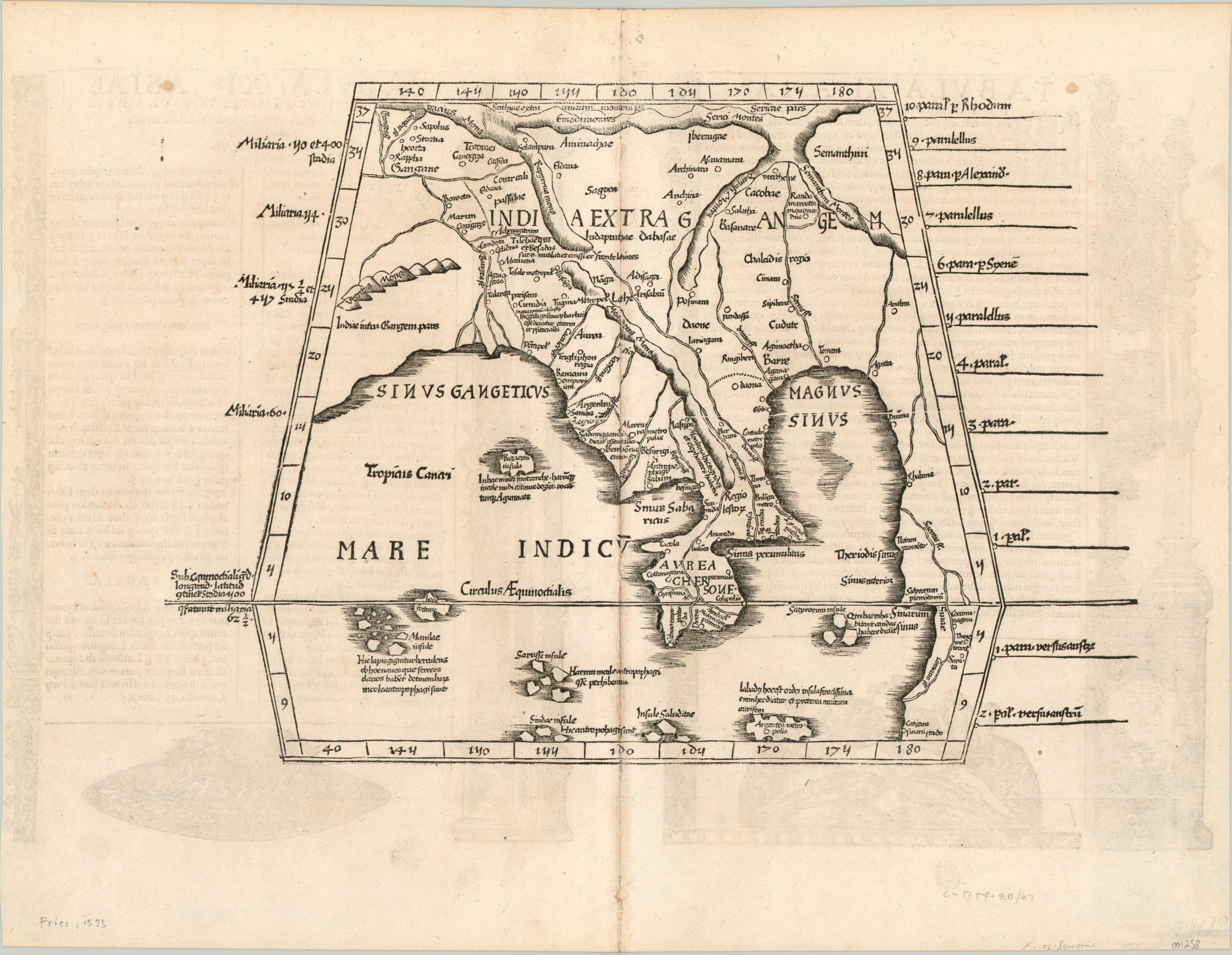
An early woodcut map of southeast Asia based on the works of an ancient Greek scholar.
1 in stock
Description
This fascinating map of southeast Asia shows the regional geography between the Bay of Bengal (Sinus Gangeticus) and South China Sea (Magnus Sinus) according to the second century Greek scholar Claudius Ptolemy. The landmass extending south along the right side of the sheet perpetuated a Ptolemaic belief that the Indian Ocean was landlocked!
This cartographic myth was one of several challenged by European scholars who studied Ptolemy’s works in the 16th century, which themselves were preserved by Arab scholars over the centuries. One of the most famous examples was Martin Waldseemuller, who issued an updated atlas based on Ptolemy in 1513. Waldemuller’s work itself was copied extensively, and this particular map was included in an example created by Laurent Fries in 1535.
The 1535 and 1541 Fries versions of Waldseemuller were published by Michael Servetus, who was burned at the stake for heresy during the Reformation. John Calvin would order copies books published by Servetus, including the one in which this map was originally included, destroyed as a result.
Map Details
Publication Date: 1535
Author: Laurent Fries
Sheet Width (in): 20.00
Sheet Height (in): 15.40
Condition: A-
Condition Description: Faint wear along the vertical centerfold and a few small spots of foxing in the outer margins. Latin text on verso.
$695.00
1 in stock