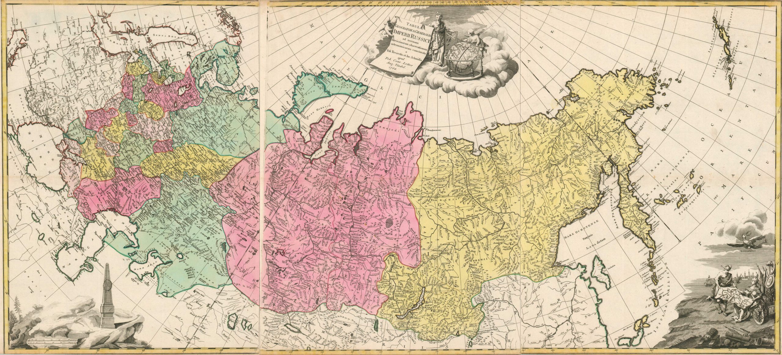
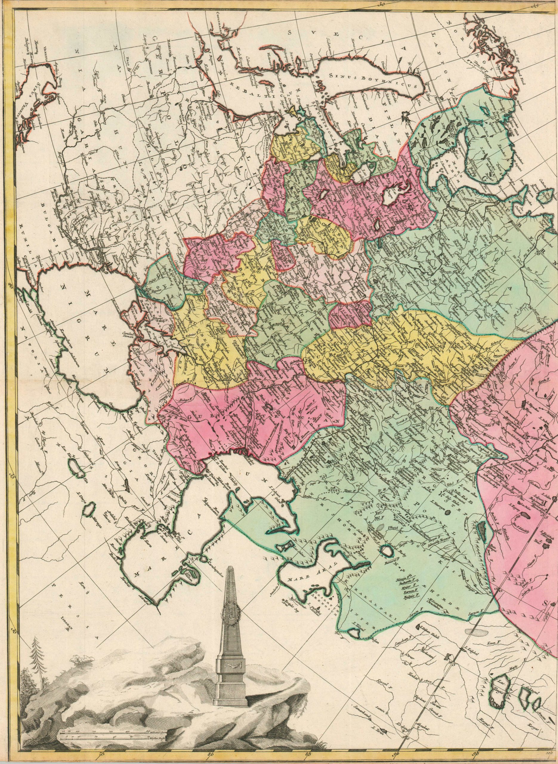
Tabula Geographica Generalis Imperii Russici
$1,500.00
A marvelous three-sheet map of the Russian Empire under Catherine the Great.
1 in stock


Description
This incredible three-sheet map captures, in exacting detail, the geographic expanse and political power enjoyed by Catherine the Great at the height of her Russian imperial reign. Catherine’s territorial ambitions led her to capture the Crimea, parts of Poland, much of the Balkans and Caucasus, and all of Siberia and the Kuril Islands. Even Russian Alaska is included as the Aleutian Islands. Such an unfathomable expanse required significant revisions to the legal code, one of many changes introduced by the enlightened autocrat.
Vibrant old color, carefully applied by hand, distinguishes the different Guberniums established by her Provincial Reform of 1775. The European part of Russia, heavily populated, is broken into more manageable sections, governable from St. Petersburg, while the Far East is divided between the massive Irkutsk and Tobolsk Guberniums. Patterns of settlement largely follow the navigable rivers, as the road network was practically non-existent (with a few exceptions). Toponyms identify a fascinating variety of geographic features, military outposts, rural villages, and more.
Each sheet also features a decorative cartouche that celebrates the regime of Catherine the Great. In the lower left, an obelisk bears the imperial monogram (E for Ekaterina) and represents her unshakable rule, as well as one of her favorite forms of public display. The scene in the upper center depicts the Empress in full regalia, accompanied by a globe and quadrant, emblems of her passion for science. Lastly, the lower right captures Catherine’s martial ambitions. Surrounded by weaponry, she ‘reattaches’ the map of northern and southern Russia with the help of Mercury. Above, an imperial eagle carries an olive branch, staff, and trumpet – likely sounding the call to peace after several successful wars of conquest.
The map was published in Augsburg by Tobias Conrad Lotter in 1784. As his primary source, Lotter used the works of Johann Treskot and Johann Schmidt, who had completed a monumental 23-sheet survey of Russia for the Imperial Academy of Sciences in the mid-1770s.
Map Details
Publication Date: 1784
Author: Tobias Conrad Lotter
Sheet Width (in): 21.3
Sheet Height (in): 25.3
Condition: B+
Condition Description: Three copperplate engraved sheets, unjoined (size given for each), with old hand color on watermarked paper. Trimmed upper and lower margins, with some scattered soiling and toning present along the edges of the neatline. Handwritten page numbers in the lower corners of the margins, which also have a few closed tears. A bit of discoloration, spotting, and surface soiling on the far right (see scan). Good to very good condition overall.
$1,500.00
1 in stock