
Tabula Generalis Totius Belgii qua Provinciae XVII Inf. Germaniae
$100.00
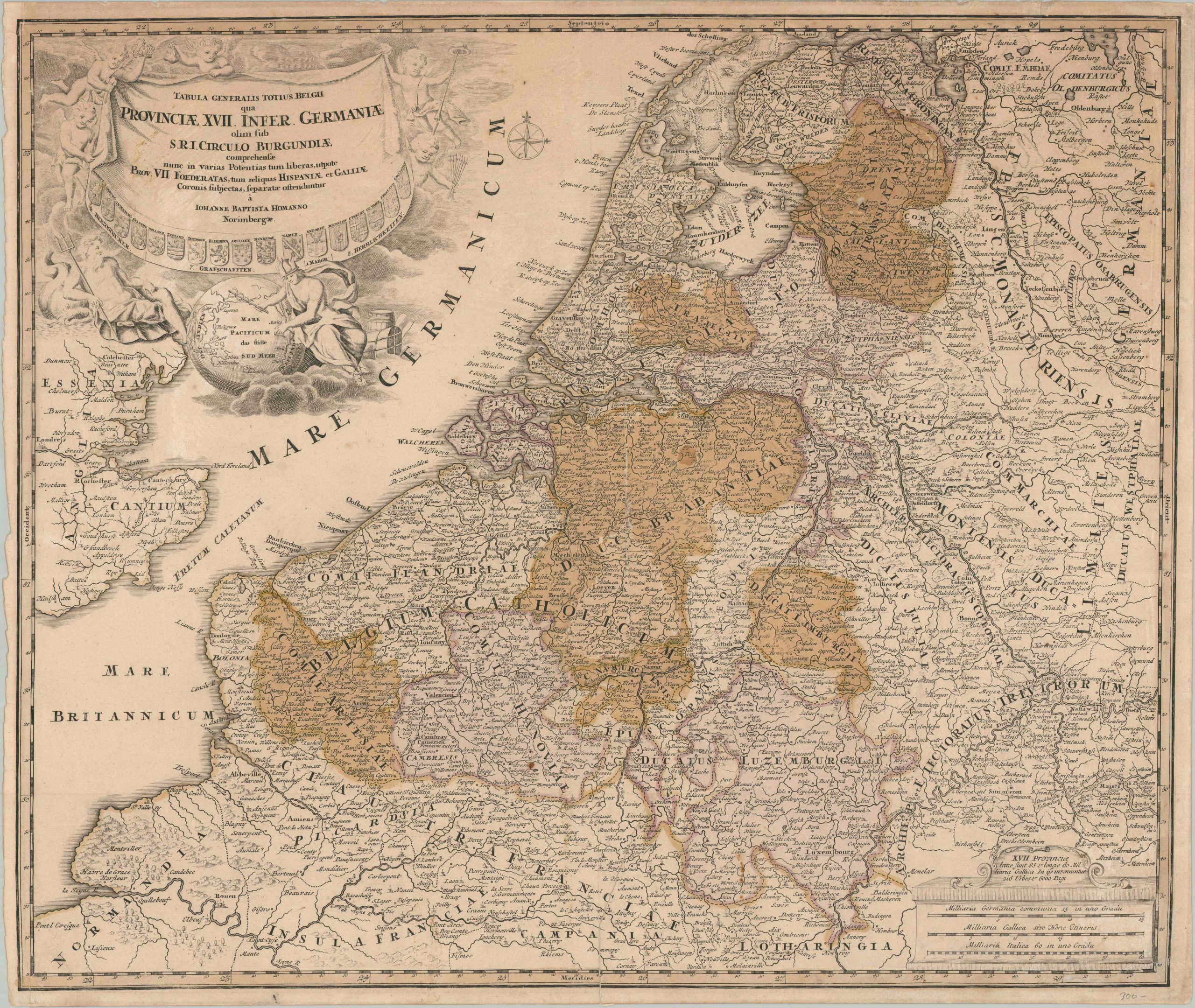
An engaging 18th century map of the Seventeen Provinces.
1 in stock
Description
This interesting antique map of the Seventeen Provinces, or the Low Countries, was published in Nuremberg around 1720 by the Imperial Royal Geographer Johann Baptiste Homann. Seven of these provinces broke away to form the Dutch Republic over a century earlier, while the remaining territory was still under the control of the Habsburgs as the Austrian Netherlands.
The carefully engraved image identifies a fascinating variety of settlements, geographic features, fortifications, ecclesiastical facilities, and aristocratic estates. Antwerp was among the region’s most vital maritime hubs. Also included is the adjacent coast of England, with the Thames up to London. This proximity underpins one of the primary reasons for the persistent Anglo-Dutch Wars.
Also of interest is the elaborate Baroque cartouche (upper left), which features several allegorical figures representing Commerce (Mercury) and the Sea (Poseidon), as well as a globe pointed to the South Pacific. The profitable trade from the Spice Islands was the foundation upon which the Dutch were able to build their empire, via the ingenious use of the Dutch East India Company.
Map Details
Publication Date: c. 1730
Author: Johann Baptiste Homann
Sheet Width (in): 23.20
Sheet Height (in): 19.60
Condition: B
Condition Description: Copperplate engraved sheet on laid paper with old hand color (toned and somewhat faded). A large irregular spot in the center, about 2" round, is slightly discolored and appears to have been repaired or replaced outright. Some light spotting and surface soiling visible elsewhere and faint wear along the centerfold. About good condition overall. Blank on verso.
$100.00
1 in stock