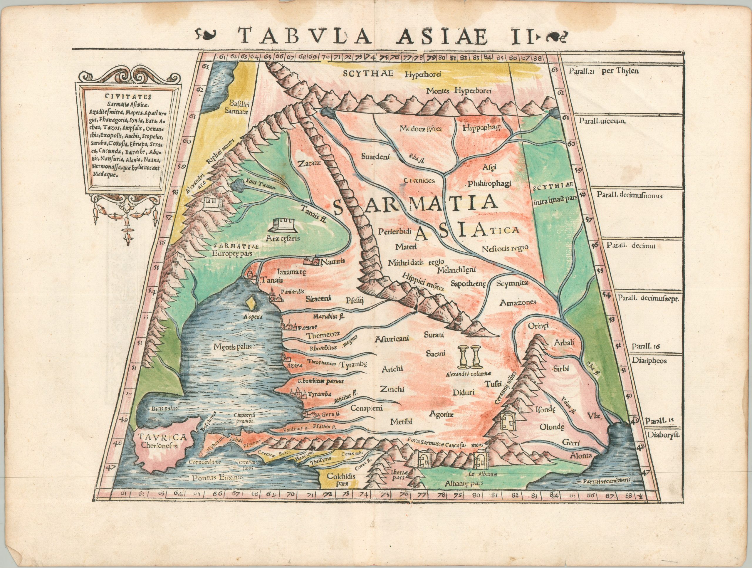
Tabula Asiae II
$195.00
An early Ptolemaic map showing the Caucasus Mountains.
1 in stock
Description
This striking woodcut engraving, titled “Tabula Asiae II,” originates from a mid-16th-century edition (c. 1550) of Sebastian Münster’s Geographia Universalis. As a professor of Hebrew at Basel and a leading Renaissance humanist, Münster was instrumental in reintroducing the classical cartography of ancient Greek scholar Claudius Ptolemy to a modern European audience. This particular plate focuses on Sarmatia Asiatica, encompassing portions of today’s southern Russia, Ukraine, and Transcaucasia.
The image captures an expansive frontier region in Central Asia, situated between the Black and Caspian Seas. These important bodies are labeled in the lower corners, while the northern border, the Montes Hyperborei, is a semi-mythical range based on classical sources. Between, various cities, tribes, and geographic features are labeled, including the Don (Tanais) River, the Altars of Caesar (Araecesaris), and the Columns of Alexander (Alexandria columnae). Literal ‘gates’ offer some of the few passages through the southern Caucasus mountains.
Map Details
Publication Date: c. 1550
Author: Sebastian Munster
Sheet Width (in): 16.10
Sheet Height (in): 12.25
Condition: B
Condition Description: Woodcut map with somewhat odd hand color that appears to be old. Some damp staining along the upper margin and faint wrinkling along the lower edge. Good condition overall.
$195.00
1 in stock