
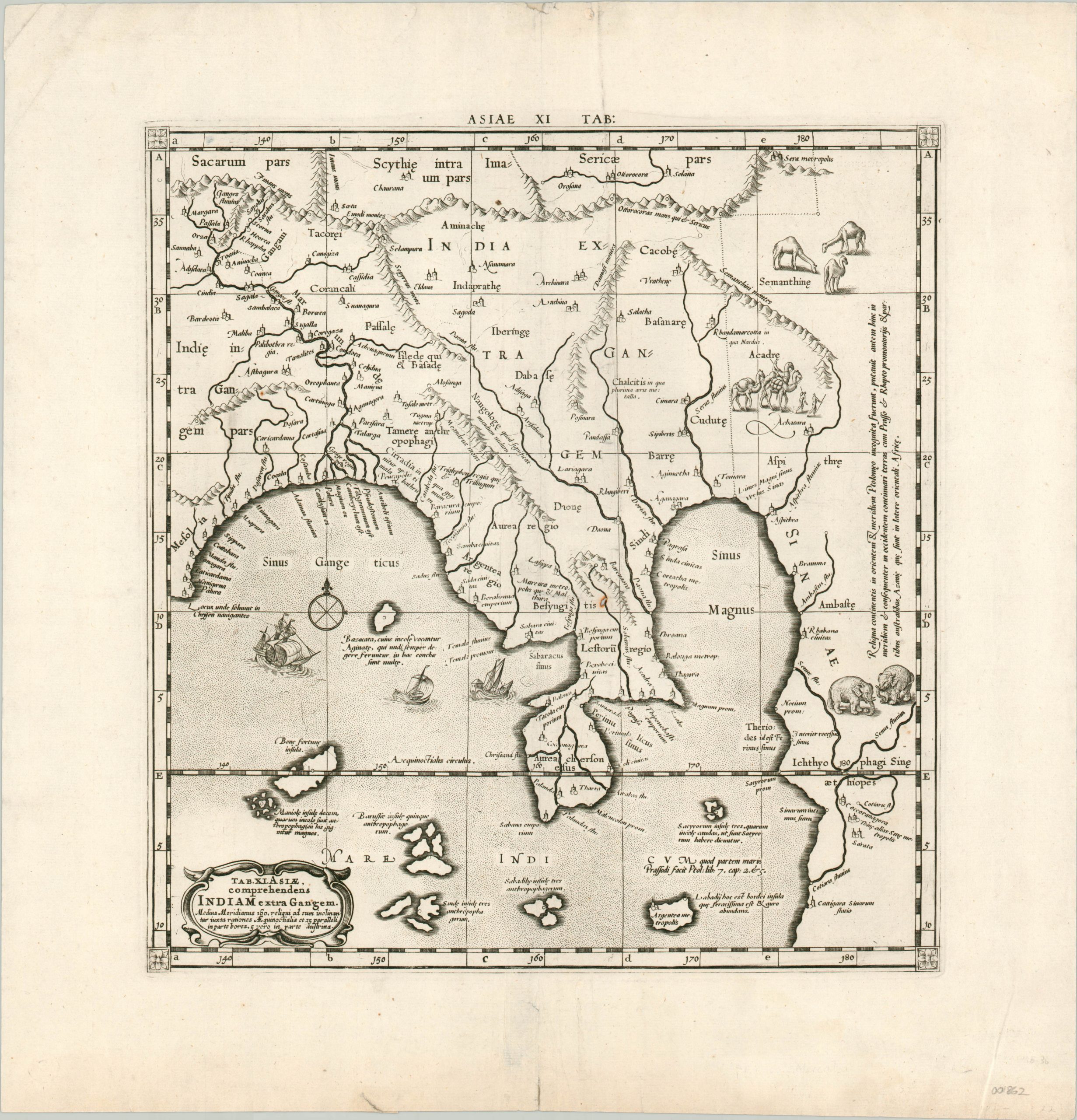
Tab. XI Asiae comprehendens Indian extra Gangem.
$350.00
A Ptolemaic view of southeast Asia from the early 18th century.
1 in stock
Description
Though best known for the map projection that bears his name, Gerardus Mercator was also one of numerous cartographers who replicated and updated the work of the ancient Greek geographer Ptolemy between the 16th and 18th centuries. This map of southeast Asia was included in Mercator’s edition of Ptolemy’s Geographia, published in Amsterdam beginning in 1695.
The map reflects the ancient belief that the Indian Ocean was landlocked, and the area on the right side of the image (labeled Sinae, or China) was assumed to be connected to a large southern continent that encircled the body of water.
The central peninsula represents Thailand, Myanmar, and Malaysia, with numerous archipelagos to the south approximating to parts of modern day Indonesia. Annotations in Latin provide further contemporary information, while small vignettes of sailing ships, elephants, and camels add interesting pictorial elements.
Map Details
Publication Date: c. 1704
Author: Gerardus Mercator
Sheet Width (in): 17.25
Sheet Height (in): 17.60
Condition: A-
Condition Description: Faint soiling and wear visible in the margins, including a bit of separation along the centerfold that has been repaired on the verso. One spot within the image, near the center. Very good condition overall - a nice, dark impression on a clean sheet.
$350.00
1 in stock