
Survey of Trinity River, Texas
$400.00
Mapping the Trinity River less than a decade before the Dallas Flood of 1908.
1 in stock


Description
“The Secretary of War is hereby director to cause a preliminary survey of said Trinity River to be made from its mouth to the city of Dalllas with separate estimates of the cost of procuring a navigable depth at low water of four feet, five feet, and six feet, respectively, in said river, by locks and dams or otherwise; said report to include the best method for improving the river.” – pg 1.
This incredibly detailed report was originally published as part of a Congressional volume in 1900, which outlined the activities of the U.S. War Department. Compiled largely by Captain C.S. Riche of the Corps of Engineers, the contents present the results of exhaustive efforts to survey Texas’s Trinity River, with the goal of improving commercial navigation. While dredging and maintaining a shipping channel would be relatively costly, the works would have undoubtedly buoyed the growing industrial economy of Dallas, whose local business interests desperately wanted a viable waterway to the Gulf.
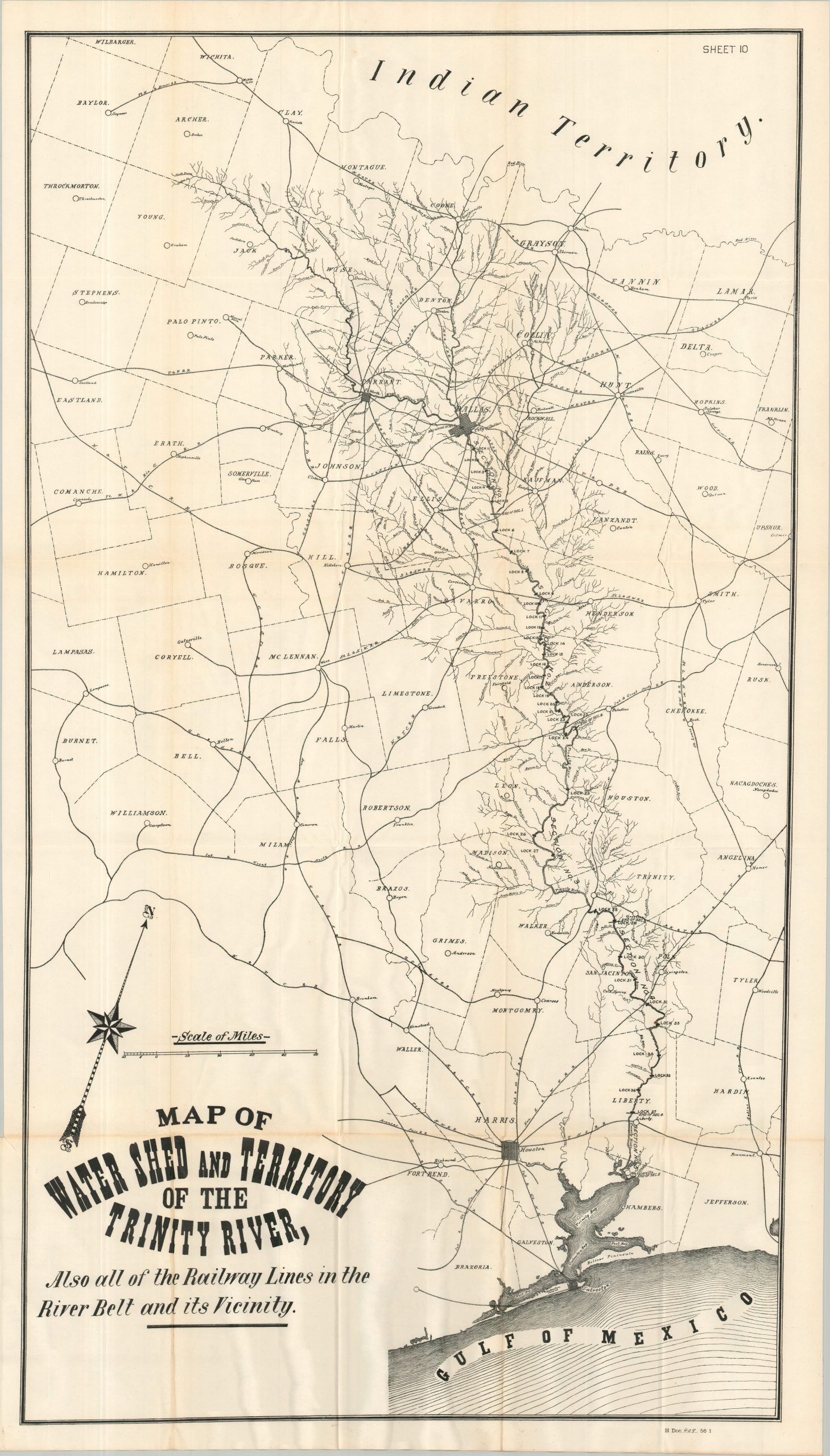
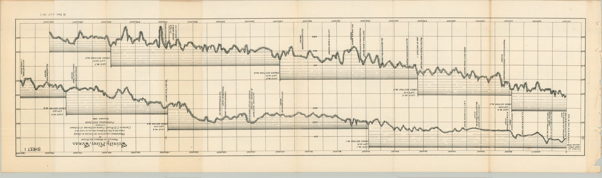
Over thirty pages of text outline cost estimates, scientific data, copies of correspondence, and information about scope and methodology. Eight fold-out cross sections of the river highlight the location of the proposed locks – nearly forty in total would be required due to the unpredictable water levels. A larger sheet presents diagrams of the various bridges that crossed the Trinity River, carefully noting the height and the composition of the banks. The final accompaniment is a sizeable plan titled Map of Water Shed and the Territory of the Trinity River, Also all of the Railway Lines in the River Belt and its Vicinity.” This persuasive image, intended to justify the aforementioned efforts and expenses, emphasizes how a navigable Trinity River would benefit much of the Lone Star State.
Despite decades of funding and the initial construction of several locks, the project was plagued by cost overruns, railroad competition, and devastating floods (especially the catastrophic Dallas flood of 1908). The grand vision of a commercial shipping canal to Dallas was abandoned in the 1920s, though there were piecemeal attempts to improve certain stretches of the river later in the century. Costs for a fully realized project were prohibitive, environmentally and economically. One 1965 estimate put the price tag at $911,000,000!
Map Details
Publication Date: 1900
Author: U.S. War Department
Sheet Width (in): See Description
Sheet Height (in): See Description
Condition: B+
Condition Description: 32 pages of text, plus ten large fold-outs (8 cross sections and 2 maps), extracted from a broken Congressional report. Ragged left binding edge and minor toning, consistent with age. Fold-outs are singled-sided and show sharp creasing along folds, plus some faint marginal wear. Good condition overall.
$400.00
1 in stock