Sunshine State Parkway
$75.00
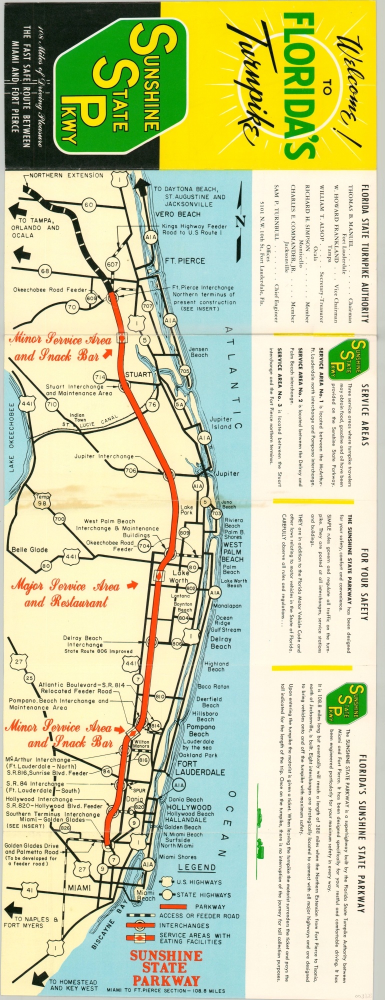
Folding brochure for the newly opened Florida Turnpike, or the Sunshine State Parkway.
1 in stock
Description
This folding map of the Sunshine State Parkway was published in 1957 by the Florida State Turnpike Authority as a resource for motorists along the newly opened route between Miami and Fort Pierce. The 108+ mile path running near the state’s eastern coast is highlighted in bright red on the map, with primary connecting routes and major towns also shown.
Service areas, toll collection, and safety procedures are described in some detail. The verso provides inset maps of the terminal interchanges at Miami and Fort Pierce, as well as a toll schedule, a list of rules and regulations, and a letter of introduction from Governor LeRoy Collins.
Map Details
Publication Date: 1957
Author: Florida State Turnpike Authority
Sheet Width (in): 9
Sheet Height (in): 24
Condition: A-
Condition Description: Creasing and light discoloration along originally issued fold lines, most evident in the center near Juno Beach. Otherwise very good to near fine.
$75.00
1 in stock

