
Strip Map Pittsburgh, Pa. to Philadelphia
$95.00
Lindy-mania’ in an uncommon strip map promoting a Philadelphia hotel.
1 in stock


Description
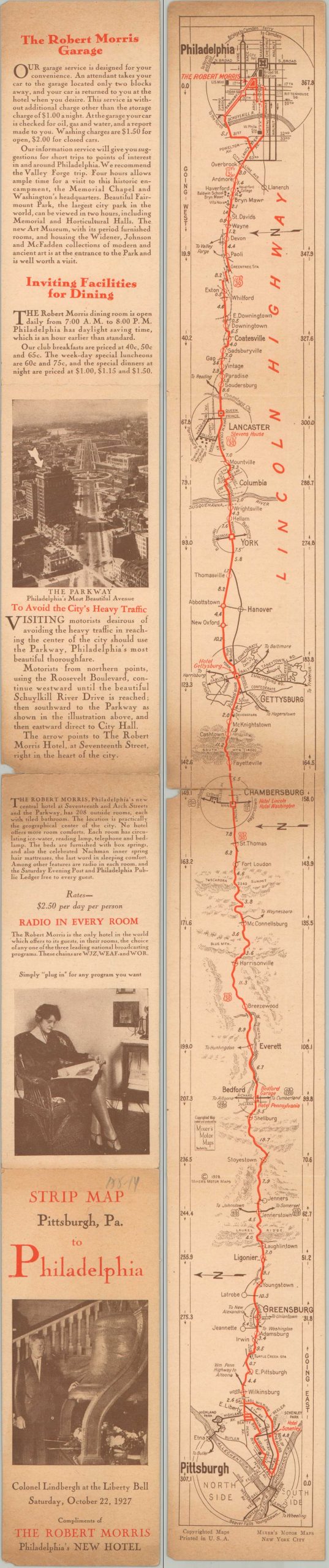
This ephemeral late-1920s strip map provides a detailed cartographic overview of the Lincoln Highway between Pittsburgh and Philadelphia. Produced by Mixers Motor Maps c. 1927–1928, the guide highlights the primary route in vibrant red; meticulously noting distances, local settlements, and key intersections. Small inset plans offer street-level navigation for the major stops along the “Main Street of America,” including Bedford, Chambersburg, Gettysburg, and Lancaster, ensuring the motorist can navigate these historic towns with ease.
The map was distributed “with the compliments” of the Robert Morris Hotel, a premier “fireproof” Philadelphia accommodation. The verso is rich with promotional copy touting the height of 1920s luxury, including in-room radios, an attached garage for the “motor-tourist,” and fine dining facilities. The front cover includes a photo of Charles Lindbergh during his triumphant October 1927 visit to the city. He famously stayed at the Bellevue-Stratford, but Lindbergh’s popularity was such that his mere appearance could boost the appeal of a hotel.
Map Details
Publication Date: 1927
Author: Mixer's Motor Maps
Sheet Width (in): 2.75
Sheet Height (in): 28.00
Condition: B
Condition Description: Double-sided strip map printed on cardstock and folded twice. Moderately toned at the top, bottom, and center, with the last showing a small repaired tear and chip. About good condition overall.
$95.00
1 in stock