Street Railway and Motor Bus Guide of Milwaukee
Depression-era transit guide to Milwaukee.
Out of stock

Description
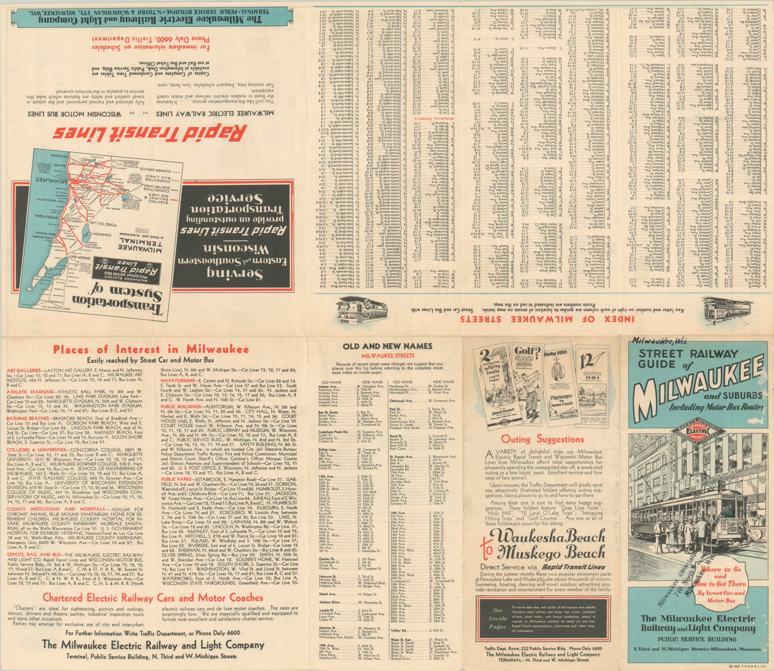
This informational map provides a detailed overview of the transportation options available to residents and visitors of Milwaukee in the early 1930s. Streetcar lines and bus routes are outlined across the city and labeled according to their operator, seen in the lower left.
Parks, cemeteries, and public spaces are highlighted in green, while the city limits are colored in yellow. Text on the right side and verso provide information on fares, route identification, weekly passes, places of interest, possible excursions, and more.
Published locally in 1931 by The Milwaukee Electric Railway and Light Company. The Great Depression resulted in a significant contraction of company assets, and in 1938 the T.M.E.R. & L. Co. was broken up into two separate companies; The Wisconsin Electric Power Company operated Lakeside Power Plant while the Milwaukee Electric Railway and Transport Company assumed control of the transportation properties.
Map Details
Publication Date: 1931
Author: The Milwaukee Electric Railway and Light Company
Sheet Width (in): 17.50
Sheet Height (in): 20.40
Condition: A-
Condition Description: Creased along former fold lines and 2" of separation have been repaired on the verso with archival tape. A bit of light edge wear, consistent with age. Very good overall.
Out of stock