Street Map of the City of Springfield, Illinois
Tracking railroad companies on Springfield during the lead up to World War II.
Out of stock
Description
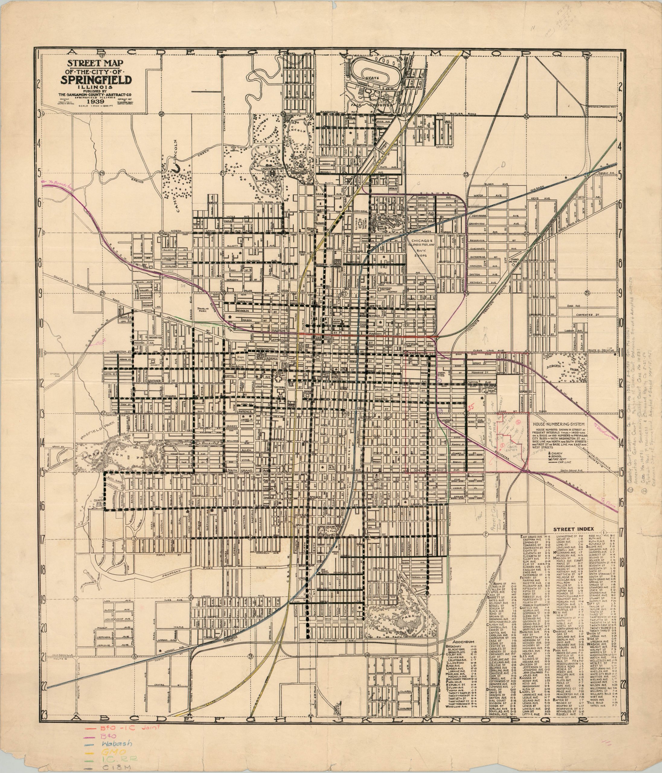
This charming street map of Springfield, Illinois was drafted by Frank L. Melin and Alfred S. Harkness and published locally by The Sangamon County Abstract Co. in 1939. Churches, schools, fire departments, and streetcar lines are noted according to the legend in the center-right. Various other labeled locations of interest include police stations, the state fairgrounds, hospitals, and public buildings. Trees and lakes dot the system of parks scattered throughout the state capital.
This example has been updated by hand to reflect several property transfers from the early 1950s. Further manuscript additions include the application of color to denote ownership of different railroads – the Baltimore & Ohio (purple), Wabash (blue), Gulf, Mobile & Ohio (yellow), Illinois Central (green), and the Chicago & Illinois Midlands (black).
Map Details
Publication Date: 1939
Author: Frank L. Melin and Alfred S. Harkness
Sheet Width (in): 24
Sheet Height (in): 28
Condition: B+
Condition Description: Heavy wear along the outer edges of the sheet, including soiling, numerous closed tears, creased corners, and a few small chips. Manuscript updates throughout, including pencil in the right margin and image and several colored track routes. About good condition overall. Blank on verso.
Out of stock