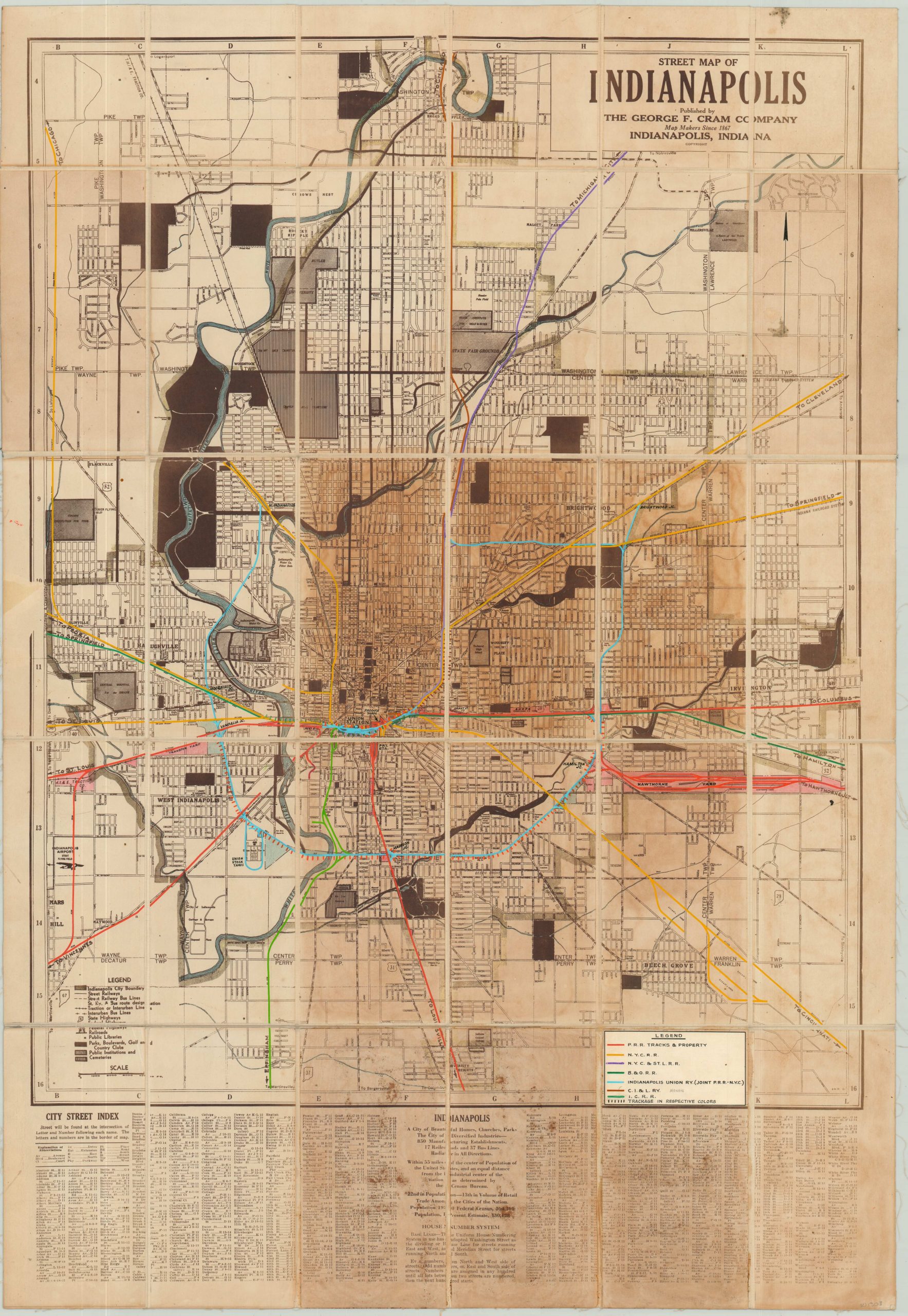
Street Map of Indianapolis
Detailed city plan of Indianapolis from the mid-1930’s.
Out of stock
Description
The map presented here was originally published in Indianapolis by the George F. Cram Company in 1935. It shows the primary transportation routes (street railways, bus lines, roads, state highways, railroads, etc.) and uses various patterns outlined within the legend to identify specific land use; parks, public institutions, and cemeteries. Important buildings are also individually labeled, and a comprehensive street index is provided at the bottom of the sheet.
This particular example has a unique history, and was customized for use in the Central Engineering Department at the Pennsylvania Railroad. For preservation and convenience of storage, the map was dissected and mounted onto linen. Hand-applied color highlights track ownership of the various railroad companies in operation within Indianapolis, and a custom legend affixed to the lower right identifies the seven owners in question.
Of particular interest is the C.I. & L. (Chicago, Indianapolis & Louisville) R.R. – a penciled annotation indicates this is known as the Monon Line, and today operates as a popular bike trail that bisects the city from North to South. Additional manuscript notations identify additional locations of interest; including Union Station, Hamilton Junction, Produce Yards, freight stations, and more.
Map Details
Publication Date: 1935
Author: George Cram
Sheet Width (in): 25.25
Sheet Height (in): 36.50
Condition: B-
Condition Description: Dissected into 30 panels and mounted on linen, with black leather covers. There is severe discoloration in the center right quadrant, likely from the adhesive used to mount the map to linen. Apart from the evident discoloration and staining (see scan), the map is in good shape.
Out of stock