Street Map of Chicago
$95.00
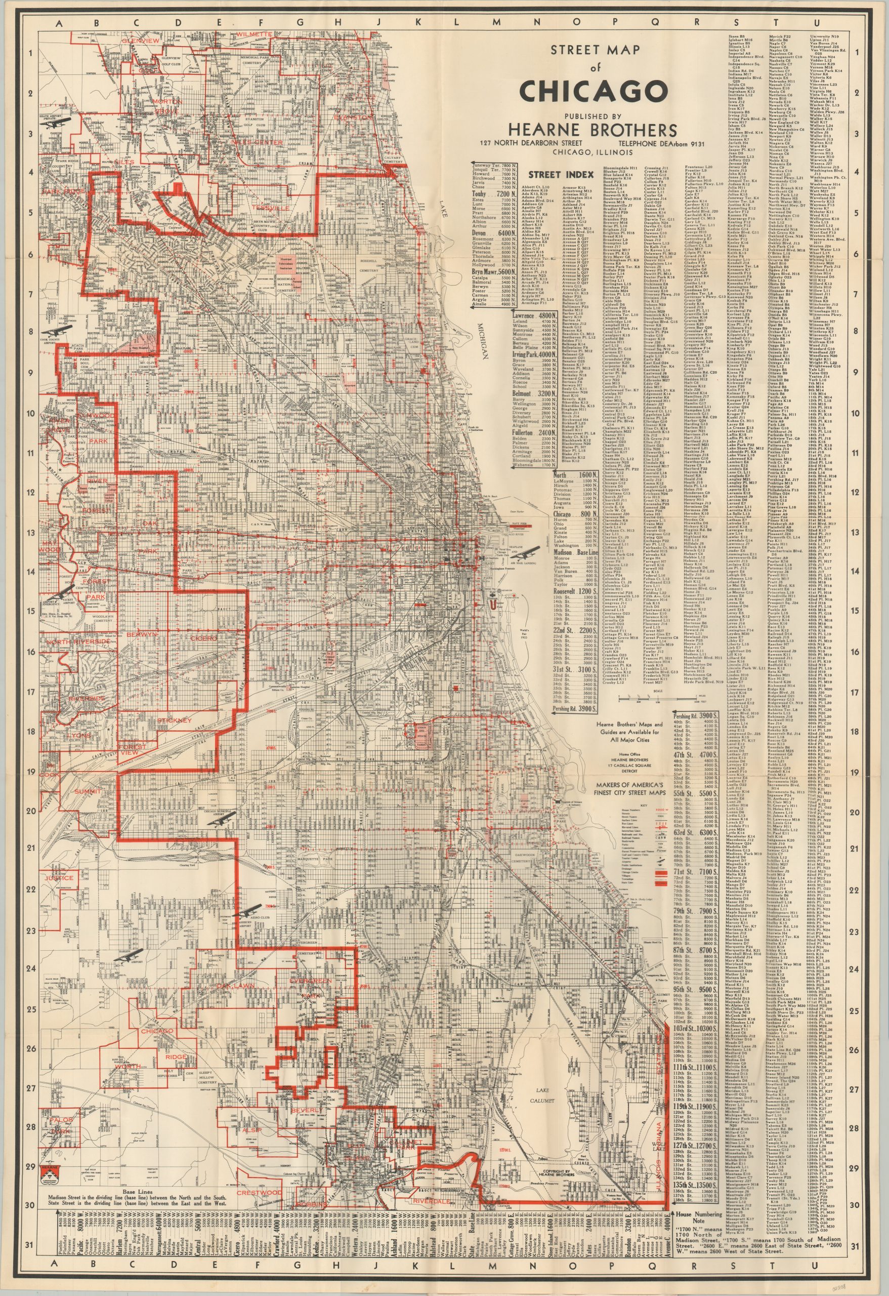
Exhaustive street map of Chicago issued in conjunction with the 1933 Century of Progress.
1 in stock
Description
This immaculately detailed map of Chicago provides a handy reference guide for visitors to the Windy City during the Century of Progress Exposition. A diminutive key in the lower right identifies the 22 different symbols used to provide a range of information including house numbers, township borders, transportation routes, recreational areas, and more.
Dozens of locations of interest like the Union Stockyards, University of Chicago, Riverview Park, and the White City (remnants of the Columbian Expo) are also labeled within the image. The right side of the sheet provides a comprehensive street index. When combined with the numerical/alphabetical border, nearly any address in the city can be easily located.
Published in Chicago in 1933 by Hearne Brothers, ‘Makers of America’s Finest City Street Maps’, according to the promotional text above the legend.
Map Details
Publication Date: 1933
Author: Hearne Brothers
Sheet Width (in): 22
Sheet Height (in): 32
Condition: A
Condition Description: Large pocket map affixed to original stiff blue paper wraps, adhered on the verso. Light toning, faint wear, and some wrinkling along fold lines, consistent with age. Very good to near fine overall.
$95.00
1 in stock