Street Index Map of Oakland
$125.00
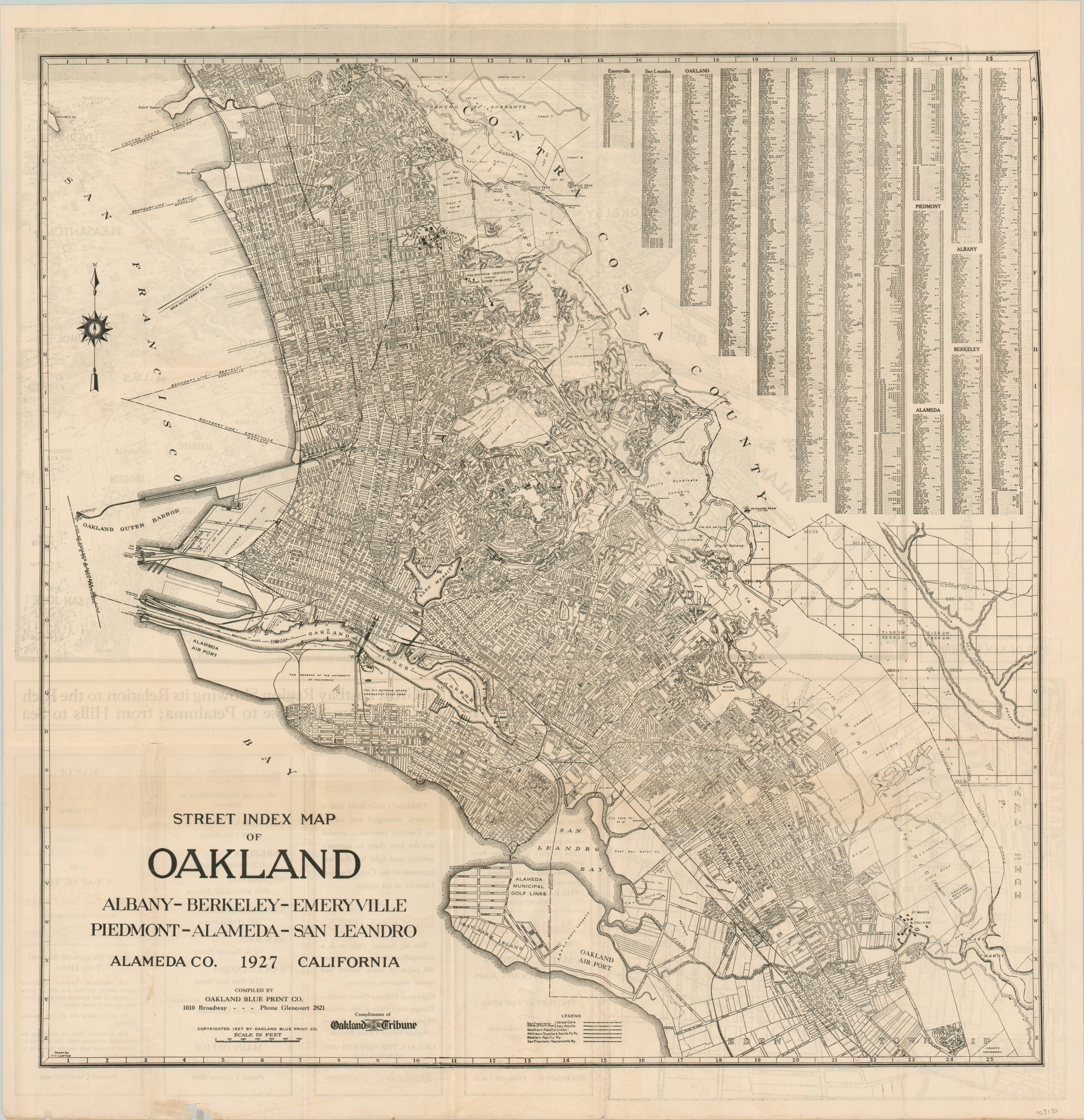
“A Map of the Great Eastbay Region compliments of the Oakland Tribune”
1 in stock

Description
This tremendously detailed street plan of Oakland, California, and adjacent cities in the East Bay area was compiled by the Oakland Blue Print Company in 1927 and distributed by the Oakland Tribune. A dense grid shows individually labeled streets, railways, and locations of interest. Street indices for each city represented in the image are provided in the upper right, but the text size is so small as to almost prohibit their use.
The verso shows a map of San Leandro and a spectacular bird’s eye view of the region “Showing its Relation to the Rich Valleys and Thriving Cities from San Jose to Petaluma; from Hills to Sea.”
Map Details
Publication Date: 1927
Author: Oakland Blue Print Company
Sheet Width (in): 24.75
Sheet Height (in): 26
Condition: B+
Condition Description: Creasing and wear along originally issued fold lines include several spots of separation at fold intersections and tears along the outer edges, repaired on the verso with archival tape. A faint strip of discoloration (offsetting from ink on the verso) is visible able the title block.
$125.00
1 in stock