Street Guide and Road Map San Diego City County Southern California
$110.00
Double-sided road map of San Diego from the interwar period.
1 in stock

Description
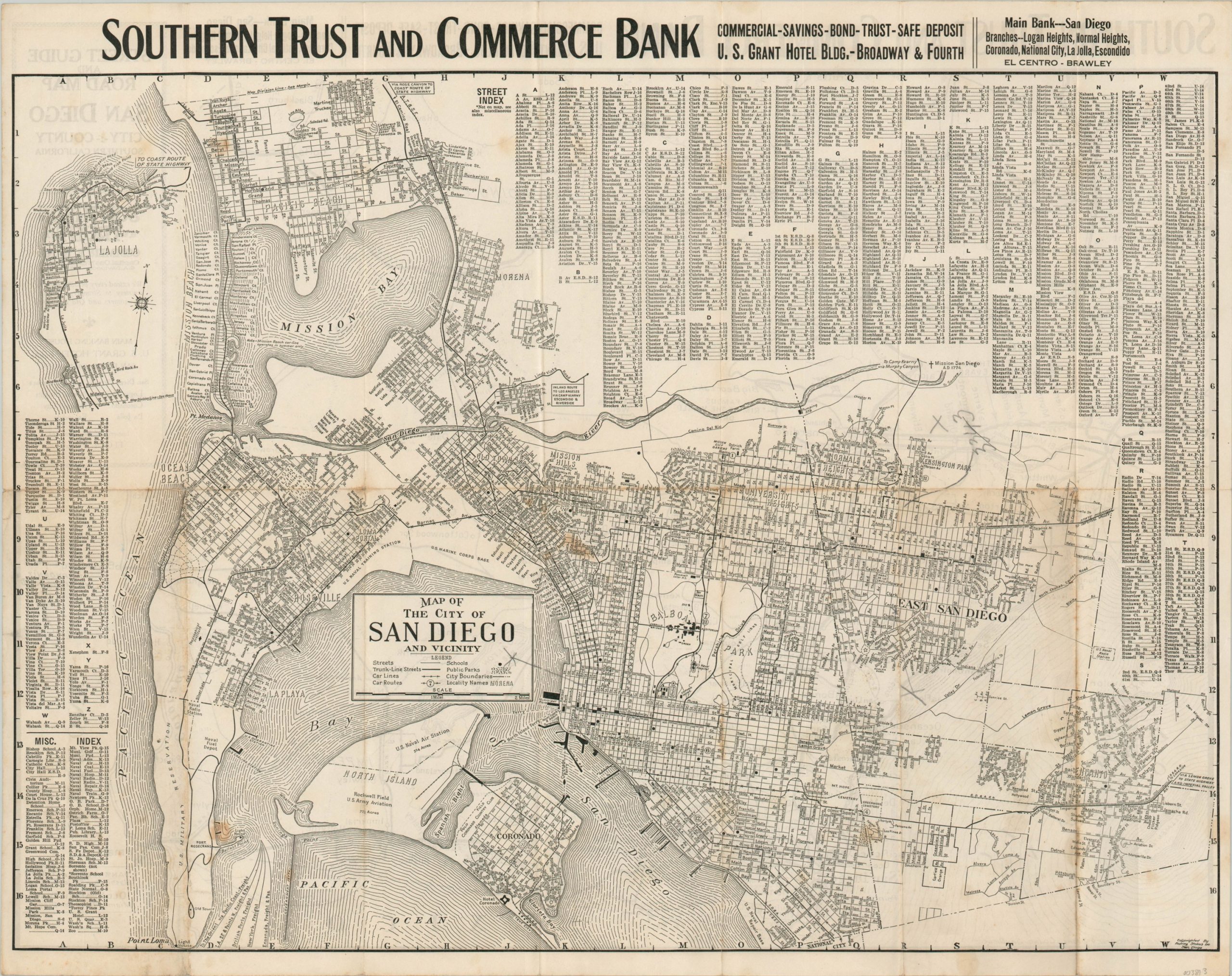
This map of San Diego and Southern California was published in the middle of the Roaring ’20s – a time of tremendous growth for the coastal city. The construction of several military installations resulted in the population surging from less than 20,000 in 1900 to nearly 75,000 two decades later. It would then double by 1930.
The contemporary growth is reflected by the detailed city map, which shows an annexed East San Diego as well as Pacific Beach and La Jolla. Large areas are occupied by the aforementioned military grounds – Fort Rosecrans, the U.S. Naval Training Station, U.S. Marine Corps Base, and Rockwell Field among them. Schools are dotted throughout and streetcar lines with their respective route numbers are shown connecting much of the city. A comprehensive street index, as well as a miscellaneous index of various points of interest, occupy the negative spaces while an advertisement for the Southern Trust and Commerce Bank (distributor of the map) can be seen at the top.
The verso shows a simple highway map of Southern California. Both were designed by the Rodney Stokes Co. Inc. of San Diego and published in 1925, based on the presence of the U.S. Naval Hospital in Balboa Park that opened that year and the absence of the Fine Arts Gallery that opened the following.
Source: San Diego History.
Map Details
Publication Date: c. 1925
Author: Rodney Stokes Co. Inc.
Sheet Width (in): 23.5
Sheet Height (in): 18.5
Condition: B
Condition Description: Formerly folded into 14 panels, with moderate wear and discoloration along fold lines. Scattered soiling and spotting also visible, concentrated along the lower half of the sheet.
$110.00
1 in stock