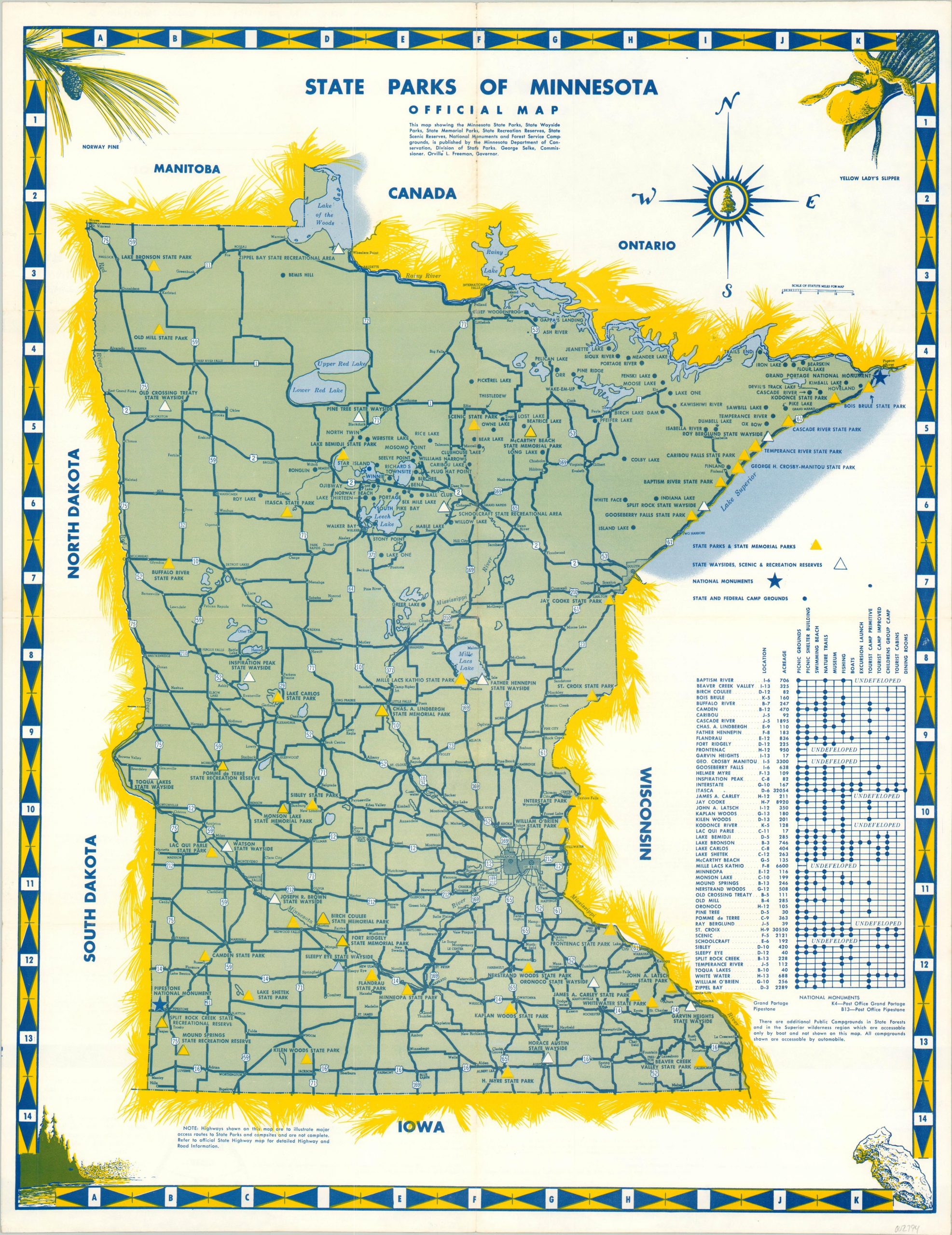
State Parks of Minnesota Official Map
$50.00
Folding mailer outlining the Minnesota State Park System in the late 1950’s.
1 in stock
Description
This detailed road map of Minnesota was distributed by the state’s Department of Conservation under governor Orville Freeman, who served between 1955 and 1961 before becoming U.S. Secretary of Agriculture.
The image clearly shows the highway network, with blue dots and triangles representing various establishments under the state park system. Nearly sixty in total are shown, corresponding to a table outlining their respective amenities and location in Minnesota.
Map Details
Publication Date: c. 1957
Author: Minnesota Department of Conservation
Sheet Width (in): 18.50
Sheet Height (in): 23.75
Condition: B+
Condition Description: Light creasing and some minor discoloration along originally issued fold lines. Staining most visible along the vertical fold line near the top of the page. Otherwise in very good condition.
$50.00
1 in stock