State of Illinois Division of Highways State Bond Issue Road System
An ambitious proposal for improving Illinois’ roads during the Prohibition Era.
Out of stock

Description
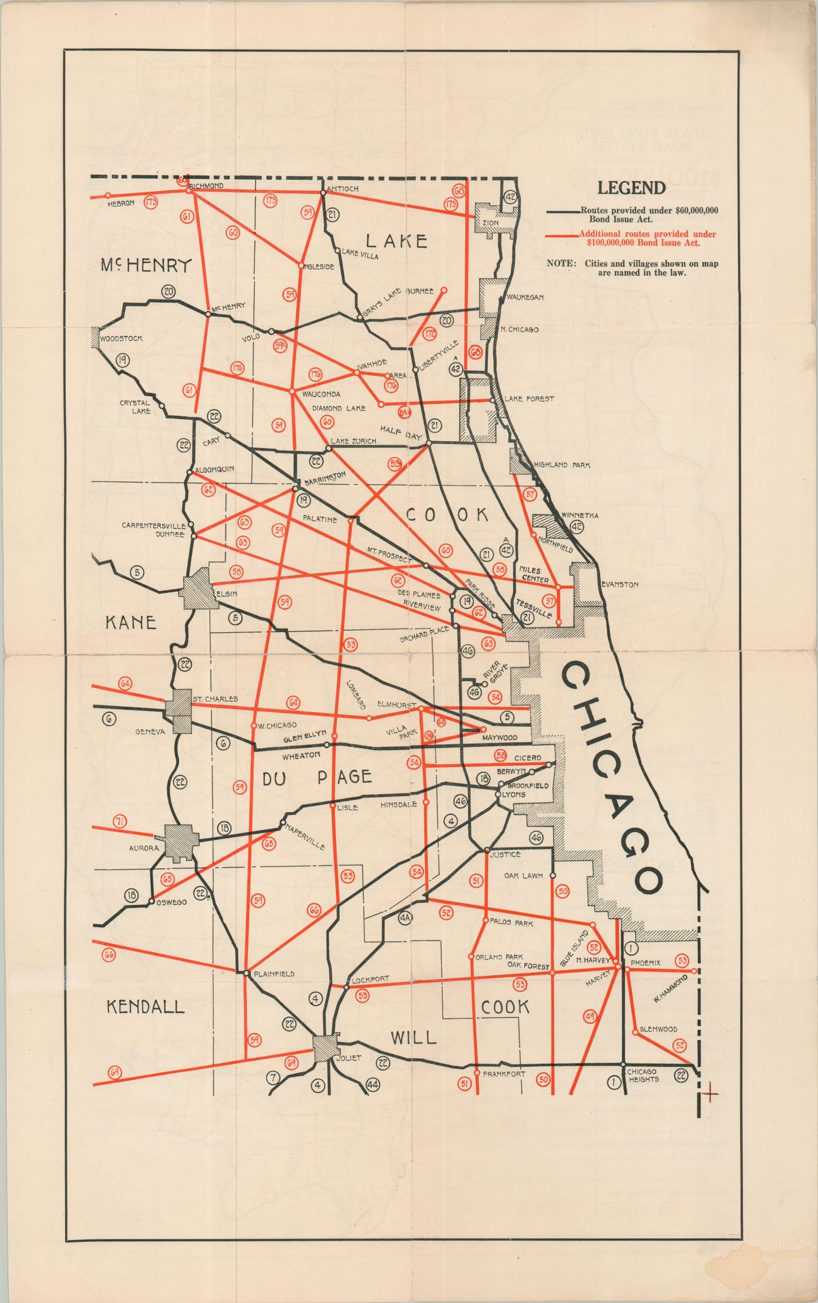
This authoritative 1927 state road map, drafted by engineer Robert Ingleson and issued by the Illinois Division of Highways, serves as a primary document of the most significant expansion of the state’s transportation infrastructure until the Interstate Highways. The map utilizes a high-contrast color scheme to delineate the evolution of the “Good Roads” movement: the established $60,000,000 Bond Issue Act roads are shown in black, while the proposed $100,000,000 State Bond Issue Law network is highlighted in bold red.
The accompanying text is a fascinating example of early 20th-century political messaging, emphasizing a “NO DIRECT TAX” pledge to reassure the public that the massive project would be funded solely through vehicle licensing and consumption fees. This “user-pays” model was pioneered in the Midwest and became the national standard for highway finance. A similar image on the verso highlights the proposed network of roads around Chicago. In 1927, Illinois had more miles of paved road than almost any other state.
Map Details
Publication Date: 1927
Author: Ingleson
Sheet Width (in): 15.50
Sheet Height (in): 25.00
Condition: B
Condition Description: Double-sided map, formerly split into four pieces. Archival repairs throughout, with very minor image loss.
Out of stock