State Highway Department Road Map of Arizona
$95.00
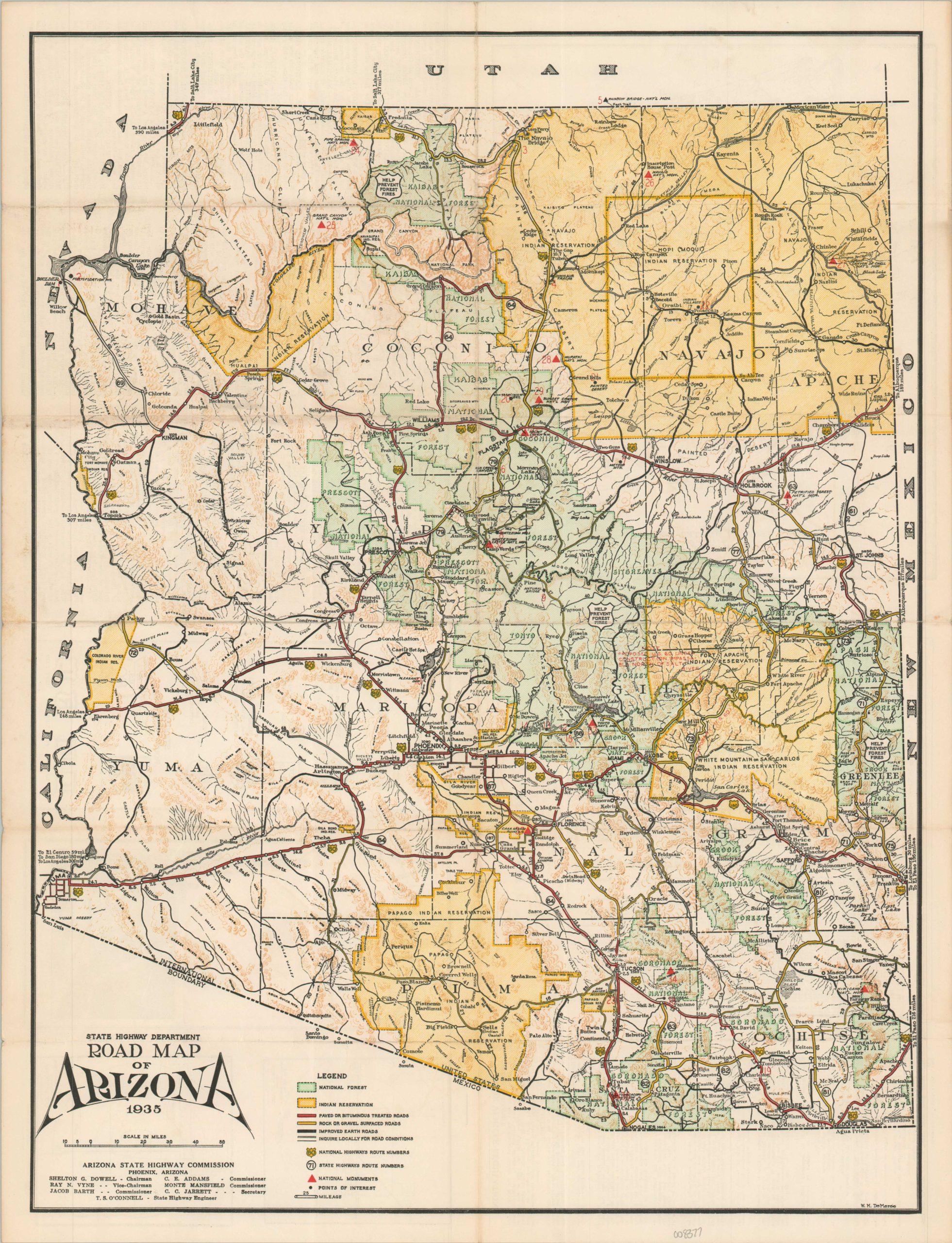
A detailed map of Arizona’s roads during the Great Depression.
1 in stock
Description
This colorful mid-1930s road map of Arizona uses red and yellow to highlight the statewide network of paved (or bituminous-treated) and gravel roads, respectively. Improved earth routes are noted with solid black lines, whereas motorists are encouraged to ‘inquire locally’ for the other available paths. National Forests (green) and Indian Reservations (yellow) are also shaded, while small red triangles designate National Monuments. The verso of the sheet provides a wealth of further information, including summaries of 37 statewide points of interest, small plans of Tucson and Phoenix, a distance table, list of motor vehicle regulations, and Map of the Western United States Showing U.S. Highway System.
The map was designed by W.F. DeMerse (named, lower right corner) and published in 1935 by the Arizona State Highway Commission. Printed in Phoenix by Arizona Printers, Inc.
Map Details
Publication Date: 1935
Author: W.M. DeMerse
Sheet Width (in): 16.90
Sheet Height (in): 22.00
Condition: A-
Condition Description: Double-sided map folder with light toning in the margins and faint wear along original folds. Very good condition overall.
$95.00
1 in stock