Standard Oil Company Official Road Map Indiana
$25.00
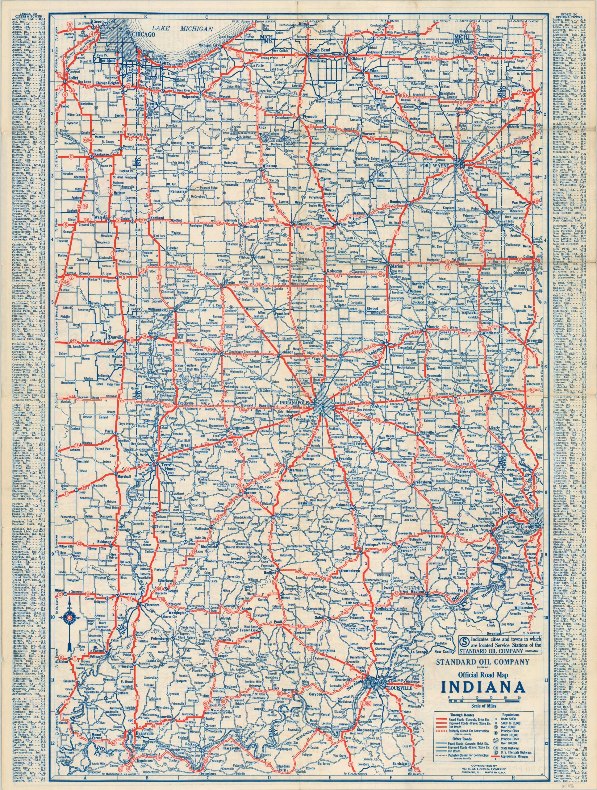
Postwar road map of Indiana issued by The H.M. Gousha Company.
1 in stock
Description
As World War II finally came to a close in 1945, many Americans had more recreational time on their hands than ever before. The convenient intersection of leisure, technology and infrastructure led to an explosion of automobile travel in the years following the conflict.
This map, published by H.M. Gousha on behalf of the Standard Oil Company, reflects this changing trend. It depicts several types of roads across the state, based on their surface treatment and condition. These could range from dirt roads, or local routes under construction, to the bold red lines paved with concrete, brick or asphalt.
An index to cities and towns is provided on either side of the map, while the verso features a territorial road map of the Midwest, insets of major urban areas, and several paragraphs of text with information on the state, and Standard Oil Services available throughout.
Map Details
Publication Date: 1945
Author: H.M. Gousha
Sheet Width (in): 18.00
Sheet Height (in): 23.60
Condition: A-
Condition Description: Faint wear along fold lines, as originally issued and minor discoloration on the verso of the sheet from age. Overall near fine condition.
$25.00
1 in stock