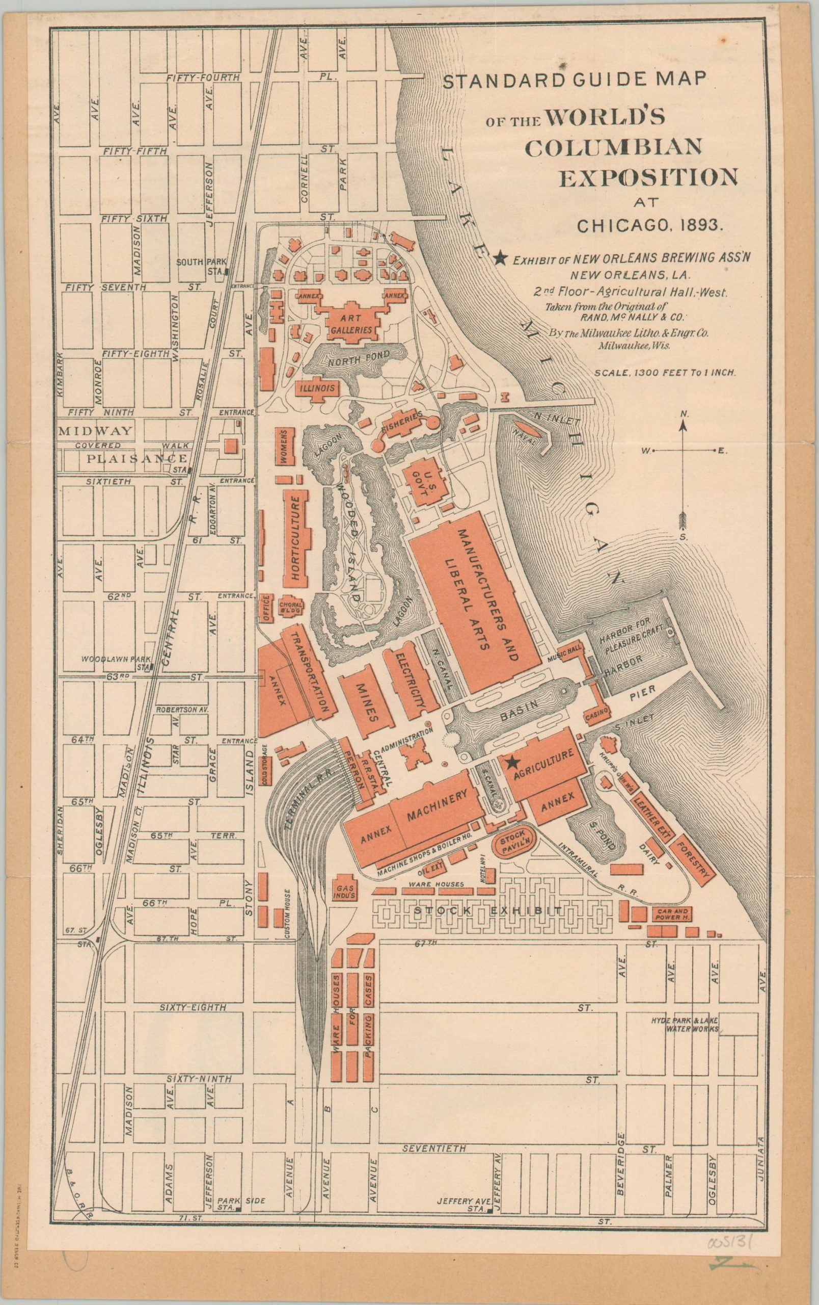
Standard Guide Map of the World’s Columbian Exposition
Rare souvenir from the Columbian Exposition.
Out of stock

Description
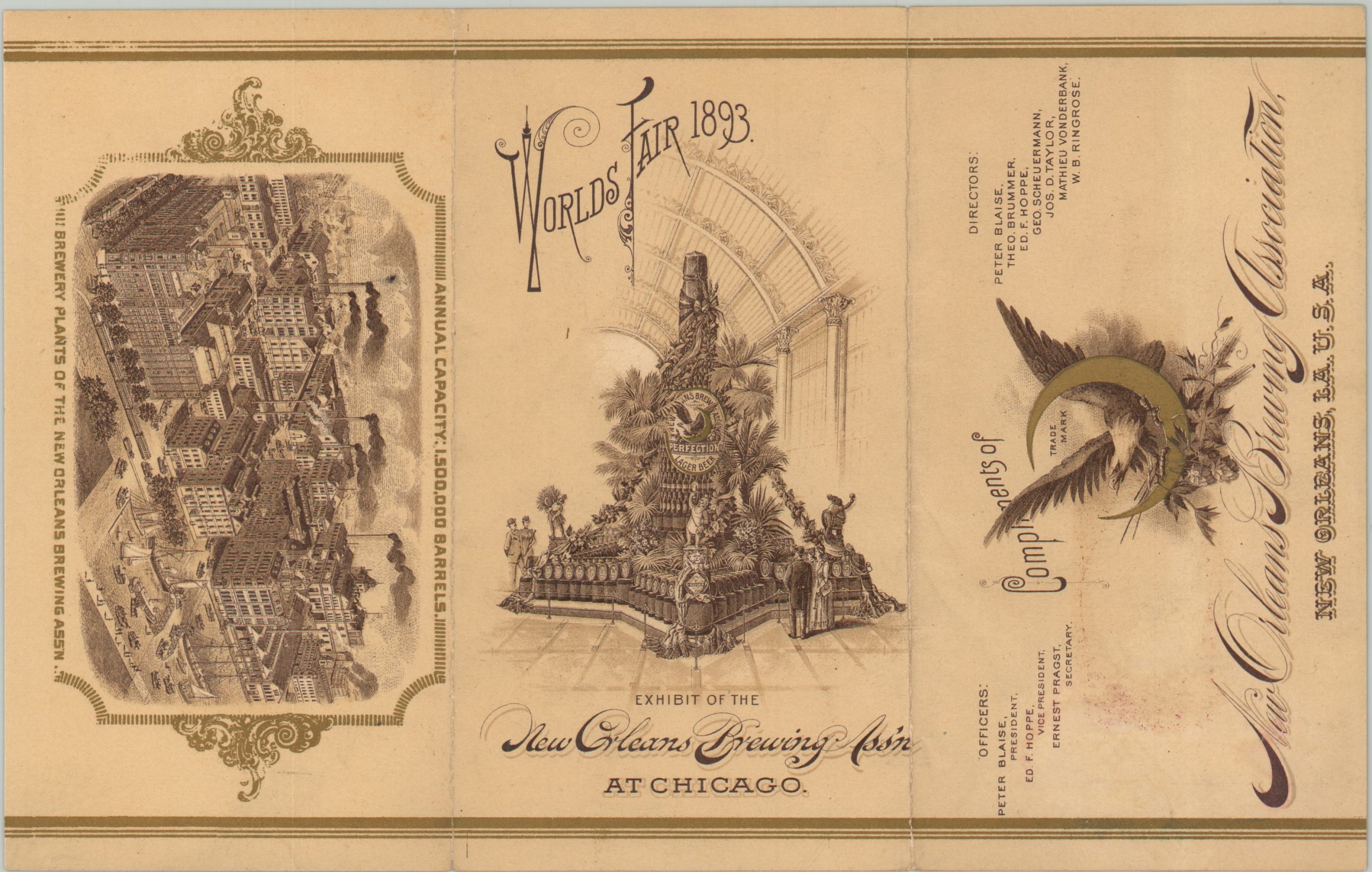
This uncommon promotional item was distributed at the 1893 Columbian Exposition by the short-lived New Orleans Brewing Association. In 1890, a collection of six breweries merged at the site of Louisiana Brewing Co. on the corner of Jackson Avenue and Tchoupitoulas Street to combat the practice of English brewery syndicates buying up their small-scale operations. The initial organization only existed until 1899, but it would be reborn in the 20th century as the New Orleans Brewing Company.
A portion of Rand McNally’s Official Guide Map has been custom-issued by the Milwaukee Lithograph and Engraving Company. The Midway Plaisance is almost entirely omitted, with emphasis on the White City – particularly the New Orleans Brewing Association Exhibit on the 2nd floor of the Agriculture Building (starred).
The map is glued to stiff paper wraps that show chromolithographed images of the Perfection, Pilsner, and Louisiana Export Beers for sale by the brewery. The covers show a view of the exhibit and an aerial perspective of the brewing association factory complex, with an alleged annual capacity of 1,500,000 barrels!
Source: New Orleans Brewery Tour;
Map Details
Publication Date: 1893
Author: Milwaukee Litho. & Engraving Co.
Sheet Width (in): 6.25
Sheet Height (in): 9.9
Condition: A-
Condition Description: Single-sided map adhered to original stiff illustrated gold covers. Light creasing along original fold lines and a few small spots visible at the top of the sheet. Very good or slightly better overall.
Out of stock