Standard Atlas of Champaign County, Illinois
$395.00
Beautifully restored atlas of Champaign County.


Description
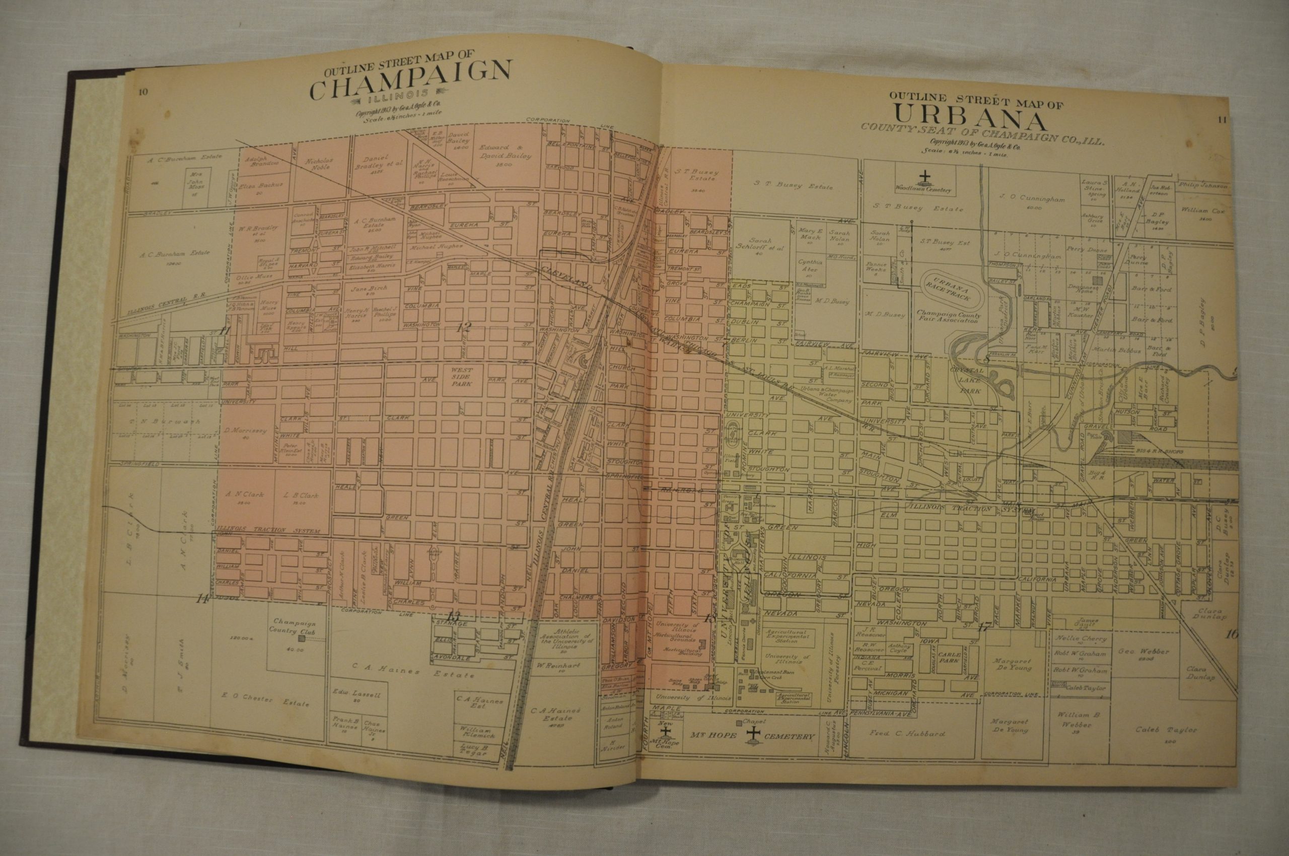
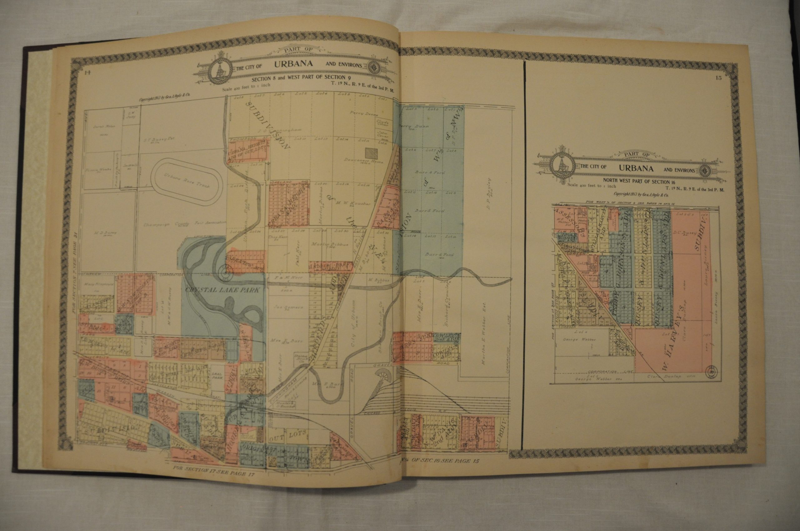
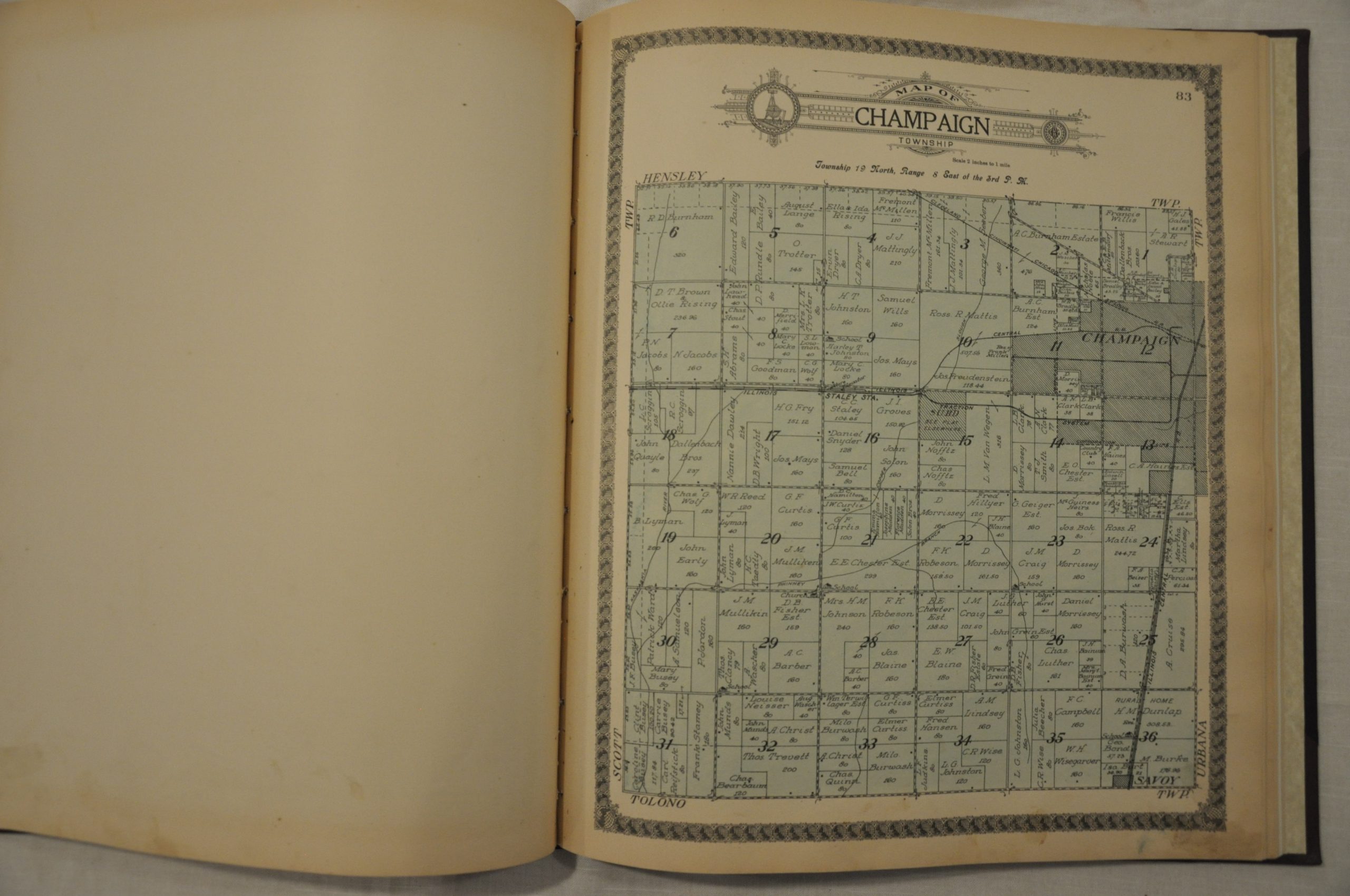
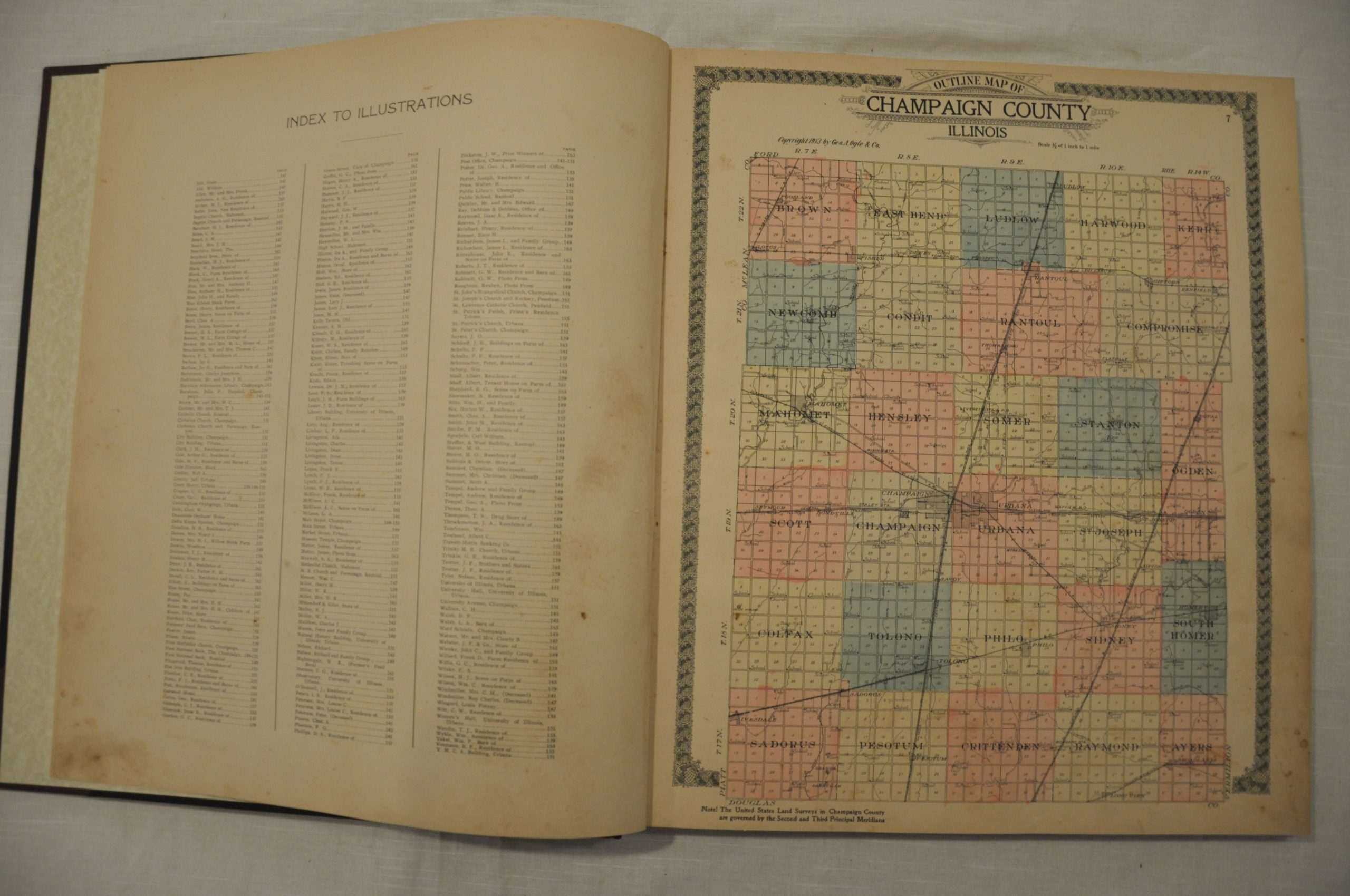
This atlas was published and engraved by the firm of George Ogle in Chicago and provides a comprehensive geographic overview of Champaign County, and to some extent, the whole world. The primary focus is on 79 maps showing land ownership in townships and cities across the county. The scale varies between 800 feet and one mile to two inches; allowing for a fine level of detail on property owners, transportation routes, and important buildings. A delicate border comprised of globes and elaborate title are the only decorative elements.
Elsewhere in the atlas, Ogle included double page maps of Illinois, the United States, and the world. An overview of the land survey system, chronology of ancient and modern history, and extensive county business directory are also part of the publication. This last inclusion would have been important, as many early 20th century atlases were sold on a subscription basis. Businesses would buy advance copies in exchange for advertising space, or private residents could do the same and have their portrait, property, or even their favorite animal included in the volume. This atlas has nearly 30 pages of illustrations of patrons of the publisher, many of whom chose to show off their new automobiles in their photographs.
Map Details
Publication Date: 1913
Author: George Ogle
Sheet Width (in): 15.5
Sheet Height (in): 17.75
Condition: A-
Condition Description: The atlas has been professionally restored and rebound with maroon gilt quarter leather binding. Complete, 186 pages with 86 color lithographed maps (16 double page). The pages are intact and in good condition, but most exhibit minor to moderate soiling along the outer edges. Very good to excellent overall.
$395.00