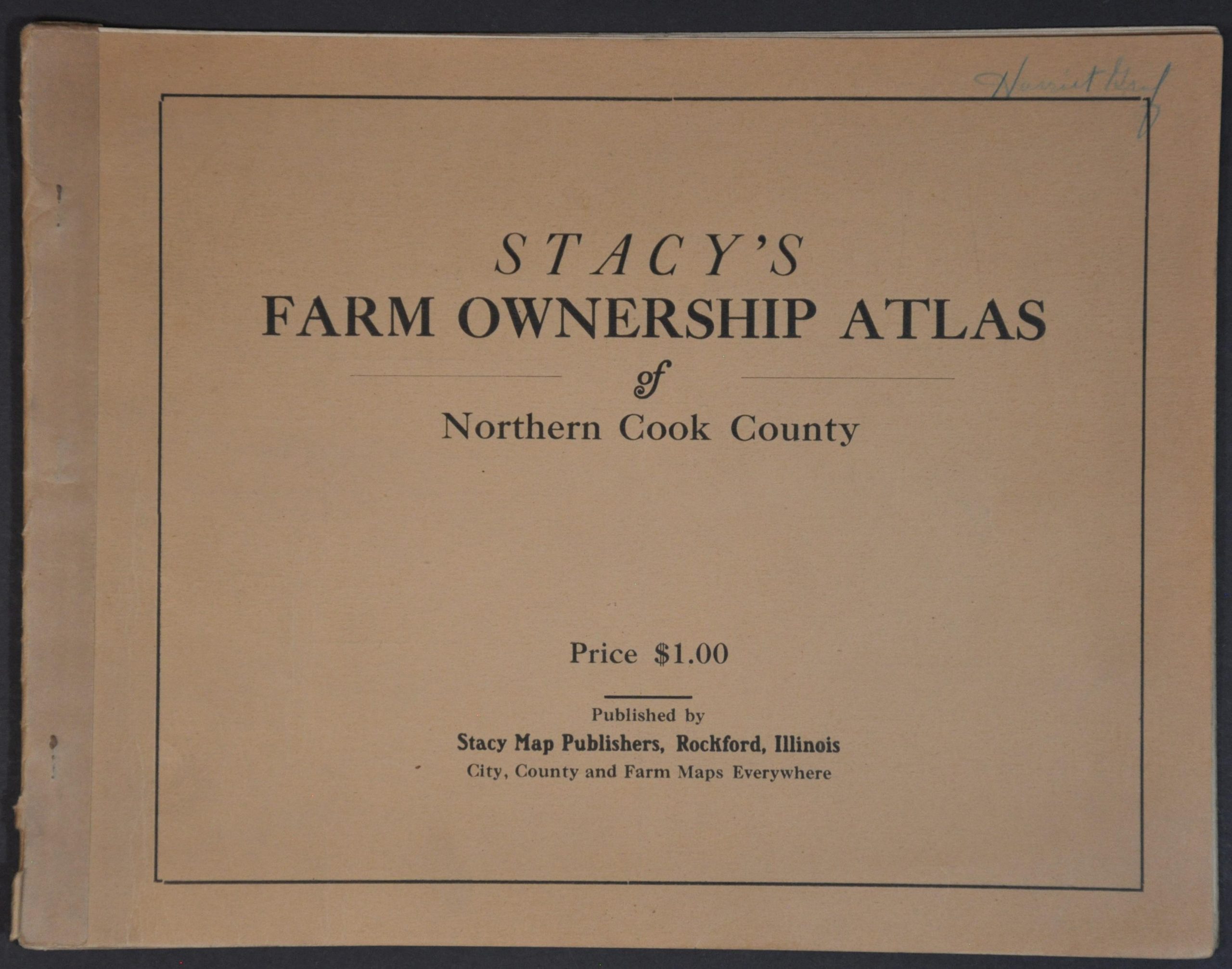
Stacy’s Farm Ownership Atlas of Northern Cook County
$395.00
Property ownership across the northern Chicago suburbs during the Great Depression.
1 in stock
Description
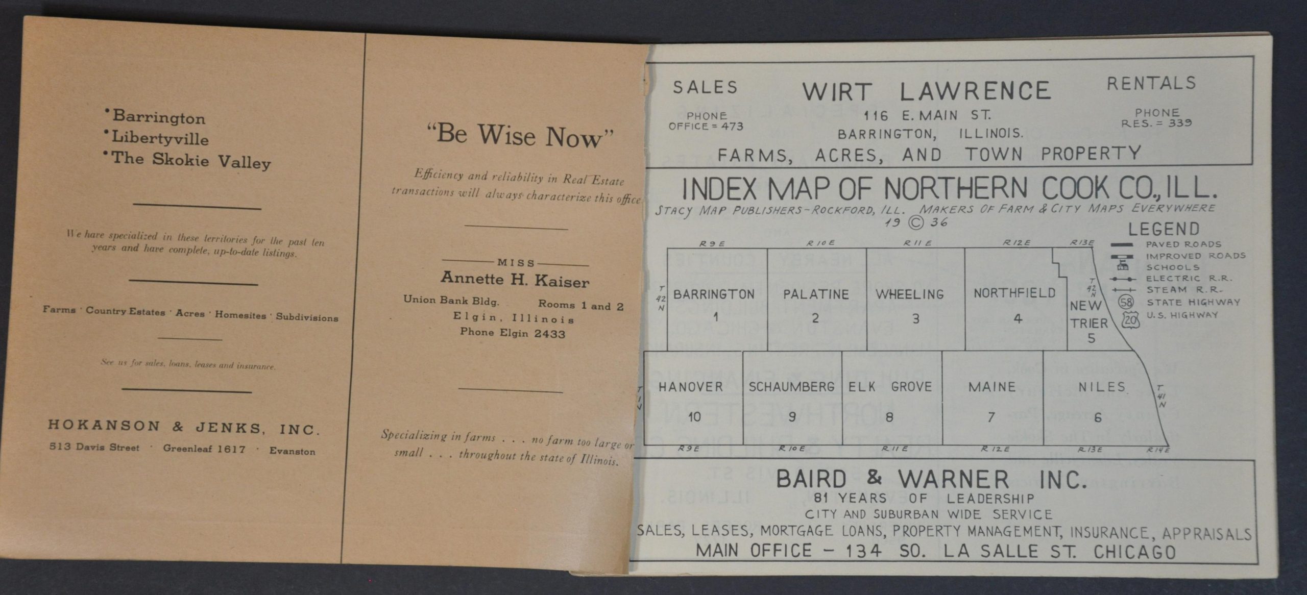
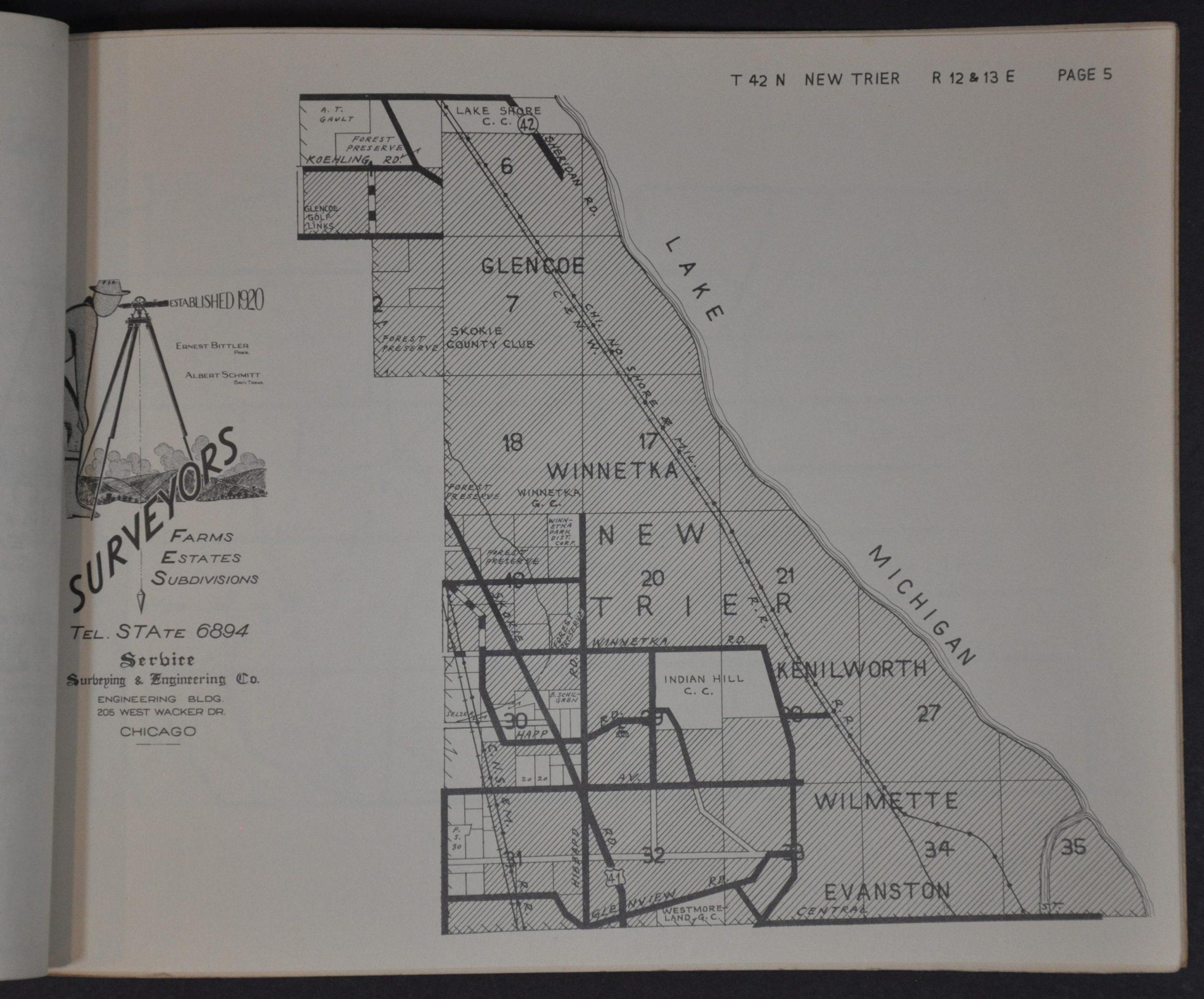
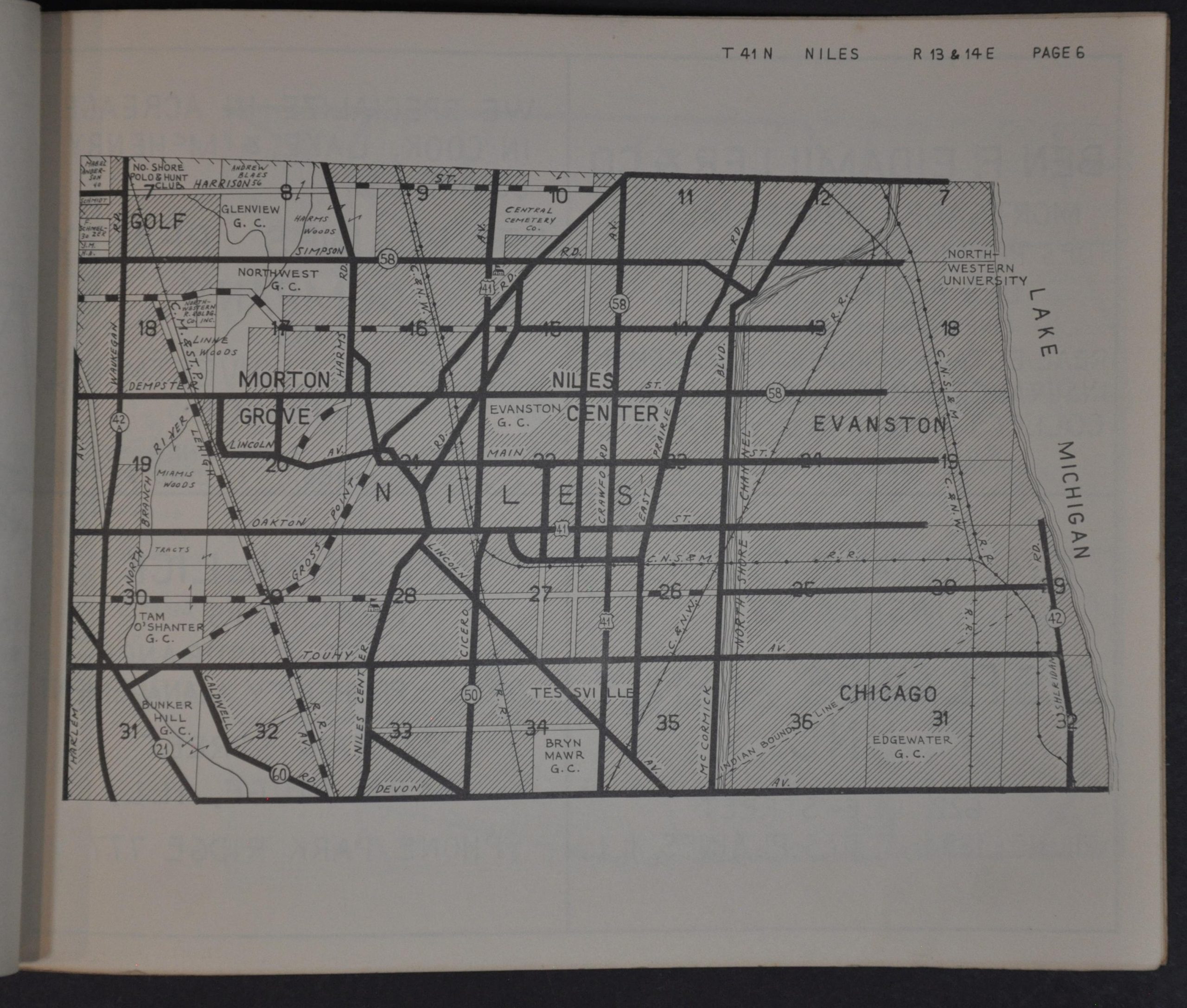
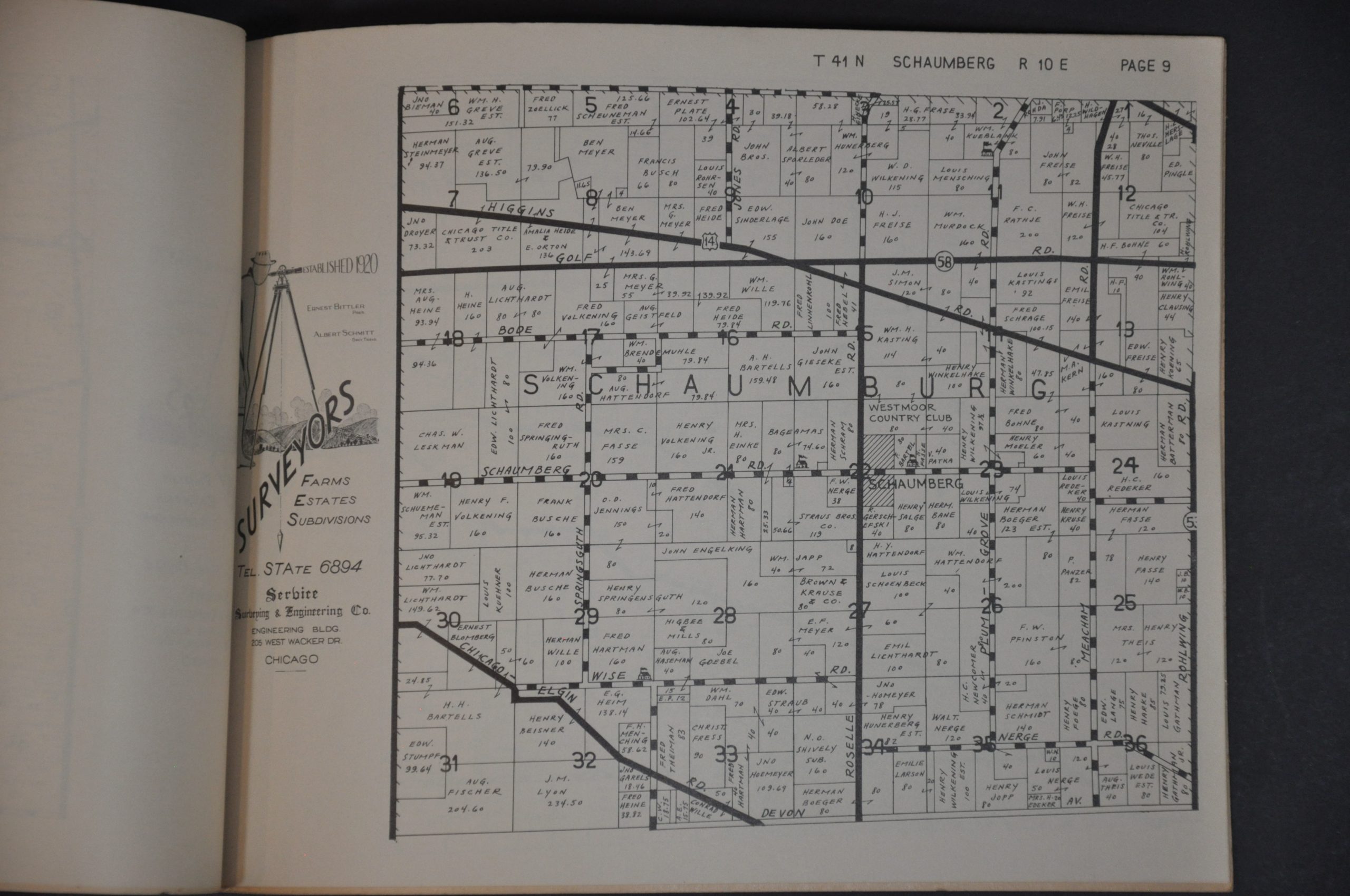
This detailed rural property atlas of northern Cook County, Illinois was copywritten in 1936 by Stacy Map Publishers of Rockford, Illinois. Landowners and large businesses throughout each township are labeled on each page; in addition to transportation routes, geographic features, and city limits (which occupy much of certain sheets). Properties of note include Arlington Park Racetrack, extensive Forest Preserves, Curtiss Reynolds Airport, and several country clubs and golf courses.
Numerous contemporary advertisements are included opposite many of the pages, most commonly for Serbice Surveying and Engineering in Chicago. Railways like the North Shore Line and an increasing network of paved roads (work on the Skokie Valley Highway/U.S. 41 began in 1931) contributed to northern Cook County’s growth and urbanization of the 1930s, in spite of the ongoing Great Depression.
Stacy Map Publishers, advertised as ‘Makers of Farm & City Maps Everywhere’ on the first page was a prolific publisher of Midwestern plat maps and urban plans during the 1930s and 1940s. The 1936 edition of the Northern Cook County Atlas is listed only once in WorldCat, at the Illinois State Library.
Source: OCLC# 1373092500
Map Details
Publication Date: 1936
Author: Stacy Map Publishers
Sheet Width (in): 11
Sheet Height (in): 8.4
Condition: A
Condition Description: 11 page atlas (10 maps + index), bound with staples in original stiff paper covers (lightly toned). Duplicate of page 8 inserted. Contents (complete) are tightly bound and show light toning and edge wear, consistent with age and use. Very good condition overall.
$395.00
1 in stock