
St. John’s – Florida’s First County [and] Map of Saint Augustine Showing Points of Interest
$185.00
An ephemeral celebration of the oldest county in Florida.
1 in stock
Description
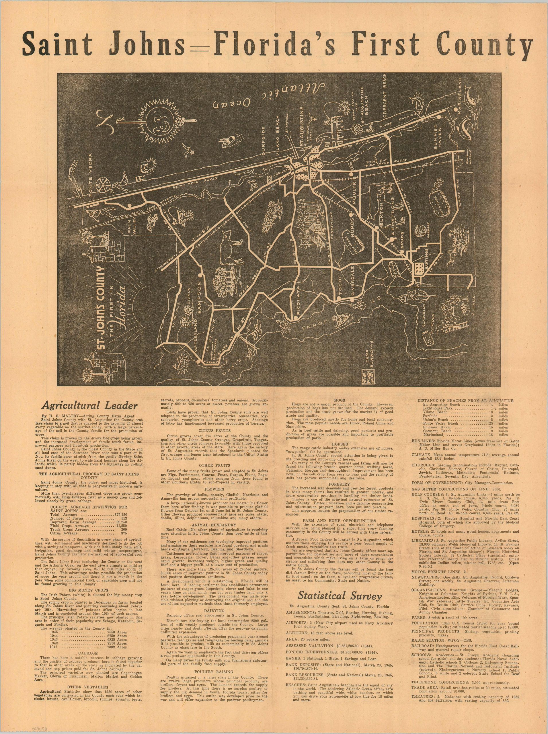
This interesting WWII-era promotional piece highlights the economic and recreational opportunities available in St. Johns County, Florida. The black-and-white map, oriented with East at the top, emphasizes the region’s robust transportation network and utilizes charming pictorial vignettes to feature points of interest and local industries. Accompanying text by H.E. Maltby, Acting County Farm Agent, outlines the county’s diverse agricultural production alongside key economic statistics.
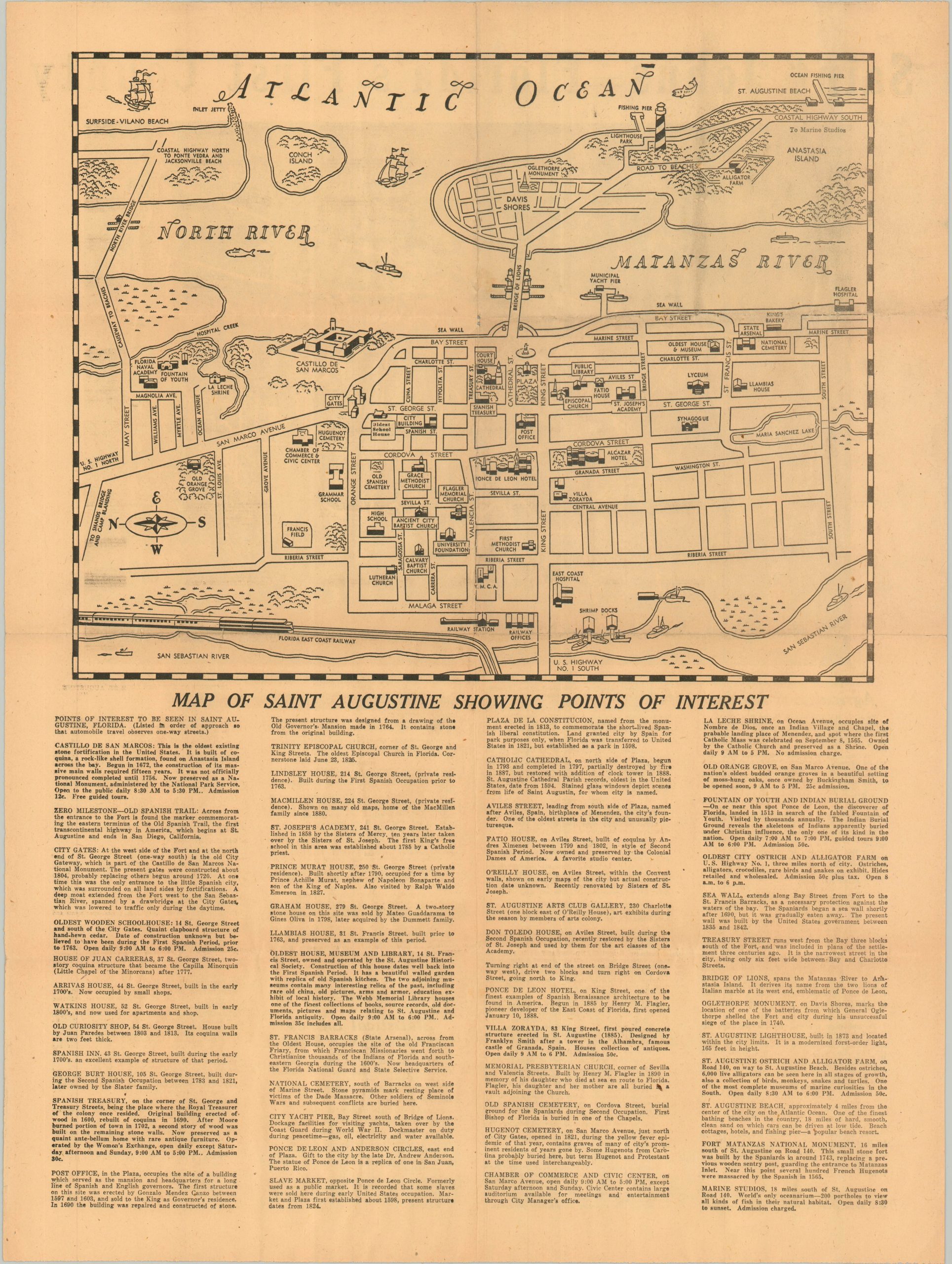
The verso features a large-scale street plan of St. Augustine (the oldest continuously occupied European-established settlement in the United States), highlighting major landmarks such as the Castillo de San Marcos, Marine Studios, and the Ponce de Leon Hotel. Although no author or publisher is explicitly credited, Maltby’s text cites statistics from March 1945, and the emphasis on civilian recreation rather than wartime military infrastructure suggests the map was issued shortly after the conclusion of World War II.
Map Details
Publication Date: 1945
Author: H.E. Maltby?
Sheet Width (in): 17.10
Sheet Height (in): 22.60
Condition: B+
Condition Description: Double-sided sheet of newsprint, creased along folds and lightly worn in the margins. Toned, consistent with age. Good condition overall.
$185.00
1 in stock