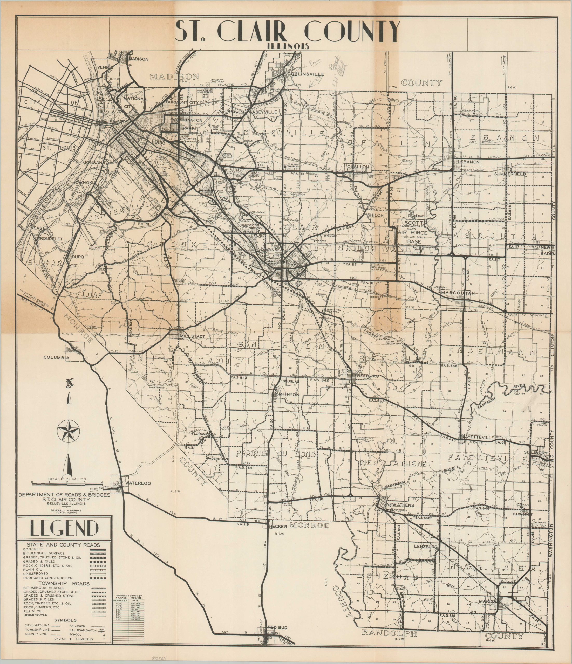
St. Clair County Illinois
$75.00
The roads around East St. Louis during the mid-20th century.
1 in stock
Description
This interesting map of St. Clair County, Illinois was originally compiled and drawn by A.Y. Wade in 1935. A table of revisions in the lower left shows updates have been made through 1958, with publication overseen by the St. Clair County Department of Roads and Bridges.
The image presents a detailed overview of the road network around East St. Louis, with a variety of line styles employed to denote different surfaces across routes managed by both townships and the state/county. Churches, schools, cemeteries, railroad switches, and more are noted according to the legend in the lower left. Other labeled locations of interest include the American Legion Freedom Farm, the Saint Clair Co. Tuberculosis Sanitorium, Parks Metropolitan Airport, and Scott Air Force Base.
Map Details
Publication Date: 1958
Author: A.Y. Wade
Sheet Width (in): 18.75
Sheet Height (in): 21.75
Condition: B
Condition Description: Heavy toning visible along the upper half of the sheet and light creasing along old fold lines. Light penciled annotations visible in several places.
$75.00
1 in stock