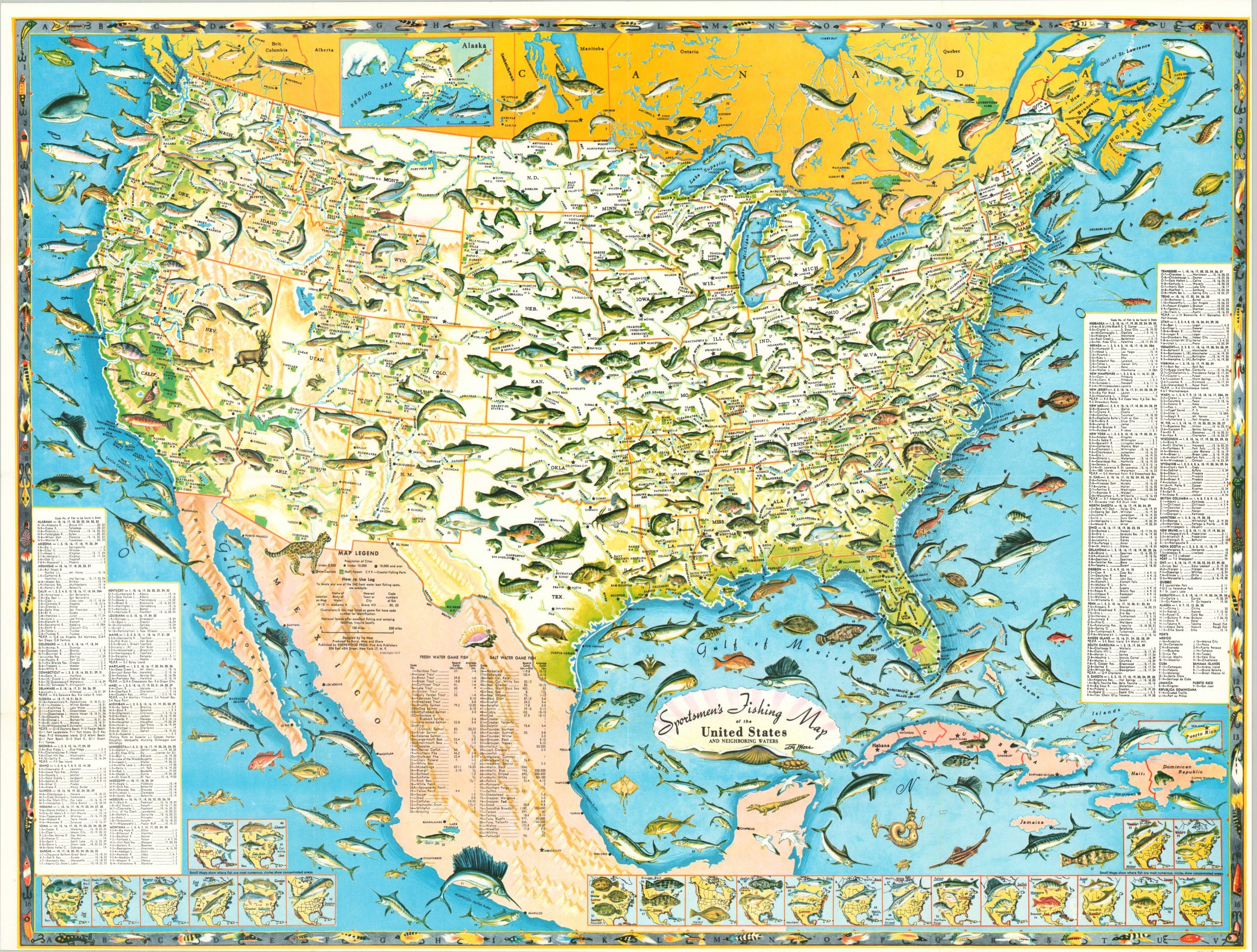
Sportsmen’s Fishing Map of the United States and Neighboring Waters
$200.00
Colorful map of the fishing opportunities available for anglers in the United States.
1 in stock
Description
Cast a reel almost anywhere in America and you’re bound to catch a fish! This eye-catching map of the United States was designed by Ira Moss and published by Shorewood Press in 1957. It highlights the bounty of marlins, sharks, trout, bass, and numerous other species of fish (approximately 80 in total) waiting to be caught in the coastal and inland waters of the United States, Mexico, and southern Canada.
Dozens of realistic vignettes dominate the image, each of which is numbered and referenced in the corresponding index. Nearly two dozen small inset maps along the bottom of the page highlight the cruising grounds for prize catches. The utility of the map as an actual fishing guide is somewhat suspect. Despite its emphasis on angling, there are some political aspects within the image as well. For example, Cuba can be seen divided into multiple states while in the midst of the revolution that would put Castro in power.
Map Details
Publication Date: 1957
Author: Ira Moss
Sheet Width (in): 23.5
Sheet Height (in): 19.25
Condition: A
Condition Description: Light creasing along old fold lines. Narrow margins, as issued. Near fine condtion overall. Blank on verso.
$200.00
1 in stock

