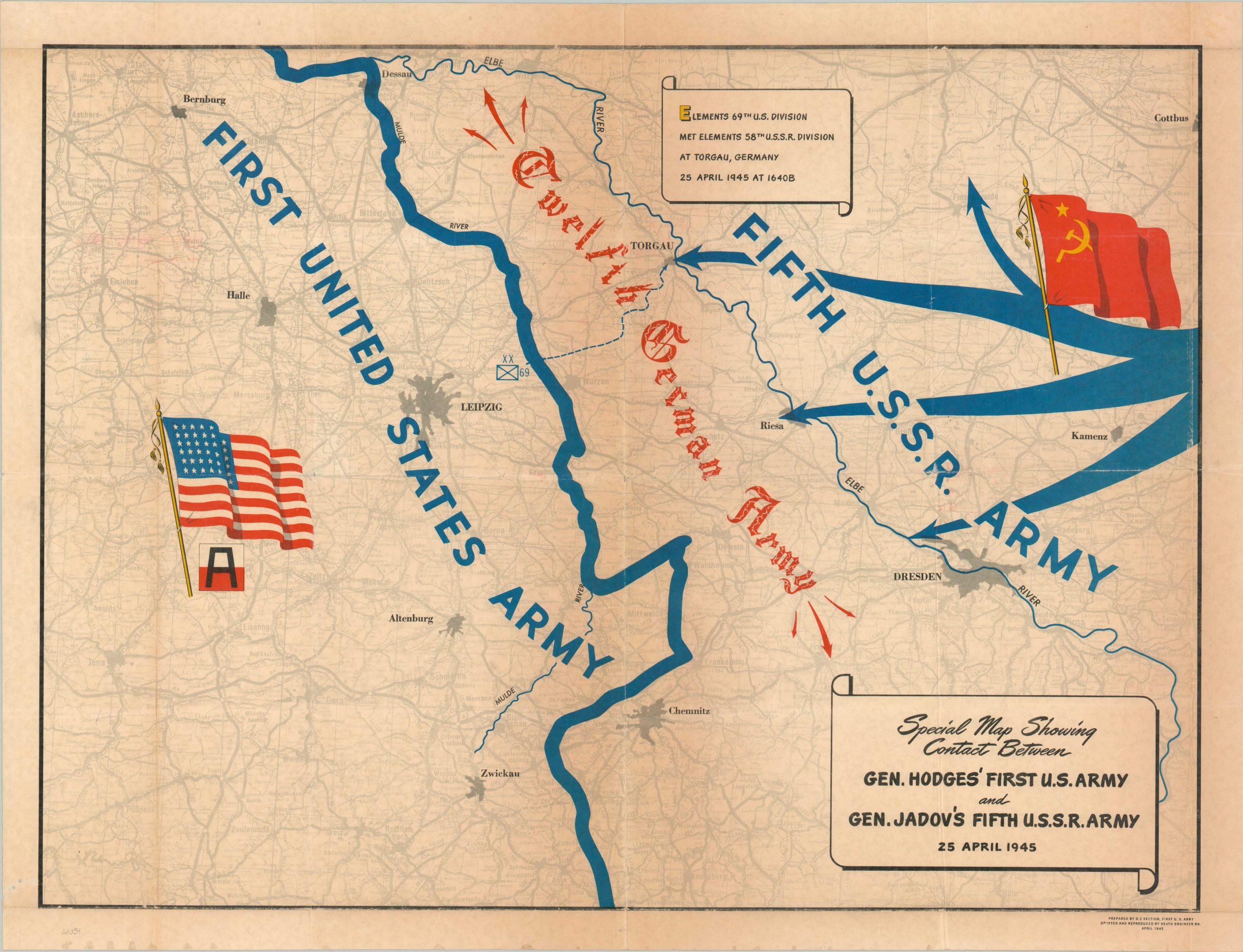
Special Map Showing Contact Between Gen. Hodges’ First U.S. Army and Gen. Jadov’s Fifth U.S.S.R. Army 25 April 1945
$350.00
The Red links up with the White and Blue in April 1945.
1 in stock
Description
This uncommon WWII map commemorates the historic linkup between the First United States Army and the Fifth Soviet Army on April 25, 1945. Known as Elbe Day, elements of the U.S. 69th Infantry Division and the U.S.S.R. 58th Guards Rifle Division met near Torgau, Germany on the Elbe River, effectively cutting the truncated Third Reich into two.
A simple base map highlights the Mulde and Elbe Rivers (oddly with the former bolded, instead of the latter). Advances of the Red Army are generalized with large arrows, with the Twelfth Germany Army squeezed between the Allied forces. Large waving flags represent the soon-to-be-victorious powers.
The map was prepared by the G-2 Section of the First United States Army. Reprinted by the 654th Engineer Battalion in April 1945. WorldCat notes examples at Texas A&M University and the University of Illinois at Urbana-Champaign, with a further copy located at the Library of Congress. OCLC# 15201154
Map Details
Publication Date: 1945
Author: G-2 Section, First U.S. Army
Sheet Width (in): 28.75
Sheet Height (in): 21.75
Condition: B+
Condition Description: Moderate wear, creasing, and toning along old folds, along with small pinholes at fold intersections. Toning also visible along the outer edges of the sheet. Good condition overall. Blank on verso.
$350.00
1 in stock