Souvenir Map of the Pennsylvania Turnpike
$80.00
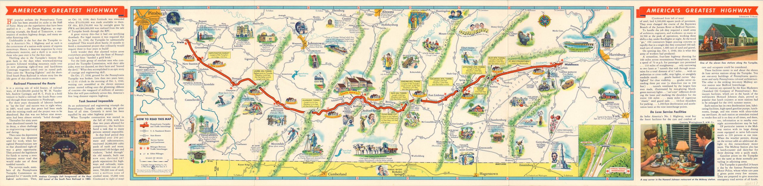
Pictorial map of the Pennsylvania Turnpike issued the year after the road first opened.
1 in stock

Description
Though it would ultimately extend across the entire breadth of the state, what you’re seeing here is the first section of the newly constructed Pennsylvania Turnpike – approximately 160 of the 360 completed miles. Opened between Carlisle and Irwin on Oct. 1, 1940, the route (highlighted in red) is billed as ‘America’s Greatest Highway’ on this promotional brochure by General Drafting Company.
Pictorial illustrations highlight many of the local attractions along the toll road as well as the numerous tunnels and bridges necessary to traverse the mountainous terrain. Service stations are also noted, allowing the motorist to stay refreshed without a long detour. An inset in the lower right shows a typical traffic interchange, with the toll booth located on entry/exit ramp.
Map Details
Publication Date: 1941
Author: General Drafting Company
Sheet Width (in): 32.90
Sheet Height (in): 8.00
Condition: A
Condition Description: Originally issued folded into six panels, with faint wear and light creasing along fold lines. Includes a original mailing envelope, slightly soiled.
$80.00
1 in stock