Southwestern Road Map
$150.00
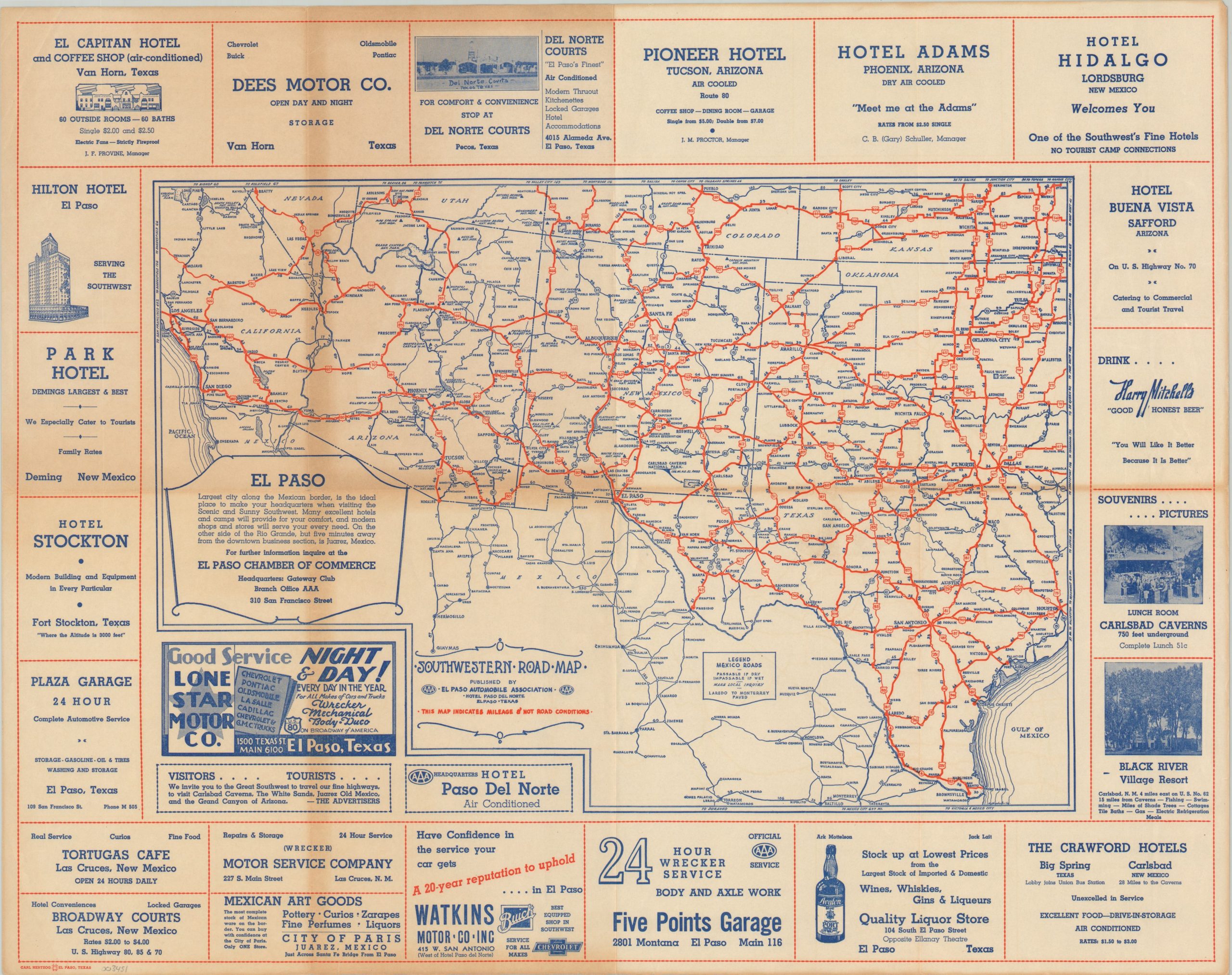
WWII-era road map of the Southwestern United States published by AAA.
1 in stock
Description
“Visitors…Tourists…We invite you to the Great Southwest to travel our fine highways, to visit Carlsbad Caverns, The White Sands, Juarez Old Mexico, and the Grand Canyon of Arizona. – THE ADVERTISERS” [Text lower left].
This eye-catching promotional map of the Southwestern United States was designed by Carl Hertzog and published in El Paso by the American Automobile Association (AAA) around 1944. The primary image shows the highway routes across portions of Texas, Arizona, New Mexico, southern California, and northern Mexico. Distances between points are noted, with a disclaimer in the lower center reading, “This map indicates mileage and not road conditions.”
Surrounding the image are over a dozen contemporary advertisements for hotels, service stations, and liquor stores across the region. A message from the El Paso Chamber of Commerce reminds the audience that the city is “the ideal place to make your headquarters when visiting the Scenic and Sunny Southwest.”
Map Details
Publication Date: c. 1944
Author: Carl Hertzog
Sheet Width (in): 23.50
Sheet Height (in): 18.75
Condition: B+
Condition Description: Moderately toned along former fold lines, with small spots of separation at fold intersections.
$150.00
1 in stock