Southern Regions
$80.00
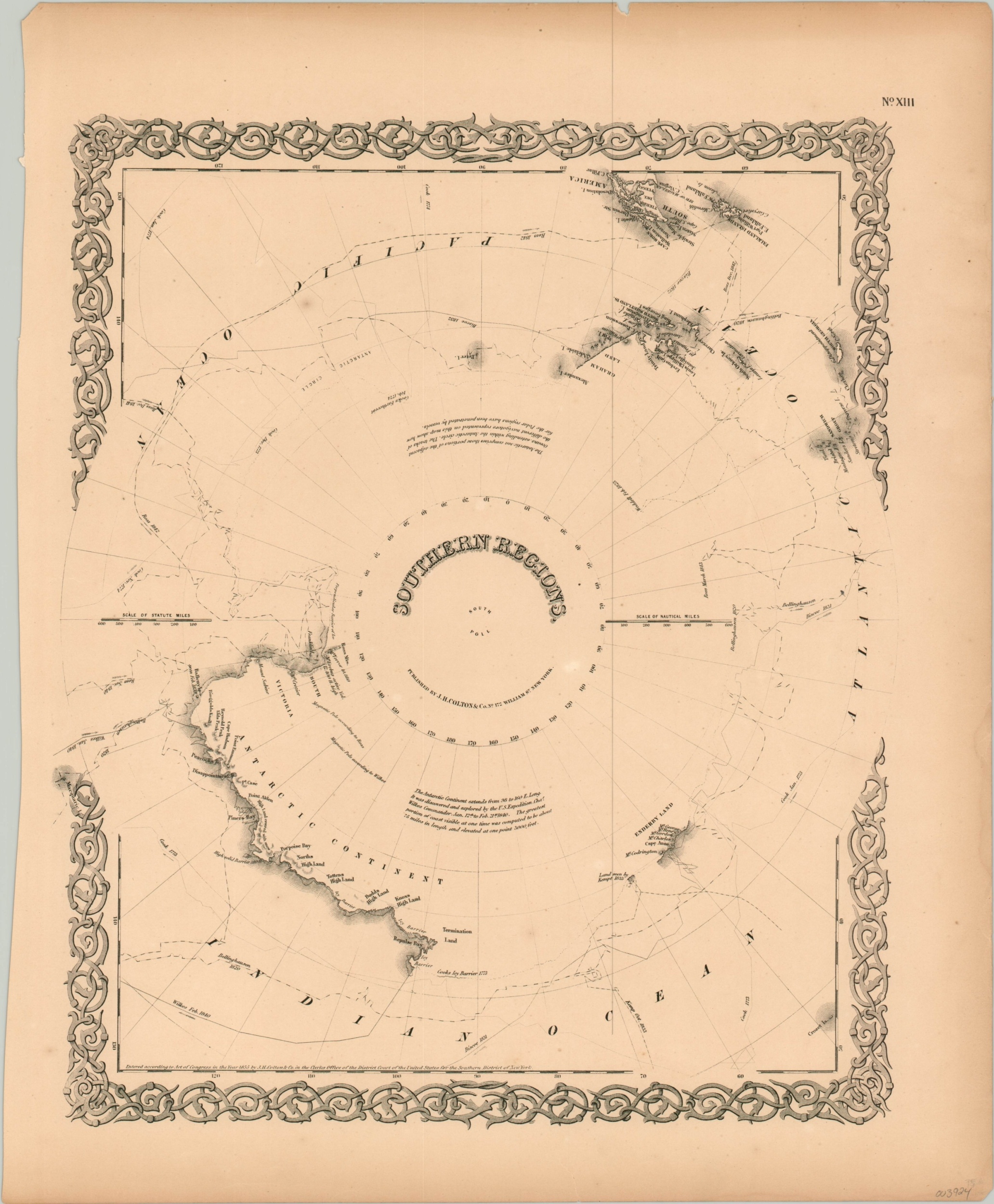
The visualization of Antarctic discovery during the mid-19th century.
1 in stock
Description
This attractive steel plate engraved map shows the culmination of western cartographic knowledge about the Southern Regions, or Antarctica, as of the 1850s. A largely incomplete coastline reflects the haphazard and difficult surveying efforts made by those few explorers who ventured into the icy waters.
The routes of Cook, Kemp, Bellingshausen, Wilkes, Biscoe, and Ross are noted throughout the image; with annotations, geographic features, and place names reflecting their notes and reports. After the monumental Ross Expedition of 1839-1843, there was a dearth of regional exploratory efforts for approximately 50 years. The South Pole, confidently identified in the center of the image, wouldn’t be reached by Roald Amundsen until 1911.
The map was published in New York in 1855 by J.H. Colton & Company.
Source: Royal Museums of Greenwich
Map Details
Publication Date: 1855
Author: J.H. Colton & Co.
Sheet Width (in): 14.75
Sheet Height (in): 18.1
Condition: A-
Condition Description: Minor toning and a few small chips and tears along the outer edges of the sheet, consistent with age. A few tiny spots in the right margin and scattered throughout the image. Very good overall.
$80.00
1 in stock