Southern Pacific Lines Division Maps
$250.00
A series of postwar maps covering the Southern Pacific Railroad from New Orleans to Los Angeles and beyond.
1 in stock


Description
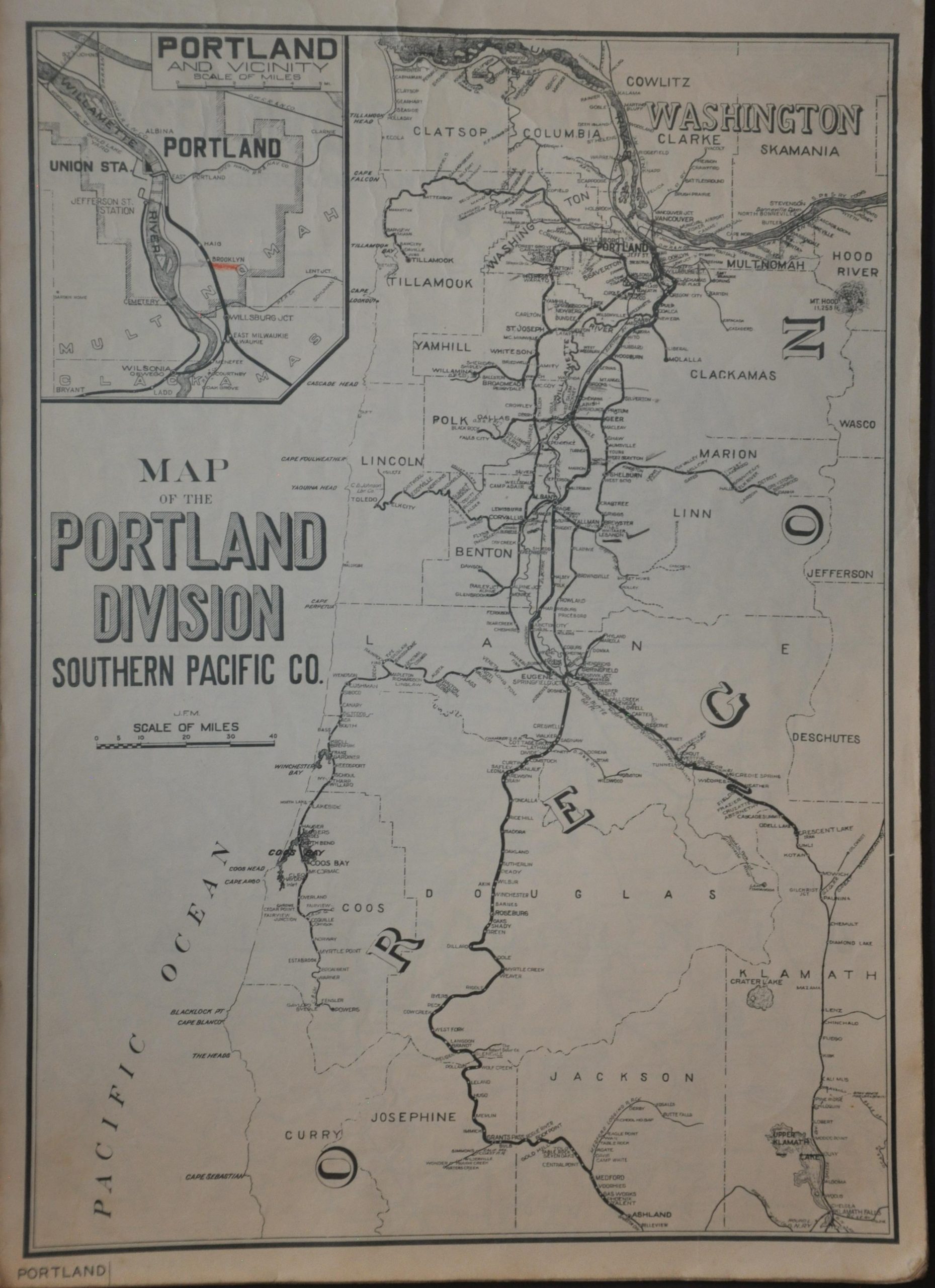
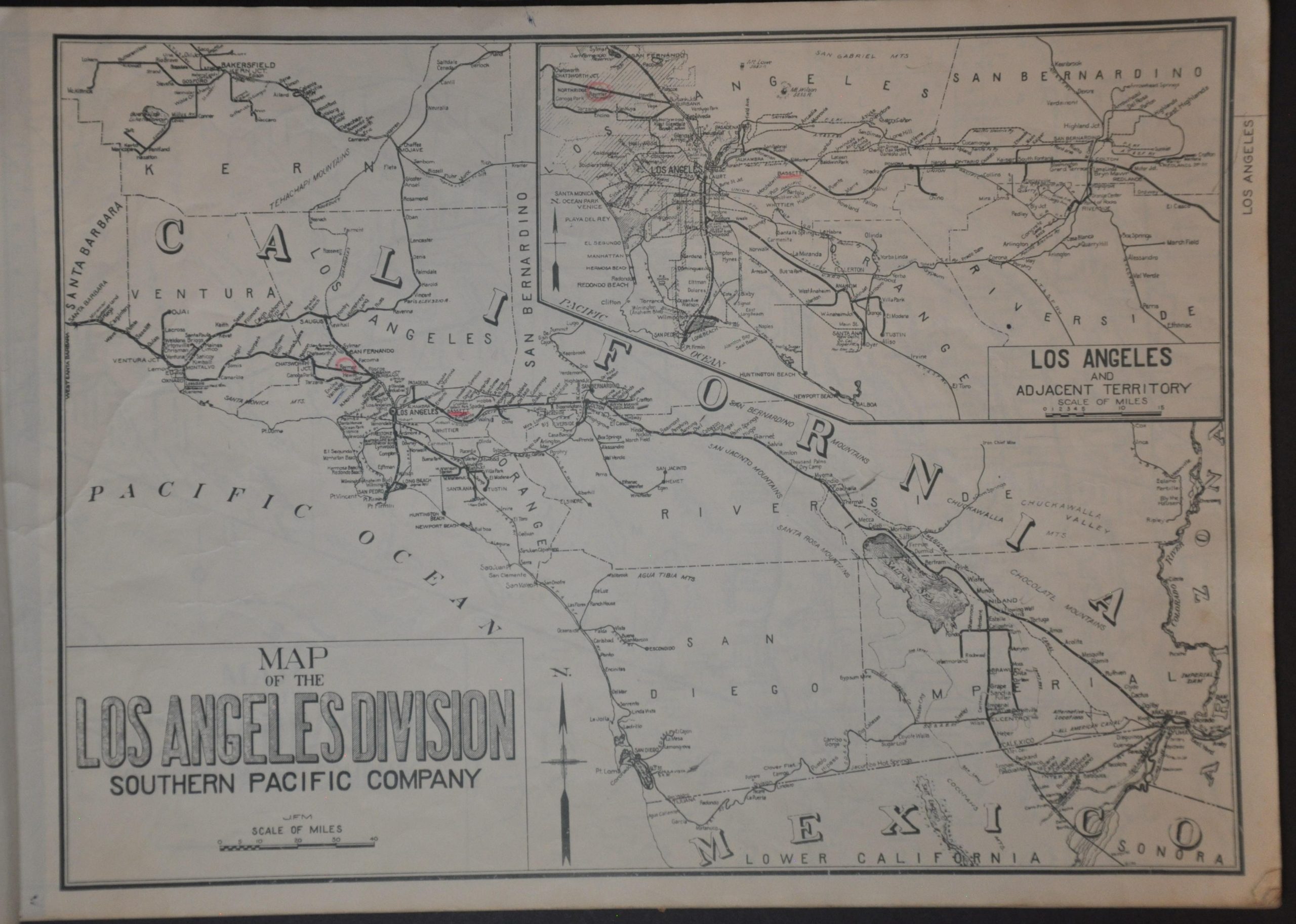
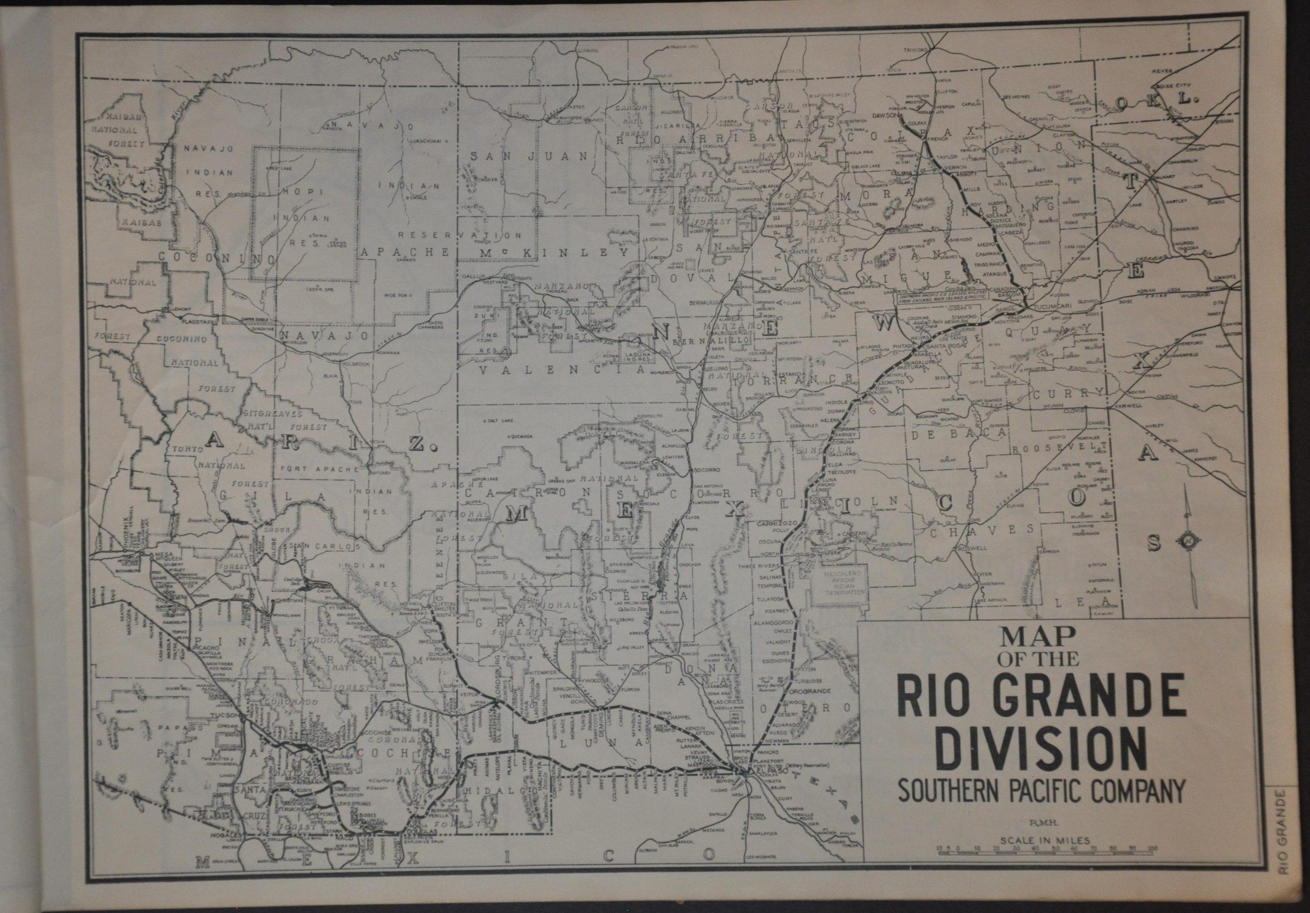
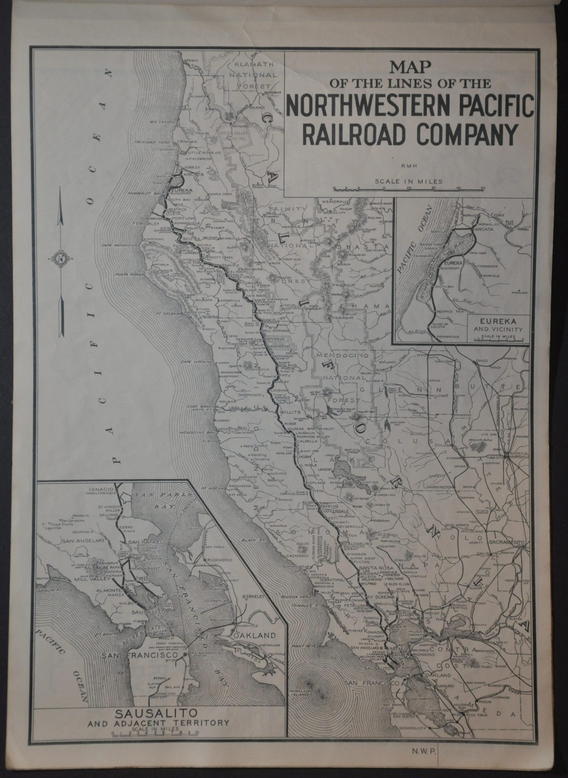
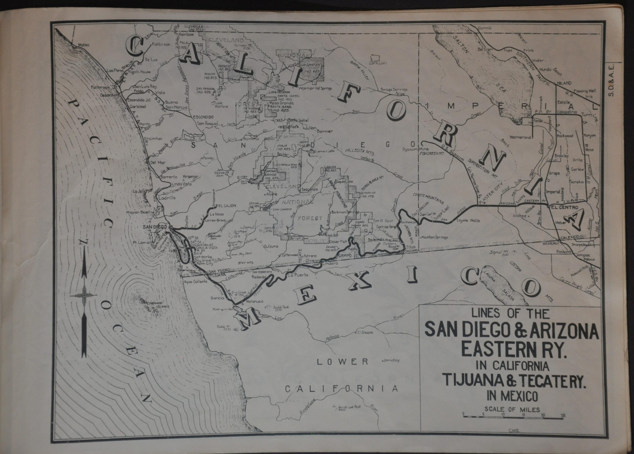
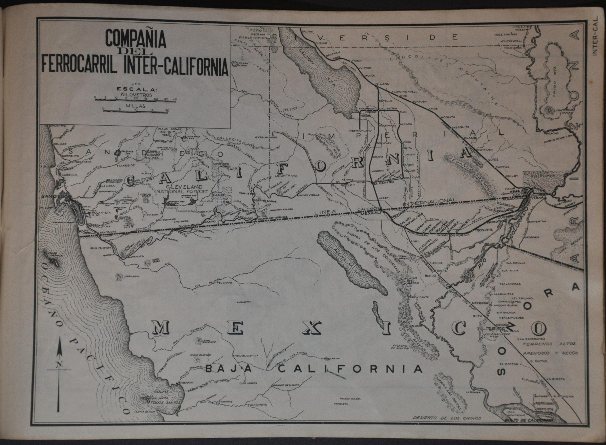
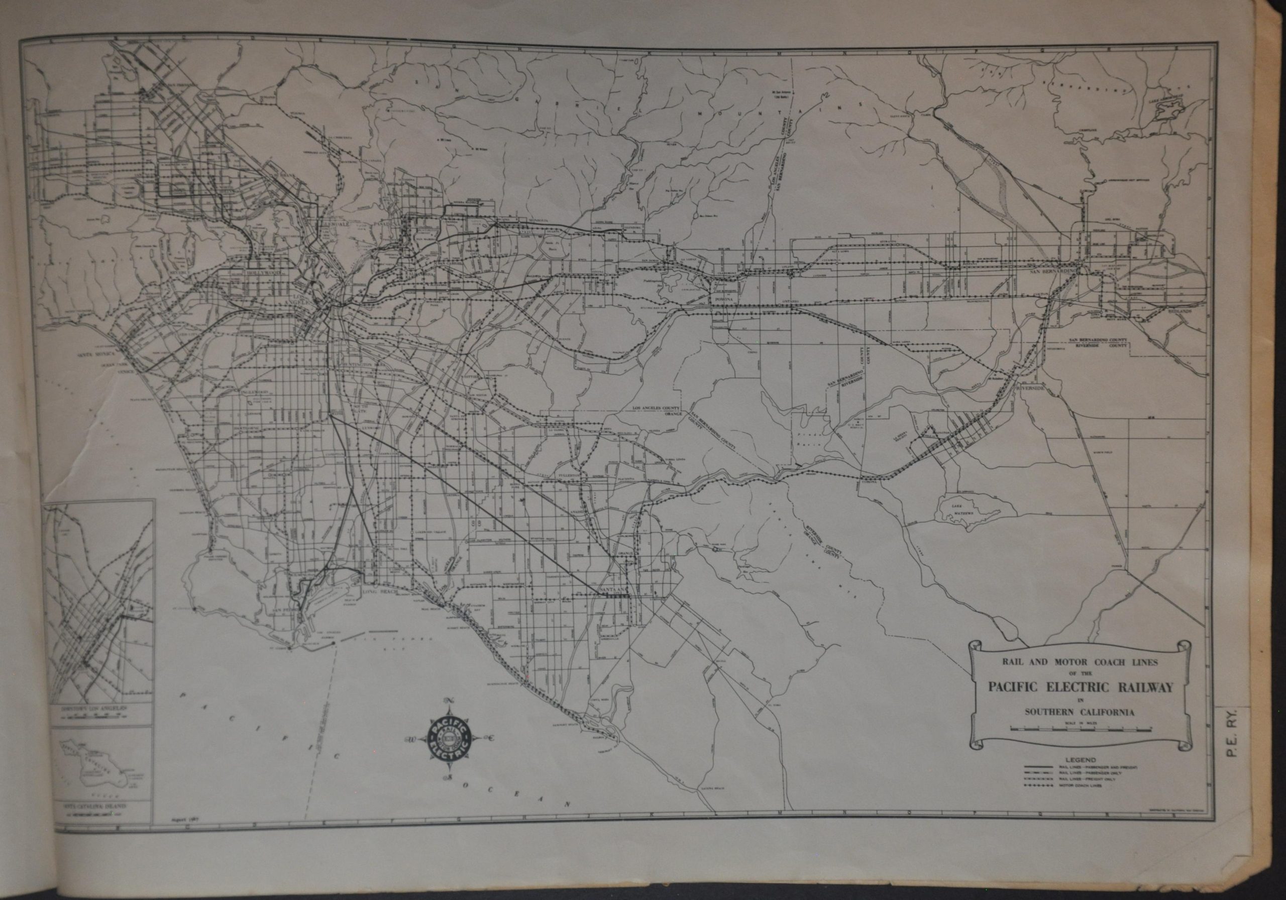
This fascinating and detailed compilation of map was published in San Francisco in 1949 by the System Freight Traffic Department of the Southern Pacific Railroad’s Office of the Vice President. Twenty single-page maps of varying scales present the different operational divisions of the Southern Pacific between the West Coast (including Mexico) and Louisiana. Extensive coverage is given to operations across California and Texas.
Particularly interesting pages present the lines of the Pacific Electric Railway, ‘The West Coast Route’ (in Mexico), the Northwestern Pacific Railroad Company, and the routes of Compañía del Ferrocarril Inter-California. The Southern Pacific enjoyed a period of tremendous prosperity during World War II, when its extensive network was vital to the war effort.
Map Details
Publication Date: 1949
Author: Southern Pacific Railroad Office of Vice-President, System Freight Traffic
Sheet Width (in): 15
Sheet Height (in): 10.6
Condition: B+
Condition Description: Twenty single-page maps of varying scales bound with staples to original stiff paper wraps. Unpaginated and without index or table of contents, so completeness is uncertain. Covers are heavily worn, chipped, creased, and soiled, with old rubbestamps and a black paper spine that's also frayed and split. Contents are generally pretty good - tightly bound and clean. A bit of wrinkling, creased corners, and manuscript annotations in red pencil that indicate some history of use. About good condition overall.
$250.00
1 in stock