Southern Asia and The Near East
$95.00
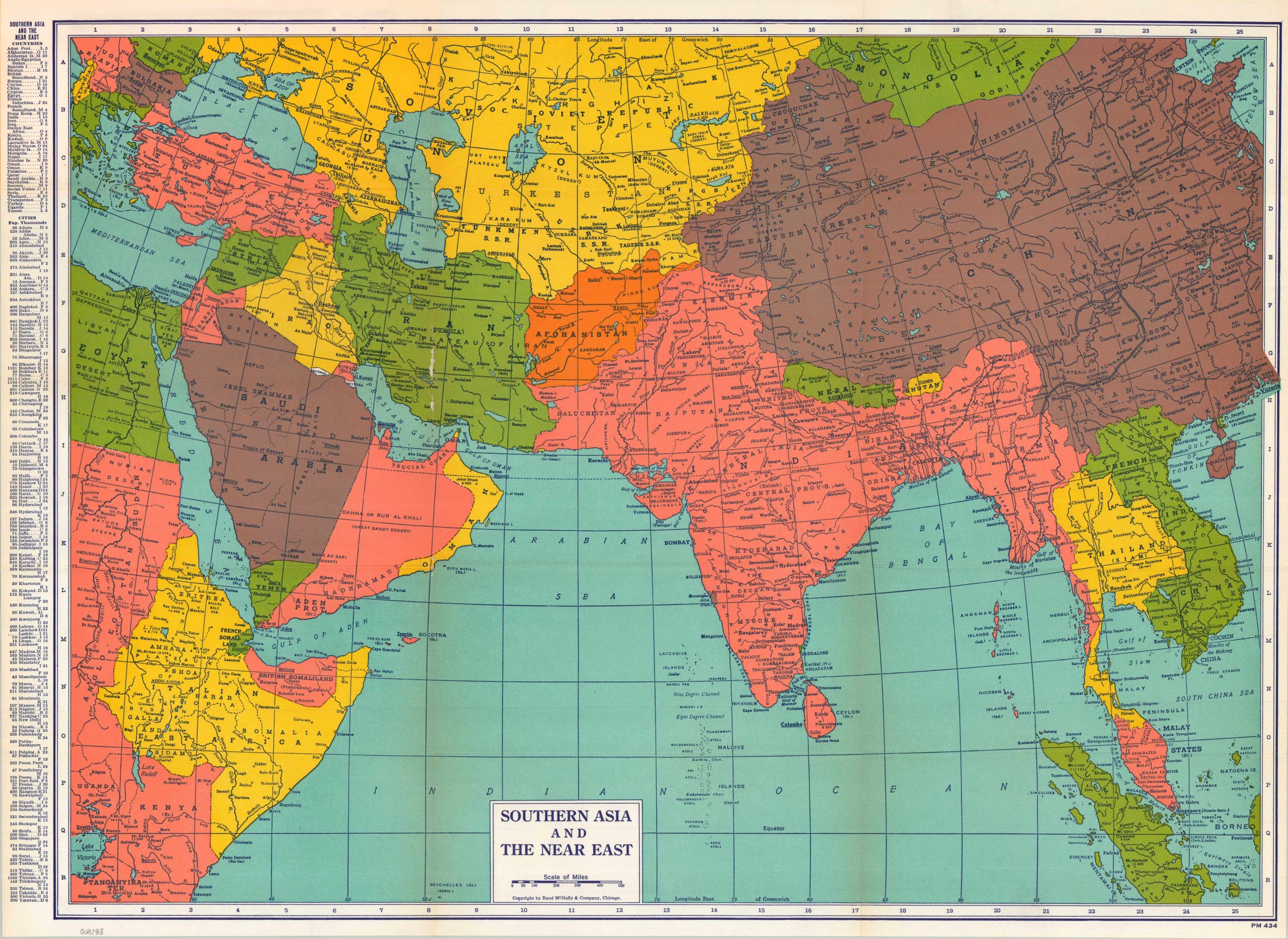
The borders of Southern Asia during the Interwar Period.
1 in stock
Description
This detailed pocket map of Southern Asia, Eastern Africa, and the Balkans provides a colorful political overview of the region shortly before the outbreak of World War II. The chaos of the Interwar Period is simplified into a static image that clearly defines national borders, often in spite of reality on the ground. For example, ‘unified’ China was in the midst of a civil war and the apparently independent countries of Iraq, Egypt, and Bhutan were all heavily under British influence. An interesting variety of settlements, regions, and geographic features are labeled throughout the image.
While the content is from the mid to late-1930s, it’s probable that the map was published by Rand McNally & Company near the end of World War II. It shares a similar printer’s code and the same format as other pocket maps that can be conclusively dated to the mid-1940s. It was not uncommon for mapmakers to issue material showing the ‘status quo’ before the outbreak of the war.
Map Details
Publication Date: c. 1945
Author: Rand McNally & Company
Sheet Width (in): 27.00
Sheet Height (in): 20.00
Condition: B+
Condition Description: Color printed pocket map, blank on verso, folded and affixed to original stiff yellow paper covers. Sharply creased, with a 4" split in the center right repaired on the verso with archival tape. Good to very good condition overall.
$95.00
1 in stock