
South Bend and Mishawaka
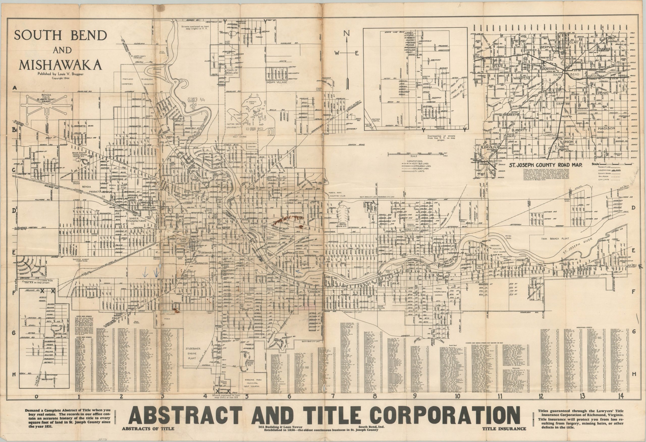
WWII-era city plan of South Bend and Mishawaka, Indiana.
Out of stock
Description
This detailed street plan of South Bend and Mishawaka, Indiana was published locally in 1944 by Louis V. Bruggner. Roads, geographic features, and major property owners are individually labeled throughout the image. Examples include the University of Notre Dame, the Studebaker Engine Plant, and Bendix Field, among other businesses and public buildings.
Transportation routes like bus lines, interurbans, and steam railroads are identified according to the legend in the lower center and an inset in the upper right shows a road map of St. Joseph County. An advertisement at the bottom of the sheet promotes the Abstract and Title Corporation – “The records in our office contain an accurate history of the title to every square foot of land in St. Joseph County since the year 1831.”
Map Details
Publication Date: 1944
Author: Louis V. Bruggner
Sheet Width (in): 34.5
Sheet Height (in): 23.5
Condition: B-
Condition Description: Heavy wear, creasing, and discoloration along fold lines, as issued. Minor image loss, several small edge tears, and small holes at fold intersections. The left side of the sheet is moderately tonied, but the image remains intact and in fair condition overall.
Out of stock