South America in globular perspective
$95.00
Understanding South America amid the shadow of World War II.
1 in stock
Description
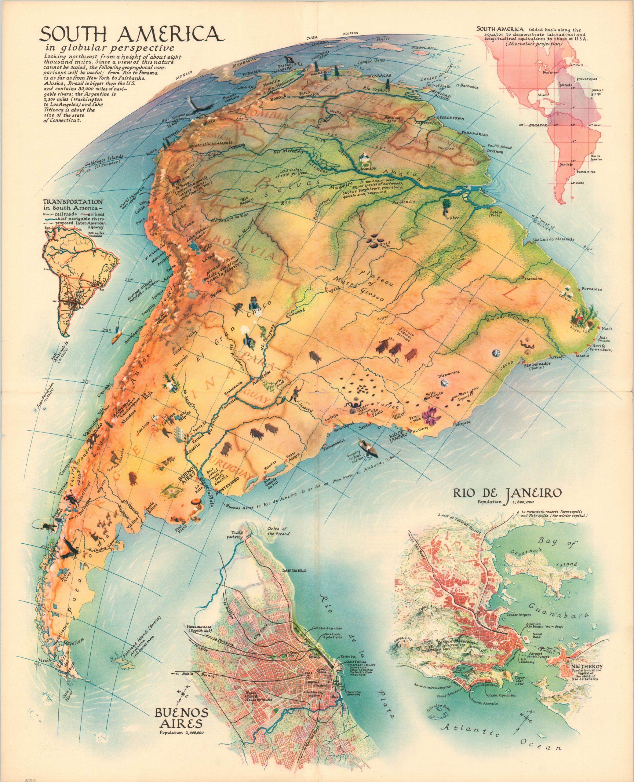
This colorful map of South America was designed by the talented Richard Edes Harrison and published in a 1937 issue of Fortune magazine. The image shows an oblique view of the continent, with portions of Central America and the United States extending into the horizon. City plans of Buenos Aires and Rio de Janeiro highlight the primary railroads, recreational opportunities, and geographic features of each. Inset diagrams in the upper corners present a transportation outline of the continent as well as a size comparison of North and South America.
Accompanying text provides further details regarding the “globular perspective looking northwest from a height of about eight thousand miles. Since a view of this nature cannot be scaled, the following geographical comparisons will be useful; from Rio to Panama is as far from New York to Fairbanks, Alaska; Brazil is bigger than the U.S. and contains 30,000 miles of navigable rivers; the Argentine is 2,300 miles (Washington to Los Angeles) and Lake Titicaca is about the size of the state of Connecticut.”
Map Details
Publication Date: 1937
Author: Richard Edes Harrison
Sheet Width (in): 22
Sheet Height (in): 27
Condition: B+
Condition Description: Single sheet supplement to Fortune Magazine, with linen tape on the verso reinforcing the seams of the vertical and horizontal fold lines. Several small tears around the outer edges of the sheet, which is also lightly toned. Very good overall.
$95.00
1 in stock